- Usage in publication:
-
- Medford Diabase*
- Modifications:
-
- Overview
- Age modified
- Geochronologic dating
- AAPG geologic province:
-
- New England province
Summary:
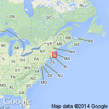
Medford Diabase dike cuts Boston Bay Group rocks and crosses northern border fault of Boston basin into Melrose block which contains Lynn Volcanic Complex. Largest diabase dike in Milford-Dedham zone. Age changed to Jurassic based on K-Ar biotite age of 194 +/-6 Ma (Krueger, H.W., 1964, The age of the diabase dike, eastern Massachusetts: Geochronicle No. 3, published by Geochron Laboratories, Inc., 24 Blackstone Street, Cambridge, Mass.). All north-trending dikes shown on the MA State geologic map (Zen and others, 1983) have been designated as Jurassic in age on basis of Medford Diabase. [Papers presented as chapters in U.S. Geological Survey Professional Paper 1366 are intended as explanations and (or) revisions to MA State bedrock geologic map of Zen and others (1983) at scale of 1:250,000.]
Source: GNU records (USGS DDS-6; Reston GNULEX).
For more information, please contact Nancy Stamm, Geologic Names Committee Secretary.
Asterisk (*) indicates published by U.S. Geological Survey authors.
"No current usage" (†) implies that a name has been abandoned or has fallen into disuse. Former usage and, if known, replacement name given in parentheses ( ).
Slash (/) indicates name conflicts with nomenclatural guidelines (CSN, 1933; ACSN, 1961, 1970; NACSN, 1983, 2005, 2021). May be explained within brackets ([ ]).

