The National Geologic Map Database is migrating to a new infrastructure. We apologize for any service disruptions during this process.
|
|---|


- Usage in publication:
-
- Mechum River metasedimentary rocks
- Modifications:
-
- Named
- Dominant lithology:
-
- Conglomerate
- Sandstone
- Siltstone
- AAPG geologic province:
-
- Piedmont-Blue Ridge province
Summary:
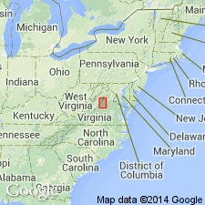
Named for Mechum River, Albemarle Co., central VA. Name applied to rocks an infolded belt along or near axis of Catoctin Mountain-Blue Ridge anticlinorium. Exposed along Mechum River. The rocks includes metamorphosed conglomerates, sandstones, and siltstone that are intruded by metagabbro and diabase. Conglomerates of Rockfish type occur at scattered localities along both edges of infold. Mechum River rocks lie about halfway between Swift Run Formation in Blue Ridge to the west and Lynchburg Formation in the Piedmont to the east. All three of the formations were derived from and unconformably overlie basement complex rocks. Mechum River rocks are equivalent in part to Swift Run and Lynchburg, as suggested by the east-to-west overlap of Swift Run and Lynchburg rocks over basement with the Mechum River rocks in between. Catoctin Formation overlies Swift Run and Lynchburg Formations in central VA, Mechum River rocks probably also were overlain by Catoctin, but it was probably removed by erosion. In addition, basement rocks, Lynchburg, Swift Run, and Mechum River rocks are all intruded by basic dikes and possibly metagabbro sills, but none occur in formations above Catoctin Formation. Age is Precambrian. Report includes geologic map and cross section.
Source: GNU records (USGS DDS-6; Reston GNULEX).
- Usage in publication:
-
- Mechum River formation
- Modifications:
-
- Revised
- AAPG geologic province:
-
- Piedmont-Blue Ridge province
Summary:
Mechum River formation includes rocks of Swift Run formation and thinned-down western edge of Charlottesville, Lynchburg, and Rockfish formations mapped as a unit. [Author is implying that Mechum River consists of rocks previously assigned to parts of other formations.] Occupies a belt 0.5 to 1 mi wide. Age is Precambrian and Cambrian.
Source: GNU records (USGS DDS-6; Reston GNULEX).
- Usage in publication:
-
- Mechums River formation
- Modifications:
-
- Overview
- AAPG geologic province:
-
- Piedmont-Blue Ridge province
Summary:
Used as Mechums River Formation [misspelled] of Precambrian and Cambrian age.
Source: GNU records (USGS DDS-6; Reston GNULEX).
- Usage in publication:
-
- Mechum River Formation
- Modifications:
-
- Overview
- AAPG geologic province:
-
- Piedmont-Blue Ridge province
Summary:
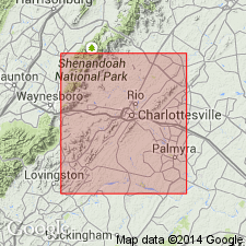
Mechum River Formation, exposed in Batesville syncline, consists of conglomerate, sandstone, siltstone, and mudstone. Thickness is difficult to determine because of structural complexities in places, but presently 1500 to 3000 ft thick. Age is designated as late Precambrian(?) based mainly on stratigraphic position; contains no fossils. Report includes geologic map.
Source: GNU records (USGS DDS-6; Reston GNULEX).
- Usage in publication:
-
- Mechum River Formation
- Modifications:
-
- Revised
- AAPG geologic province:
-
- Piedmont-Blue Ridge province
Summary:
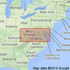
Mechum River Formation is contained within Virginia Blue Ridge complex. Age is late Precambrian.
Source: GNU records (USGS DDS-6; Reston GNULEX).

- Usage in publication:
-
- Mechum River Group
- Modifications:
-
- Revised
- AAPG geologic province:
-
- Piedmont-Blue Ridge province
Summary:
First use of Mechum River at group rank. No subdivisions listed.
Source: GNU records (USGS DDS-6; Reston GNULEX).
- Usage in publication:
-
- Mechum River Formation*
- Modifications:
-
- Revised
- AAPG geologic province:
-
- Piedmont-Blue Ridge province
Summary:
Blackwater Creek Rhyolite Member named as a member of Mechum River Formation. Named for Blackwater Creek, a nearby feature. Occurs in an area 3.6 km (2.2 mi) long between Castleton Mountain and Blackwater Creek, Castleton 7.5-min quad, central VA. Consists of white, aphanitic rhyolite similar in composition to felsite of Battle Mountain Alkali Feldspar Granite. Occurs intercalated with metasedimentary rocks (including pale-green phyllite, meta-arkose, and metaconglomerate) assigned to Mechum River Formation. Encompasses at least three discontinuous layers within Mechum River. Total thickness of member is at least 100 m (328 ft). Metaconglomerate stratigraphically overlying rhyolite layers typically contain clasts of lithologically identical rhyolite, thus indicating that contacts are unconformable. Probably derived from Battle Mountain volcanic center (informal name) located north of Battle Mountain type locality 8.0 km (5.1 mi) to the northeast. Age is Late Proterozoic. Report includes geologic map.
Source: GNU records (USGS DDS-6; Reston GNULEX).
For more information, please contact Nancy Stamm, Geologic Names Committee Secretary.
Asterisk (*) indicates published by U.S. Geological Survey authors.
"No current usage" (†) implies that a name has been abandoned or has fallen into disuse. Former usage and, if known, replacement name given in parentheses ( ).
Slash (/) indicates name conflicts with nomenclatural guidelines (CSN, 1933; ACSN, 1961, 1970; NACSN, 1983, 2005, 2021). May be explained within brackets ([ ]).