

- Usage in publication:
-
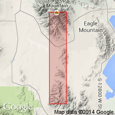
- Meadow Canyon member
- Modifications:
-
- Named
- Dominant lithology:
-
- Quartzite
- Limestone
- AAPG geologic province:
-
- Great Basin province
- Wasatch uplift
Summary:
Named as a member (1 of 5) of Oquirrh formation for Meadow Canyon west of Lewiston Peak in secs. 29 and 32, T 5 S, R 3 W, Tooele Co., UT in the Great Basin province; this is the type locality. Conformably overlies the newly named Hall Canyon member of Oquirrh; the top bed of Hall Canyon is usually a cherty crystalline and bioclastic limestone 40 to 94 ft thick. Conformably underlies the newly named Cedar Fort member of Oquirrh; upper contact usually an easily selected topographic boundary placed between less resistant beds of the Cedar Fort and the heavy bedded prominent ledge-forming basal beds of the Cedar Fort. Has been mapped throughout the southern Oquirrh Mountains and in the Fivemile Pass quad, in Tooele and adjoining Utah Co. (Wasatch uplift), UT. Geologic maps. Typically consists of orthoquartzite intercalated with calcareous limestone, and crystalline bioclastic limestone. Forms ledge and bench topography. Is 945 ft thick in its type measured locality. The quartzites are flesh-colored, fine grained, tan to brown weathered. Chert present as brown and black layers, nodules, blebs and "gobs". Some crinoidal limestone, brachiopod beds, bryozoan hash beds. Fusulinids. Assigned a Pennsylvanian, Derryan age.
Source: GNU records (USGS DDS-6; Denver GNULEX).
For more information, please contact Nancy Stamm, Geologic Names Committee Secretary.
Asterisk (*) indicates published by U.S. Geological Survey authors.
"No current usage" (†) implies that a name has been abandoned or has fallen into disuse. Former usage and, if known, replacement name given in parentheses ( ).
Slash (/) indicates name conflicts with nomenclatural guidelines (CSN, 1933; ACSN, 1961, 1970; NACSN, 1983, 2005, 2021). May be explained within brackets ([ ]).