

- Usage in publication:
-
- Meade gravels
- Modifications:
-
- Named
- Dominant lithology:
-
- Gravel
- Sand
- AAPG geologic province:
-
- Anadarko basin
Summary:
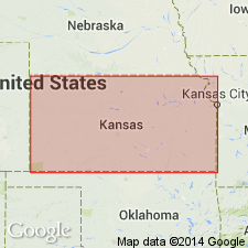
Named as a formation of the "Tule division" of Cummins (Equus beds of Cope); named after Meade Center, Meade Co, KS, Anadarko basin. No type locality given. Occurs at several localities in KS, typically on Bluff creek, in Clark Co, Anadarko basin. Here occurs as the lowest succession of three terranes, laid down in deep and broad valleys. Consists of mostly unconsolidated gravels and sands generally 10 to 30 or 40 ft in thickness; frequently contain hard ledges in Meade Co and elsewhere. Contains abundant remains of horses, llamas, elephants, turtles, etc. Fauna of Equus beds listed. Conformably underlies Pearlette ash (new), into which the gravels frequently grade. Of late Pliocene age.
Source: GNU records (USGS DDS-6; Denver GNULEX).
- Usage in publication:
-
- Meade formation
- Modifications:
-
- Revised
- AAPG geologic province:
-
- Anadarko basin
Summary:
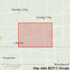
Pg. 399 (table), 411-419. Meade formation. As herein redefined includes Meade gravels of Cragin (1896) at base; Cragin's (1896) Pearlette ash; Smith's (1940) Odee formation, EQUUS NIOBRARENSIS beds, and Jones Ranch beds; and all other beds of Pleistocene age above Rexroad member of Ogallala formation and below Kingsdown silt. Thickness 50 to 150 feet. Type locality designated because original Meade type locality cannot be located accurately.
Source: US geologic names lexicon (USGS Bull. 1200, p. 2437-2438).
- Usage in publication:
-
- Meade formation
- Modifications:
-
- Revised
- AAPG geologic province:
-
- Anadarko basin
Summary:
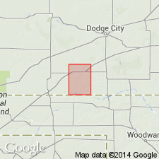
Meade formation redefined to exclude an upper part that is named Crooked Creek formation in this report. Divided into Meade gravels member (lower) and the Missler member (in upper part, new). As thus redefined includes "Meade gravels of Cragin" near Vanhem PO and some overlying silts and caliche. Occurs in Meade Co, KS in the Anadarko basin. Unconformably overlies Rexroad formation; unconformably underlies Crooked Creek formation (new). Stratigraphic chart. Fossils (rodents, probscidea, perissodactyls, and artiodactyls from Missler member) listed. Of Pleistocene age.
Source: GNU records (USGS DDS-6; Denver GNULEX).
- Usage in publication:
-
- Meade(?) formation*
- Modifications:
-
- Areal extent
- AAPG geologic province:
-
- Anadarko basin
Summary:
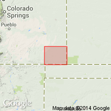
Thin (40-50 ft) red and brown silt, sand, and gravel above the Ogallala formation at scattered localities in the north part of Baca Co, CO in the Anadarko basin are thought to be equivalent to the Meade formation of southwest KS. Judgment based on position above algal limestone bed at top of Ogallala and presence of ash bed (Pearlette?) present in Meade. Is poorly exposed. Is a poorly sorted unit with many nodules and stringers of caliche. Geologic map. Of Pleistocene age.
Source: GNU records (USGS DDS-6; Denver GNULEX).
- Usage in publication:
-
- Meade group
- Modifications:
-
- Revised
- AAPG geologic province:
-
- Anadarko basin
Summary:
Raised in rank to group. In Meade Co, KS, in the Anadarko basin, includes all deposits above the Rexroad formation and below the Kingsdown formation. Meade group consists of Ballard formation (lower) and Crooked Creek formation (upper). Is 64.4 ft thick in measured section in S1/2 NW1/4 sec 18 to center of NW1/4 sec 18, T32S, R28W, Meade Co, where group is divisible into the (ascending): Angell (new) and Missler (reallocated) members of Ballard (new), and Stump Arroyo (reallocated) and Atwater (new) members of Crooked Creek (revised). History of nomenclature chart. Of Pleistocene age.
Source: GNU records (USGS DDS-6; Denver GNULEX).
For more information, please contact Nancy Stamm, Geologic Names Committee Secretary.
Asterisk (*) indicates published by U.S. Geological Survey authors.
"No current usage" (†) implies that a name has been abandoned or has fallen into disuse. Former usage and, if known, replacement name given in parentheses ( ).
Slash (/) indicates name conflicts with nomenclatural guidelines (CSN, 1933; ACSN, 1961, 1970; NACSN, 1983, 2005, 2021). May be explained within brackets ([ ]).