- Usage in publication:
-
- McPherson equus beds
- Modifications:
-
- Original reference
- AAPG geologic province:
-
- Sedgwick basin
Summary:
McPherson equus beds. Alternating layers of fossiliferous sand and clay, with stratum of volcanic ash in part of northern area and in places heavy gravel stratum near bottom. Thickness 65 feet. Overlies Dakota sandstone.
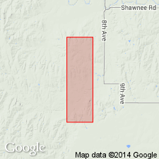
Named from exposures in McPherson Co., KS.
See also R.C. Moore, 1920, Kansas Geol. Survey Bull., no. 6, pt. 2, pl. xiii, on p. 92; mapped the distribution of this formation in Kansas.
Source: US geologic names lexicon (USGS Bull. 896, p. 1261).
- Usage in publication:
-
- McPherson formation
- Modifications:
-
- Revised
Summary:
Term McPherson Equus beds was used by previous investigators to include all unconsolidated deposits in Harvey and McPherson Counties, and all these beds were held to be of Pleistocene age. Present investigation shows that although part of these deposits is Pleistocene in age, a large part appears to be Pliocene in age. Proposed herein to remove Pliocene beds from McPherson Equus beds of Haworth and Beede and to assign to them name Emma Creek formation. McPherson formation (restricted) is retained to include only fluvial deposits of Pleistocene age.
See also 1940, Econ. Geol., v. 35, no. 7, p. 849-851.
Source: US geologic names lexicon (USGS Bull. 1200, p. 2312-2313).
- Usage in publication:
-
- McPherson formation
- Modifications:
-
- Revised
Summary:
Pg. 59-70, pls. 1, 7. McPherson formation. As redefined in this report, includes all unconsolidated stream and slope deposits of Pleistocene age which occur in McPherson Valley and Arkansas River valley; includes Emma Creek formation at the type locality and much of the loess of Lohman and Frye (1940). In general, formation consists of early Pleistocene stream deposits, later and coarser Pleistocene stream channel deposits, and still later Pleistocene silt, day, and fine sand. Locally, conglomeratic bed 1 to 6 feet thick occurs at base formation; material in this conglomerate is similar to materials comprising so-called Abilene conglomerate. Volcanic ash present locally. Overlies Delmore formation (new).
Source: US geologic names lexicon (USGS Bull. 1200, p. 2312-2313).
- Usage in publication:
-
- McPherson equus beds
- Modifications:
-
- Revised
Summary:
Pg. 94, 110. McPherson Equus beds included in list of units which are classed at least in part as Sanborn formation. Meade formation in [McPherson] Valley was formerly included within broadly inclusive McPherson formation.
Source: US geologic names lexicon (USGS Bull. 1200, p. 2312-2313).
- Usage in publication:
-
- McPherson Formation
- Modifications:
-
- Principal reference
- Revised
- AAPG geologic province:
-
- Sedgwick basin
Summary:
McPherson Formation of Sanborn Group. Restricted to serve as local term for sand and gravel deposits containing abundant fragments of fossil vertebrates (EQUUS beds, Sandahl local fauna). Excludes "lower" McPherson Formation of Williams and Lohman (1949), which contains Pearlette ash; beds included in underlying Meade Group (Kansan). Overlain by Loveland Formation of Sanborn Group (Illinoian to Sangamon). Previously called Crete Formation by Frye and Leonard (1952). Age is late Pleistocene (Illinoian) based on the fossil vertebrates.
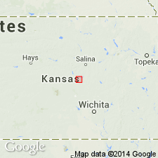
Type section (McPherson Formation, restricted): in northwest corner of Sandahl gravel pit, in SE/4 SW/4 sec. 29, T. 18 S., R. 4 W., McPherson Co., southwestern KS. Additional reference localities at Flor pit, in NW/4 SW/4 sec. 7, T. 18 S., R. 4 W., and Hammann pit, in NE/4 SW/4 sec. 31, T. 18 S., R. 4 W.
Source: Publication.
- Usage in publication:
-
- McPherson Formation
- Modifications:
-
- Overview
Summary:
(Cenozoic Era; Quaternary System by C.K. Bayne and H.G. O'Connor, p. 66.) The "McPherson Formation" in McPherson, Harvey, and Sedgwick Counties and the "Belleville Formation" in Republic County are in part equivalent to the Grand Island Formation in central and western Kansas. Age is late Pleistocene (Kansan).
Source: Publication.
For more information, please contact Nancy Stamm, Geologic Names Committee Secretary.
Asterisk (*) indicates published by U.S. Geological Survey authors.
"No current usage" (†) implies that a name has been abandoned or has fallen into disuse. Former usage and, if known, replacement name given in parentheses ( ).
Slash (/) indicates name conflicts with nomenclatural guidelines (CSN, 1933; ACSN, 1961, 1970; NACSN, 1983, 2005, 2021). May be explained within brackets ([ ]).

