The National Geologic Map Database is migrating to a new infrastructure. We apologize for any service disruptions during this process.
|
|---|


- Usage in publication:
-
- McKay Formation*
- Modifications:
-
- Named
- Biostratigraphic dating
- AAPG geologic province:
-
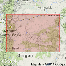
- Columbia basin
Summary:
Unit is named the McKay Formation of the Dalles Group replacing the informally named McKay beds of Hogenson (1964). Is exposed in the vicinity of the McKay reservoir in the Agency basin, OR. Consists of fanglomerate or valley fill deposits of partially carbonate-cemented basalt gravel and interbedded tuffaceous sand and silt. Conformably overlies the Frenchman Springs Member of the Wanapum Basalt and the Grande Ronde Basalt; underlies Quaternary loess. Thickness ranges from 2 to 72 m. Age is late Miocene and early Pliocene based on fossils [vertebrates]. (B1565)
Source: GNU records (USGS DDS-6; Menlo GNULEX).
For more information, please contact Nancy Stamm, Geologic Names Committee Secretary.
Asterisk (*) indicates published by U.S. Geological Survey authors.
"No current usage" (†) implies that a name has been abandoned or has fallen into disuse. Former usage and, if known, replacement name given in parentheses ( ).
Slash (/) indicates name conflicts with nomenclatural guidelines (CSN, 1933; ACSN, 1961, 1970; NACSN, 1983, 2005, 2021). May be explained within brackets ([ ]).