The National Geologic Map Database is migrating to a new infrastructure. We apologize for any service disruptions during this process.
|
|---|


- Usage in publication:
-
- McHugh Complex*
- Modifications:
-
- Named
- Reference
- Geochronologic dating
- Dominant lithology:
-
- Siltstone
- Graywacke
- Metavolcanics
- AAPG geologic province:
-
- Alaska Southern region
Summary:
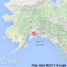
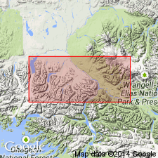
Named for type locality along Seward HWY east and west of McHugh Creek, Chugach Mountains, southern AK. Reference locality designated between bridge across Knik River on Glenn HWY and Pioneer Peak area. Has been traced through Anchorage C-6 and C-5 quads. Consists of chaotically juxtaposed sequences of weakly metamorphosed siltstone, graywacke, arkose and conglomeratic sandstone, and metavolcanic basaltic greenstones, metachert, and argillite. Is in fault contact with Valdez(?) Group. K-Ar age on granitic clast yielded 146 +/-7 Ma (M.A. Lanphere and Arthur Grantz, oral commun., 1971). Helen Foreman identified radiolarians of Mesozoic types (written commun., 1970). R.C. Douglass identified fusulinids of late Paleozoic age (written commun., 1970). Age of McHugh Complex is thought to be Late Jurassic and (or) Cretaceous.
Source: GNU records (USGS DDS-6; Menlo GNULEX).
- Usage in publication:
-
- McHugh Complex*
- Modifications:
-
- Age modified
- AAPG geologic province:
-
- Alaska Southern region
Summary:
Age (protolithic) is Late Triassic to mid-Cretaceous based on radiolarians from unit (see Winkler and others, 1981, OF-80-892-A).
Source: GNU records (USGS DDS-6; Menlo GNULEX).
For more information, please contact Nancy Stamm, Geologic Names Committee Secretary.
Asterisk (*) indicates published by U.S. Geological Survey authors.
"No current usage" (†) implies that a name has been abandoned or has fallen into disuse. Former usage and, if known, replacement name given in parentheses ( ).
Slash (/) indicates name conflicts with nomenclatural guidelines (CSN, 1933; ACSN, 1961, 1970; NACSN, 1983, 2005, 2021). May be explained within brackets ([ ]).