The National Geologic Map Database is migrating to a new infrastructure. We apologize for any service disruptions during this process.
|
|---|


- Usage in publication:
-
- McCully Formation*
- Modifications:
-
- Named
- Dominant lithology:
-
- Limestone
- Shale
- Sandstone
- AAPG geologic province:
-
- Chautauqua platform
- Arkoma basin
Summary:
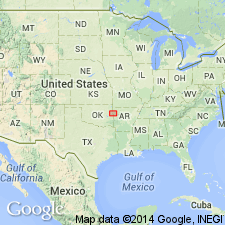
Name applied to rocks above the Lower Pennsylvanian Sausbee Formation (new) and unconformably below the Middle Pennsylvanian Atoka Formation. Type area designated as the exposures on west side of Arkansas River near Webbers Falls Reservoir, Muskogee Co, OK. Type sections in sec 34, T13N, R20E. Source of geographic name not stated. Occurs in Muskogee and Cherokee Cos on the Chautauqua platform, and as far east as central Adair and Sequoyah Cos in the Arkoma basin. Varies in thickness due to post-Morrowan, pre-Atokan truncation. Ranges from 19.5 to 22.9 m thick. Consists of 1) a basal limestone and thin interbedded shale named Chisum Quarry Member, 2) a noncalcareous shale called shale "A" member, 3) a wackestone named Greenleaf Lake Limestone Member, and 4) a thin noncalcareous shale called shale "B" member. Contains about equal amounts of limestone and shale near the Arkansas River but changes to predominantly shale eastward. Sandstone occurs mostly as thin lenses. Equivalent to the Dye Shale, Kessler Limestone, and Trace Creek Shale Members of Bloyd Shale to east in OK and AR. Fossiliferous (goniatites, fragments of bryozoans, pelmatozoans, algae). Of Middle Pennsylvanian, late Morrowan age. Cross section. Stratigraphic chart.
Source: GNU records (USGS DDS-6; Denver GNULEX).
For more information, please contact Nancy Stamm, Geologic Names Committee Secretary.
Asterisk (*) indicates published by U.S. Geological Survey authors.
"No current usage" (†) implies that a name has been abandoned or has fallen into disuse. Former usage and, if known, replacement name given in parentheses ( ).
Slash (/) indicates name conflicts with nomenclatural guidelines (CSN, 1933; ACSN, 1961, 1970; NACSN, 1983, 2005, 2021). May be explained within brackets ([ ]).