The National Geologic Map Database is migrating to a new infrastructure. We apologize for any service disruptions during this process.
|
|---|


- Usage in publication:
-
- McCullough Formation*
- Modifications:
-
- Named
- Geochronologic dating
- Dominant lithology:
-
- Tuff
- AAPG geologic province:
-
- Great Basin province
Summary:
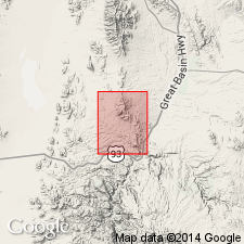
McCullough Formation is named (type) for McCullough Hill in N/2, sec. 6, T1N R66E, Highland Peak 7.5' quad, Lincoln Co, NV. Consists primarily of sedimentary rocks with interbedded airfall and water-lain rhyolite tuff. At least 900 m thick at type locality. Overlain by tuff of Etna (informal) and sedimentary rocks of Newman Canyon (lower part); underlain by volcanic rocks of Klondike Spring (informal). Age is Miocene based on Ar-Ar date of 15.3 Ma from bed in upper part of unit.
Source: GNU records (USGS DDS-6; Menlo GNULEX).
For more information, please contact Nancy Stamm, Geologic Names Committee Secretary.
Asterisk (*) indicates published by U.S. Geological Survey authors.
"No current usage" (†) implies that a name has been abandoned or has fallen into disuse. Former usage and, if known, replacement name given in parentheses ( ).
Slash (/) indicates name conflicts with nomenclatural guidelines (CSN, 1933; ACSN, 1961, 1970; NACSN, 1983, 2005, 2021). May be explained within brackets ([ ]).