The National Geologic Map Database is migrating to a new infrastructure. We apologize for any service disruptions during this process.
|
|---|


- Usage in publication:
-
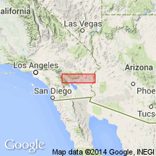
- McCoy Mountains formation
- Modifications:
-
- Named
- Dominant lithology:
-
- Metavolcanics
- Tuff
- Conglomerate
- Quartzite
- Limestone
- Schist
- AAPG geologic province:
-
- Salton basin
Summary:
Named for its occurrence in southern part of McCoy Mountains, Riverside Co, CA in Salton basin. No type locality designated. Consists of metavolcanics and some interbedded metasediments. The metavolcanics are mainly foliated, well-bedded, fine-grained, green gray metatuffs. The interbedded rocks are gray, fine-grained quartzite, thin beds of finely crystalline limestone, gray quartzite arenaceous phyllites, quartz mica and sericitic schist, and conglomeratic schist. The conglomerate is well rounded to subangular pebbles and cobbles up to 10 inches long of mostly quartzite, some aplite, some granite in an arkosic matrix. [No description of sequence of lithologies.] Thought to be many thousands of feet thick. Intruded by Coxcomb granodiorite (named) of late Mesozoic age. No fossils found. Assigned a Triassic or Paleozoic age. Geologic maps.
Source: GNU records (USGS DDS-6; Denver GNULEX).
- Usage in publication:
-
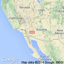
- McCoy Mountains Formation
- Modifications:
-
- Overview
- Areal extent
- Paleomagnetics
- AAPG geologic province:
-
- Salton basin
- Basin-and-Range province
Summary:
Lies along a major discontinuity or terrane boundary that separates autochthonous North America from suspect terranes. Mapped in southern Plomosa and Dome Rock Mountains, and Livingston Hill, La Paz Co, AZ in the Basin-and-Range province, and in Coxcomb, McCoy, and Palen Mountains, Riverside Co, CA in the Salton basin, a greater areal extent than recognized in earlier reports. Displaces term Livingston Hills Formation formerly used in the Livingston Hills and Dome Rock Mountains. Is a 7.3 km thick metasedimentary sequence divisible into 6 members (ascending): sandstone (2 "basal members"), mudstone, conglomerate, sandstone, siltstone. Deposited on and interbedded with Lower Jurassic volcanics. Intruded by undeformed Jurassic? or Upper Cretaceous plutons. Stratigraphic top is not exposed. Fossil wood thought to be of Late Cretaceous or Paleocene age found in upper part, but age assignment disputed. Paleomagnetic dating indicates late Middle to middle Late Jurassic age. This is probably a minimum age, but is bracketed by underlying volcanics. Shown as Mesozoic age on geologic map. Sedimentary petrology descriptions. A fluvial and lacustrine deposit. Paleocurrents show southerly flow. Northern source.
Source: GNU records (USGS DDS-6; Denver GNULEX).
- Usage in publication:
-
- McCoy Mountains Formation*
- Modifications:
-
- Overview
- AAPG geologic province:
-
- Salton basin
- Basin-and-Range province
Summary:
Known to be older than the latest Cretaceous K-Ar minimum ages of crosscutting plutons, faults, and veins. Other data on the age are contradictory or equivocal. Basal strata interbedded with volcanic rocks of Early and (or) Middle Jurassic age. Paleomag data suggest formation is older than middle Late Jurassic. Upper part contains angiosperm of probable mid-Cretaceous or younger age. Lower part may be same age as lower part of Winterhaven Formation (new name) exposed 70 km away. Also 1) these two formations rest on and locally interfinger with Jurassic silicic volcanic rocks; 2) the quartz arenite and argillitic siltstone members of Winterhaven appear to correspond to basal sandstone and the mudstone members of McCoy Mountains. The dacite member of Winterhaven has no equivalent in the McCoy Mountains. However, this correlation cannot be proven or disproven. McCoy Mountains may consist of an Early and (or) Middle Jurassic unit, and a later Cretaceous unit.
Source: GNU records (USGS DDS-6; Denver GNULEX).
- Usage in publication:
-
- McCoy Mountains Formation
- Modifications:
-
- Overview
- AAPG geologic province:
-
- Basin-and-Range province
Summary:
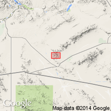
Basin facies rocks identified outside McCoy Mountains structural basin. Mapped (geologic map) in Granite Wash Mountains, La Paz Co, AZ in Basin-and-Range province. Divisible into 7 mappable units. 1) Lower sandstone unit, 200 m thick; composed of gray (fresh), tan to brown (weathered), medium-grained, moderately well-sorted, well-rounded grains with local discontinuous lenses of granule conglomerate, trough and festoon cross-bedding; fluvial origin. 2) Yellowbird sedimentary rocks, 150 to 200 m thick; gradationally above lower unit; consists of gray to black mudstone, and thin marble, siltstone, fine-grained sandstone and conglomerate; mottled gray; macroscopic pyrite; fluvial and lacustrine origin for units 2-6. 3) Interlayered mafic volcanics includes a 30 m thick cliff-forming sill. 4) Polymict conglomerate 5-10 m thick; has clasts of quartzite, siltstone, sandstone, mudstone, pink and white marble, porphyritic volcanic rocks. 5) Lithic sandstone unit 450-500 m thick; sandstone interbedded with mudstone and polymict conglomerate; sandstone is coarse grained in lower part and medium to fine grained in upper part. 6) Mudstone unit, predominately siliceous gray shale with thin layers of fine-grained calc-silicate rock, calcareous feldspathic sandstone, rare conglomerate layers. 7) Orange-weathering sandstone and conglomerate unit, feldspathic sandstone. Contains Paleozoic clasts. Jurassic or Cretaceous age.
Source: GNU records (USGS DDS-6; Denver GNULEX).
- Usage in publication:
-
- McCoy Mountains Formation
- Modifications:
-
- Revised
- AAPG geologic province:
-
- Basin-and-Range province
Summary:
Revised in the Harquar plate in the Little Harquahala and Harquahala Mountains of La Paz Co, AZ, Basin-and-Range province, in that it is divided into a basal informal unit, the Ranegras member (first published use), and an unnamed member. The Ranegras is a quartzose to feldspathic sandstone, quartzite-cobble conglomerate, and purple siltstone or mudstone. The unnamed member consists of lithofeldspathic sandstone, conglomeratic sandstone, and mudstone. The members occur in fault-bounded blocks. Stratigraphic relations between the members is not clear because of complex folding and faulting. The Ranegras was probably deposited in a meandering fluvial system. The unnamed member was deposited in a fluvial and lacustrine environment. Clasts in the conglomerates suggest local source. Ranegras overlies Black Rock volcanics (first used, informal term) depositionally. Represented in Centennial plate in Little Harquahala Mountains in its Apache Wash facies. This facies 750 m thick divisible (mapped) into a lower evaporitic shale, sandstone and conglomeratic sandstone member, and an upper lithofeldspathic sandstone, siltstone, and conglomerate member. Assigned a Jurassic and Cretaceous age. Geologic maps. Stratigraphic sections.
Source: GNU records (USGS DDS-6; Denver GNULEX).
For more information, please contact Nancy Stamm, Geologic Names Committee Secretary.
Asterisk (*) indicates published by U.S. Geological Survey authors.
"No current usage" (†) implies that a name has been abandoned or has fallen into disuse. Former usage and, if known, replacement name given in parentheses ( ).
Slash (/) indicates name conflicts with nomenclatural guidelines (CSN, 1933; ACSN, 1961, 1970; NACSN, 1983, 2005, 2021). May be explained within brackets ([ ]).