- Usage in publication:
-
- McCoy Creek Group
- Modifications:
-
- Named
- Dominant lithology:
-
- Quartzite
- Phyllite
- Schist
- Marble
- AAPG geologic province:
-
- Great Basin region
Summary:
McCoy Creek Group. In southern Snake Range and central Schell Creek Mountains, eastern Nevada, and in southeast part of Deep Creek Range, Utah (Great Basin region), name is applied to a thick succession of quartzose and argillaceous metasediments formerly included in Prospect Mountain Quartzite. Lower part contains minor marble, and in Deep Creek Range, Utah, tillitic schists. Base not exposed.
In southern Snake Range, upper 3,600 feet of group is exposed; six formations (5 newly named) recognized (ascending): unnamed formation of quartzite (300+ feet), Willard Creek Quartzite (500 +/- feet), Strawberry Creek Formation (750 +/- feet), Shingle Creek Conglomeratic Quartzite (300 +/- feet), Osceola Argillite (800 +/- feet), and Stella Lake Quartzite (700 to 800 feet).
At type section along McCoy Creek, Schell Creek Mountains, upper 8,800 feet of group exposed. Eight units A through H recognized: (A) quartzite, marble, schist, 800+ feet; (B) phyllite and schist, 1,800 feet; (C) phyllite, quartzite, metasiltstone, 2,200 feet; (D) quartzite, 400 feet; (E) phyllite, phyllitic argillite, metasiltstone, 1,500 feet; (F) quartzite, 900 feet; (G) metasiltstone and phyllite, 400 feet; (H) quartzite, 800 feet. At least upper 4,300 feet are equivalent to formations exposed in southern Snake Range.
In Trout Creek area of southeastern Deep Creek Range about 8,800 feet of metasediments are exposed which represents lower part of group and are believed to include strata older than any exposed in McCoy Creek area. Seven formations recognized, designated Trout Creek Unit 1 through 7 (ascending): (1) mica schist, 200 to 300 feet; (2) dolomitic marble, 500 to 600 feet; (3) mica schist, 1,100 +/- feet; (4) quartzite and quartzitic schist, 600 +/- feet; (5) mica schist, 1,300 feet; (6) mica schist, 3,500 feet; (7) quartzite, 1,500+ feet. Lower Part includes some marble and three units of tillitic schists totalling about 1,350 feet.
Group also exposed between southern end of Cherry Creek Mountains and northern Egan Range, as well as in Egan Range north of Ely, Nevada. Overlain concordantly but with sharp boundary by Lower Cambrian Prospect Mountain Quartzite (restricted). Age is late Precambrian. Report includes petrology, petrography section; geologic map.
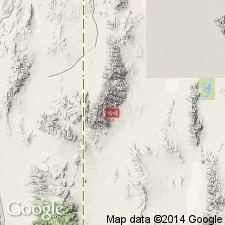
Type section (base not exposed): along McCoy Creek, east slope of Schell Creek Mountains, White Pine Co., northeastern NV. Named from McCoy Creek.
Source: US geologic names lexicon (USGS Bull. 1350, p. 450); GNU records (USGS DDS-6; Denver GNULEX).
For more information, please contact Nancy Stamm, Geologic Names Committee Secretary.
Asterisk (*) indicates published by U.S. Geological Survey authors.
"No current usage" (†) implies that a name has been abandoned or has fallen into disuse. Former usage and, if known, replacement name given in parentheses ( ).
Slash (/) indicates name conflicts with nomenclatural guidelines (CSN, 1933; ACSN, 1961, 1970; NACSN, 1983, 2005, 2021). May be explained within brackets ([ ]).

