

- Usage in publication:
-
- McCourt sandstone
- Modifications:
-
- Named
- Dominant lithology:
-
- Sandstone
- AAPG geologic province:
-
- Green River basin
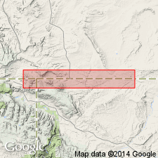
Summary:
Named as an unranked sandstone in the Rock Springs formation for the McCourt Ranch. Type locality is in sec 7, T14N, R103W, Sweetwater Co, WY in the Greater Green River basin. Is a brown to buff sandstone at base and white to light-gray sandstone at top. Has heavy mineral lenses at some localities. Is 105 ft thick at type. Overlies the Coulson tongue of the Rock Springs; underlies a sequence of carbonaceous beds 25 ft thick [of the Rock Springs?]. Is very fossiliferous. Assigned to the Late Cretaceous.
Source: GNU records (USGS DDS-6; Denver GNULEX).
For more information, please contact Nancy Stamm, Geologic Names Committee Secretary.
Asterisk (*) indicates published by U.S. Geological Survey authors.
"No current usage" (†) implies that a name has been abandoned or has fallen into disuse. Former usage and, if known, replacement name given in parentheses ( ).
Slash (/) indicates name conflicts with nomenclatural guidelines (CSN, 1933; ACSN, 1961, 1970; NACSN, 1983, 2005, 2021). May be explained within brackets ([ ]).