

- Usage in publication:
-
- McBryde limestone member*
- Modifications:
-
- Named
- Dominant lithology:
-
- Limestone
- AAPG geologic province:
-
- Mid-Gulf Coast basin
Summary:
Name McBryde limestone member of Clayton formation proposed for the Nautilus rock of early authors. In type area, consists of hard white fine-grained sandy limestone, 20 to 25 ft thick. Overlies Bine Barren member (new) and underlies calcareous tongue of Porters Creek clay. Thin ledges of limestone similar to the McBryde are interspersed through several feet of the Porters Creek. To the east, in Butler Co., unit thickens to about 100 ft and breaks up into shaly more sandy beds with concretionary layers. Still farther east, it passes into limestone of middle part of undifferentiated Clayton. Westward, the McBryde thins and becomes more argillaceous. It loses its distinctive lithologic character in western Wilcox Co.
Source: GNU records (USGS DDS-6; Reston GNULEX).

- Usage in publication:
-
- McBryde Limestone Member
- Modifications:
-
- Overview
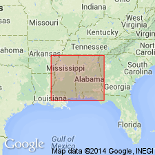
- Areal extent
- Dominant lithology:
-
- Marl
- Chalk
- AAPG geologic province:
-
- Mid-Gulf Coast basin
Summary:
Only in Wilcox, Lowndes, and Butler Cos, is the Clayton subdivided into two members. The upper McBryde Limestone Member consists of gray to white marl and clayey chalk 20 to 50 ft thick. Overlies the lower Pine Barren Member. Age is Paleocene (Midwayan--Danian).
Source: GNU records (USGS DDS-6; Reston GNULEX).
For more information, please contact Nancy Stamm, Geologic Names Committee Secretary.
Asterisk (*) indicates published by U.S. Geological Survey authors.
"No current usage" (†) implies that a name has been abandoned or has fallen into disuse. Former usage and, if known, replacement name given in parentheses ( ).
Slash (/) indicates name conflicts with nomenclatural guidelines (CSN, 1933; ACSN, 1961, 1970; NACSN, 1983, 2005, 2021). May be explained within brackets ([ ]).