

- Usage in publication:
-
- McBean formation
- Modifications:
-
- Original reference
- Dominant lithology:
-
- Clay
- Marl
- Limestone
- Sand
- AAPG geologic province:
-
- South GA-North FL sedimentary province
Summary:
Pg. 237-284. McBean formation of Claiborne group. Mainly clays, in nature of fullers earth, shell marls, sandy limestones and calcareous glauconitic sands; the marls are for the most part massive bedded and friable, but hard, compact, and even partially silicified beds were noted on Savannah River. Basal bed of McBean formation consists principally of fullers earth and drab or greenish sandy clays, here called Congaree clay member [p. 268]. Thickness of formation 100 to 400 feet. Underlies Barnwell sand and overlies Wilcox formation. Is a shallow-water marine deposit included in Claiborne group, along with Barnwell sand. OSTREA GEORGIANA zone at Shell Bluff, on Savannah River, Georgia, is top member of McBean formation. Age is Eocene.
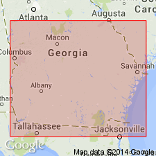
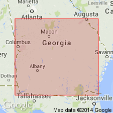
Named from exposures at McBean and on McBean Creek, in Richmond Co., eastern GA.
Source: US geologic names lexicon (USGS Bull. 896, p. 1246-1247).
- Usage in publication:
-
- McBean formation*
- Modifications:
-
- Revised
- AAPG geologic province:
-
- South Georgia sedimentary province
Summary:
Authors showed that the faunas of the Barnwell sand and of OSTREA GEORGIANA zone are of Jackson age, restricted Claiborne group of Georgia and McBean formation to the beds beneath OSTREA GEORGIANA zone and above Wilcox formation, including the OSTREA GEORGIANA zone in Barnwell formation. They also showed that Congaree clay member of Veatch and Stephenson does not lie at base of Claiborne group and of McBean formation, but that it is of Jackson age and much younger than Congaree shales of Sloan, to which it was supposed to be equivalent. They therefore discarded Congaree clay, renamed the beds Twiggs clay member, and included them in Barnwell formation. They showed (p. 53) OSTREA GEORGIANA zone to be contemporaneous with lower part of Twiggs clay member, and that Twiggs member thins out in Georgia near Savannah River and is absent in South Carolina. These are the definitions of McBean and Barnwell formations at present used by the USGS.
Source: US geologic names lexicon (USGS Bull. 896, p. 1246-1247).
- Usage in publication:
-
- McBean formation*
- Modifications:
-
- Overview
- AAPG geologic province:
-
- Atlantic Coast basin
Summary:
McBean formation. Unit described in the Coastal Plain of South Carolina. Thickness about 100 feet. Includes unit termed Warley Hill phase by Sloan (1905). Overlies Tuscaloosa formation or Black Mingo formation; unconformably underlies Santee limestone or Barnwell sand, both of Jackson age.
Source: GNU records (USGS DDS-6; Reston GNULEX).
- Usage in publication:
-
- McBean formation*
- Modifications:
-
- Revised
- AAPG geologic province:
-
- South GA-North FL sedimentary province
- Atlantic Coast basin
Summary:
In historical summary of Congaree formation, authors state that Cooke and Shearer (1918, USGS Prof. Paper 120-C) supposed that all of their Congaree clay member was of Jackson age and transferred it to Barnwell formation under name of Twiggs clay member. Later Cooke (1943, USGS Bull. 941) restored that facies consisting of thin-bedded or laminated sand and clay to McBean formation. The McBean is here restricted to include only the Cook Mountain equivalent, the OSTREA SELAEFORMIS zone, of the Lisbon formation. This is represented at McBean, GA, and in SC by white sandy marl and massive yellow or red sand, which appears to be at least partly residual from sandy marl. Santee limestone, heretofore supposed to be of early Jackson age, represents the OSTREA SELAEFORMIS zone and seems to be offshore facies of restricted McBean. Warley Hill phase is raised to formation rank. McBean is included in lower Claiborne group.
Source: GNU records (USGS DDS-6; Reston GNULEX).
- Usage in publication:
-
- McBean Formation*
- Modifications:
-
- Revised
- AAPG geologic province:
-
- Atlantic Coast basin
Summary:
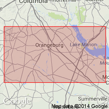
In study area, McBean Formation assigned to Orangeburg Group and restricted to outcrops of Claiborne age. Elsewhere unit is still in Claiborne Group.
Source: GNU records (USGS DDS-6; Reston GNULEX).

- Usage in publication:
-
- McBean Formation
- Modifications:
-
- Overview
- AAPG geologic province:
-
- Atlantic Coast basin
Summary:
Authors include the Huber, Congaree, Warley Hill and McBean Formations in the Orangeburg Group. The upper middle Eocene McBean Formation correlates with the upper part of the Lisbon Formation and the Cook Mountain Formation of the Claiborne Group in the Gulf Coast. In SC, the McBean is mainly composed of quartzose, clayey sediments and generally is much less calcareous than at McBean Creek, GA. Noticeably more fine-grained than over and underlying units. Averages 6 to 9 m thick, but ranges to more than 15 m on the Savannah River site. Unconformably underlies the upper Eocene Barnwell Group. Grades laterally downdip into the Santee Limestone.
Source: GNU records (USGS DDS-6; Reston GNULEX).
- Usage in publication:
-
- McBean Formation
- Modifications:
-
- Revised
- AAPG geologic province:
-
- Atlantic Coast basin
Summary:
McBean Formation. Recent excavations in Orangeburg, South Carolina, revealed a two-part division of the upper McBean Formation: a lower part containing PTEROPSELLA LAPIDOSA-bearing carbonates and clays typical of the formation, and an upper part, here informally named the Orangeburg District bed, containing sandy montmorillonitic clays and clayey sands with thin lenticular coquinas of silicified shells. Name based on Conrad's (1848) original locality citation for fossils of this unit. Bed underlies nonfossiliferous sands of the Barnwell Group and includes 169 molluscan species and subspecies, 58 of which are known only from the Orangeburg area. 47 occur in both the Gosport Sand and the Cook Mountain Formation and/or older formations; 44 occur in the Cook Mountain and/or older formations; and 20 occur in the Gosport Sand and/or younger Jackson Group. Unit may be of intermediate age between the Cook Mountain and Gosport formations, but authors believe that it is an Atlantic Coastal Plain equivalent of the Gosport Sand. Inclusion of the Orangeburg District bed in the upper unit of the McBean changes Cooke and MacNeil's (1952) revision of the formation that included only the Cook Mountain equivalent, the OSTREA SELLAEFORMIS zone of the Lisbon Formation.
Source: GNU records (USGS DDS-6; Reston GNULEX).
- Usage in publication:
-
- "McBean"
- Modifications:
-
- Not used
- AAPG geologic province:
-
- Atlantic Coast basin
Summary:
Santee Limestone used in report area rather than McBean Formation because of the confusion surrounding the use of McBean. Santee has priority, having been applied in this area in 1908. McBean was not defined until 1911. Authors are waiting until the McBean has been defined more precisely before they incorporate it into their stratigraphic column. [This decision supersedes their usage of McBean beds of Santee Limestone in their 1992 Bald Head Conference paper.]
Source: GNU records (USGS DDS-6; Reston GNULEX).

- Usage in publication:
-
- "McBean beds"
- Modifications:
-
- Revised
- AAPG geologic province:
-
- Atlantic Coast basin
Summary:
"McBean beds." Though Siple (1967) referred to the beds overlying the Warley Hill as the McBean Formation, authors are using term Santee because of priority. They informally refer to the light-colored, calcareous part of the section as the "McBean beds," the gray and green, laminated, calcareous part as the "Blue Bluff beds," and the siliciclastic part as the "Tims Branch beds." The Santee is late middle Eocene based on dinoflagellates, calcareous nannofossils, and other taxa.
Source: GNU records (USGS DDS-6; Reston GNULEX).

- Usage in publication:
-
- McBean Formation*
- Modifications:
-
- Overview
- AAPG geologic province:
-
- Atlantic Coast basin
Summary:
McBean Formation. Although name McBean Formation has been used for a variety of lithologic units of various ages, authors here follow Cooke and MacNeil (1952) and Nystrom and others (1989) and use the name for siliciclastic and calcareous sediments that occur in the upper Coastal Plain that are time-equivalent to carbonate sediments that occur downdip and contain CUBITROSTREA SELLAEFORMIS. In the Savannah River area, the unit generally consists of lower fine-grained glauconitic quartz sand and upper argillaceous, silty and sandy micrite that often contains thin molluscan-mold grainstone. Overlies the Warley Hill or Congaree Formations. Unconformably underlies the Utley Limestone. In places, impure micrite forms the entire sequence and is considered to represent the Blue Bluff Member of the Lisbon Formation [of Huddleston, in prep]. The McBean is correlated to the upper Santee Limestone of the outer Coastal Plain of South Carolina, the upper Lisbon Formation of Alabama, and sequence 2 of the Castle Hayne Limestone of North Carolina. Age is late middle Eocene; supported by three conventional K-Ar ages (glauconitic mica).
Source: GNU records (USGS DDS-6; Reston GNULEX).
- Usage in publication:
-
- McBean Formation*
- Modifications:
-
- Mapped 1:100k
- Dominant lithology:
-
- Limestone
- Marl
- Clay
- Sand
- AAPG geologic province:
-
- Atlantic Coast basin
- South Georgia sedimentary province
Summary:
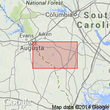
Pg. 5, 9, 14, 21, geol. map. McBean Formation (of Veatch and Stephenson, 1911). Consists of sandy limestone, marl, clay, and sand in a coarsening-upwards sequence indicative of transgression and regression of the sea. The calcareous beds that characterize the formation in downdip areas are generally absent in Barnwell sheet. Maximum thickness about 42 m (140 feet). Base of formation can be highly-irregular with as much as 10 m (33 feet) of relief over short distances. Unconformably underlies Barnwell Group; unconformably[?] overlies Huber and Congaree Formations, undivided. Age is late middle Eocene, based on fossils (dinoflagellates identified by L.E. Edwards, USGS, written commun., 1982-1984). Report includes correlation chart.
Best exposure in quadrangle: large roadcut on northeast side of Savannah River Site road "C" just southeast of the Upper Three Runs bridge.
Source: Publication.
For more information, please contact Nancy Stamm, Geologic Names Committee Secretary.
Asterisk (*) indicates published by U.S. Geological Survey authors.
"No current usage" (†) implies that a name has been abandoned or has fallen into disuse. Former usage and, if known, replacement name given in parentheses ( ).
Slash (/) indicates name conflicts with nomenclatural guidelines (CSN, 1933; ACSN, 1961, 1970; NACSN, 1983, 2005, 2021). May be explained within brackets ([ ]).