

- Usage in publication:
-
- Mazomanie sandstone
- Modifications:
-
- Original reference
- Dominant lithology:
-
- Sandstone
- AAPG geologic province:
-
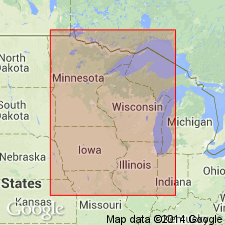
- Wisconsin arch
Summary:
Pg. 73-78. Mazomanie sandstone. A more or less decidedly calcareous formation; a magnesian sandstone; contains considerable disseminated glauconite. Approximate thickness 10 to 100 feet. Rests on Franconia sandstone and underlies St. Lawrence formation. Age is Late Cambrian.
Source: US geologic names lexicons (USGS Bull. 896, p. 1329; USGS Bull. 1200, p. 2437).
- Usage in publication:
-
- Mazomanie formation
- Modifications:
-
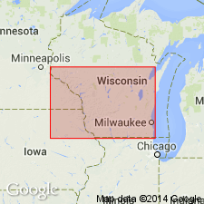
- Areal extent
- Dominant lithology:
-
- Sandstone
- Shale
- Dolomite
- AAPG geologic province:
-
- Wisconsin arch
Summary:
Pg. 548. Mazomanie formation. Fine to medium-grained gray to dark-red sandstone irregularly cemented by dolomite; locally beds of red, green, and gray calcareous shale; base consists of gray dolomite with purple spots very similar to St. Lawrence or Black Earth member of Trempealeau formation; entire formation contains more or less dolomite. Maximum thickness 165 feet; average 100 feet. Thins out to west and overlaps Franconia for distance of 10 to 20 miles. Is known from far northeastern Wisconsin to near Spring Green, Wisconsin. In northern IL, it was formerly correlated with the Madison and Mendota of Wisconsin, but it bears no resemblance to those formations. Underlies Trempealeau formation [St. Lawrence formation] and overlies Franconia formation. Age is Late Cambrian.
Source: US geologic names lexicon (USGS Bull. 896, p. 1329).
- Usage in publication:
-
- Mazomanie sandstone
- Modifications:
-
- Not used
- AAPG geologic province:
-
- Wisconsin arch
Summary:
Pg. 21-79. Mazomanie sandstone. Is same as Franconia sandstone, and not younger, as Ulrich claims.
Source: US geologic names lexicon (USGS Bull. 896, p. 1329).
- Usage in publication:
-
- Mazomanie formation
- Modifications:
-
- Not used
- AAPG geologic province:
-
- Wisconsin arch
Summary:
Pg. 13. Mazomanie formation. Formerly it was rather generally believed Mazomanie formation of Ulrich was = the Franconia. Ulrich then advanced the view that there are 2 distinct formations, the Mazomanie representing an invasion from the east and the Franconia from the west, and the former overlapping the latter. Little evidence was advanced to support this view. Recent studies have shown that Mazomanie faunas extend west beyond the Mississippi, and that Franconia faunas underlie those of the Mazomanie wherever lower part of the succession is fossiliferous. Also, Pentland's study of the Franconia and Mazomanie shows a homogeneity of mineral content which could hardly have been possible had the materials been derived from different regions. As Franconia has priority it is here used, and it is recommended that Mazomanie be abandoned or given rank as a member.
Source: US geologic names lexicon (USGS Bull. 896, p. 1329).
- Usage in publication:
-
- Mazomanie sandstone
- Modifications:
-
- Not used
- AAPG geologic province:
-
- Wisconsin arch
Summary:
Pg. 116-117. Mazomanie sandstone. The strata designated "Mazomanie" by Ulrich in 1920 are now known to be a part ot Franconia formation, from which they differ in being somewhat coarser-grained and more dolomitic. Ulrich at first supposed Franconia is confined to west side of Wisconsin arch and the Mazomanie to the east. Later studies showed this is error, and most geologists have abandoned Mazomanie as a synonym, although it has been given wide currency among well drillers in eastern Wisconsin and in Illinois. [Type section by F.T. Thwaites, on p. 116, calls the beds Franconia.]
Source: US geologic names lexicon (USGS Bull. 896, p. 1329).
- Usage in publication:
-
- Mazomanie formation
- Modifications:
-
- Not used
- AAPG geologic province:
-
- Wisconsin arch
Summary:
Pg. 1702. Mazomanie formation. Upper beds of Hudson member of Franconia formation in various parts of Wisconsin, notably central area, contain fauna Ulrich assigned to his proposed Mazomanie formation, but which writers designate PROSAUKIA subfaunal zone. Lower part of Hudson member contains PTYCHASPIS subfauna. Ulrich named his Mazomanie formation from Mazomanie village, on Wisconsin River, near which the strata are exposed in conspicuous cliff. [Summarize parts of Ulrich's definition.] Nothing of kind described by Ulrich exists. His Mazomanie continues westward to Mississippi River and beyond, and his Franconia continues east over the arch with undiminished thickness. Writers do not consider the Mazomanie to merit rank of a formation, but to be little more than a minor subdivision of Franconia formation.
Source: US geologic names lexicon (USGS Bull. 896, p. 1329).
- Usage in publication:
-
- Mazomanie sandstone
- Modifications:
-
- Overview
- AAPG geologic province:
-
- Wisconsin arch
Summary:
Mazomanie sandstone. Is quite distinct from "Franconia," both faunally and lithologically, and is younger.
Source: US geologic names lexicon (USGS Bull. 896, p. 1329).
- Usage in publication:
-
- Mazomanie sandstone member
- Modifications:
-
- Revised
- AAPG geologic province:
-
- Wisconsin arch
- Iowa shelf
Summary:
Pg. 555; 1951, Minnesota Geologist, v. 8, no. 4, p. 1, 2. Mazomanie sandstone member of Franconia formation. Rank reduced to member status in Franconia formation which is herein subdivided into five formations. Ulrich (1920) used term Mazomanie formation for nonglauconitic dolomitic sandstone in central Wisconsin that contains PROSAUKIA fauna; he believed Mazomanie was younger than Franconia. This sandstone represents a facies to the north and east of the more highly glauconitic Franconia sandstone, and name Mazomanie member is applied here to this nonglauconitic facies. Interfingers with and replaces glauconitic sandstones to north and east. Overlies Tomah member (new), interfingers with Reno member (new).
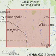
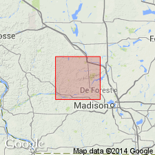
Type area: at Ferry Bluff, in SW/4 sec. 20, T. 9 N., R. 6 E., Sauk Co., south-central WI. This is a locality mentioned by Ulrich (1920) and is situated across Wisconsin River from town of Mazomanie [see also Clayton and Attig, 1990].
Source: US geologic names lexicon (USGS Bull. 1200, p. 2436-2437).
- Usage in publication:
-
- Mazomanie sandstone member
- Modifications:
-
- Revised
- Areal extent
- AAPG geologic province:
-
- Wisconsin arch
- Iowa shelf
Summary:
Pg. 866-869, measured sections. Mazomanie sandstone member of Franconia formation. Twenhofel, Baasch, and Thwaites (1935, GSA Bull., v. 46, no. 11) rejected name Mazomanie. From Mississippi River eastward into Wisconsin, interbedded nonglauconitic sandstone in Franconia greensands thicken until in central Wisconsin entire Franconia above Tomah member is composed of nonglauconitic and dolomitic sandstone; revived name Mazomanie is applied to facies that intertongues with Reno member. Member consists of two rock types: a crossbedded dolomitic sandstone dominant in type area, and a thin-bedded sandstone well exposed only in St. Croix Valley. The thin-bedded Mazomanie is a distinct type distinguished from the Tomah by absence of interbedded shale, but regional relationships between the two Mazomanie rock types cannot be distinguished in detail. Term Mazomanie has been expanded to include all sandstones that constitute nonglauconitic facies to north and east. In some areas, the Mazomanie overlies Birkmose member of Franconia. At type area, the Mazomanie constitutes more than three-fourths of Franconia thickness. Thickness at type locality 116.5 feet. Measured sections show Mazomanie present in Minnesota. Age is Late Cambrian.
Source: US geologic names lexicon (USGS Bull. 1200, p. 2436-2437).
- Usage in publication:
-
- Mazomanie Member
- Modifications:
-
- Revised
- AAPG geologic province:
-
- Wisconsin arch
Summary:
Pg. 6 (fig. 4), 21-22. Mazomanie Member of Tunnel City Formation (revised). Nearly nonglauconitic, commonly pale brown. Forms wedge in middle of Lone Rock Member in much of south-central Wisconsin. However, in eastern Sauk County, makes up most of formation; Lone Rock Member makes up most of formation in western part of county. Approximately equivalent to "Yellow Sandstone" of Twenhofel and Thwaites (1919) and "Hudson Member" of Twenhofel and others (1935). Age is Cambrian.
Authors consider Ferry Bluff section to be type section. Berg (1954) implied type section is at Ferry Bluff, in SW/4 sec. 20, T. 9 N., R. 6 E., Sauk Co., south-central WI. This is a locality mentioned by Ulrich (1920) and is situated across Wisconsin River from town of Mazomanie. Odom, 1978 (Wisconsin Geol. Nat. Survey, Field Trip Guidbook, no. 3, p. 121) considered type section to be School House Bluff at southeast edge of village of Mazomanie, Dane Co., WI (section also described by Ostrom, 1978, Wisconsin Geol. Nat. Survey, Geol. Wisconsin, Outcrop description SK11/5E/22).
Source: Publication.
For more information, please contact Nancy Stamm, Geologic Names Committee Secretary.
Asterisk (*) indicates published by U.S. Geological Survey authors.
"No current usage" (†) implies that a name has been abandoned or has fallen into disuse. Former usage and, if known, replacement name given in parentheses ( ).
Slash (/) indicates name conflicts with nomenclatural guidelines (CSN, 1933; ACSN, 1961, 1970; NACSN, 1983, 2005, 2021). May be explained within brackets ([ ]).