- Usage in publication:
-
- Mazarn shale*
- Modifications:
-
- Named
- Dominant lithology:
-
- Shale
- Limestone
- Sandstone
- AAPG geologic province:
-
- Ouachita folded belt
Summary:
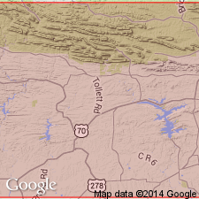
Named from Mazarn Creek, whose headwaters are in the northeast corner of the Caddo Gap quadrangle, Montgomery Co, AR, Ouachita tectonic belt province. No type locality designated. Name applied to part of the "Ouachita shale" (abandoned in this report) below the Blakely sandstone. Composed of shale and small amounts of limestone and sandstone; shale is ribboned and consists of alternating black and green layers which split at an angle with the bedding. Is 1,000 ft thick. Overlies Crystal Mountain sandstone; underlies Blakely sandstone (new). Stratigraphic chart. Geologic map. Early Ordovician graptolites found.
Source: GNU records (USGS DDS-6; Denver GNULEX).
For more information, please contact Nancy Stamm, Geologic Names Committee Secretary.
Asterisk (*) indicates published by U.S. Geological Survey authors.
"No current usage" (†) implies that a name has been abandoned or has fallen into disuse. Former usage and, if known, replacement name given in parentheses ( ).
Slash (/) indicates name conflicts with nomenclatural guidelines (CSN, 1933; ACSN, 1961, 1970; NACSN, 1983, 2005, 2021). May be explained within brackets ([ ]).

