

- Usage in publication:
-
- Maywood formation*
- Modifications:
-
- Original reference
- Dominant lithology:
-
- Limestone
- Shale
- Sandstone
- AAPG geologic province:
-
- Montana folded belt
Summary:
Maywood formation. Flaggy reddish, gray, and whitish magnesian limestones and gray, whitish, and olive-green calcareous shale, with beds of light-colored calcareous sandstone about 40 feet above base. Thickness 200 to 300 feet. Of marine origin. No fossils. May be Lower Devonian, Silurian, Ordovician, or Upper Cambrian. Overlies Red Lion formation, possibly unconformably. Underlies Jefferson limestone conformably. Age is Silurian(?).
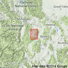
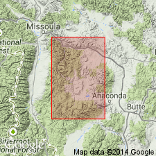
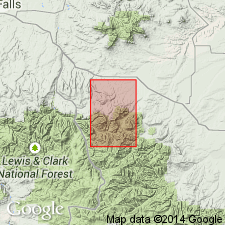
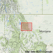
Named from Maywood Ridge, west of Princeton, on whose northeastern face, 2 mi above mouth of South Boulder Creek, the best exposure occurs, [in T. 8 N., R. 13 W., Philipsburg quadrangle, Granite Co.], central western MT.
Source: US geologic names lexicon (USGS Bull. 896, p. 1328).
- Usage in publication:
-
- Maywood formation
- Modifications:
-
- Age modified
- AAPG geologic province:
-
- Montana folded belt
Summary:
Maywood in area of Philipsburg quad, Granite Co, MT, is lithologically identical Upper Cambrian Dry Creek formation in what author refers to as central Montana basin, Montana folded belt province. Thus, assigns Maywood to Late Cambrian.
Source: GNU records (USGS DDS-6; Denver GNULEX).
- Usage in publication:
-
- Maywood formation
- Modifications:
-
- Revised
- AAPG geologic province:
-
- Montana folded belt
Summary:
Pg. 2202 (fig. 1), 2213. Maywood formation. As used in this report, Maywood overlies Sage pebble conglomerate member (new) of Dry Creek shale (redefined). Consists of buff-orange dolomite, maroon-green dolomite, and mudstones 65 to 85 feet thick. Underlies Jefferson dolomite. Devonian. Most of the beds referred to in literature by Weed, 1900 (USGS 20th Ann. Rpt. for 1898-1899, pt. 3), Deiss, 1936 (GSA Bull., v. 47, no. 8), and Lochman and Duncan (1944) as Dry Creek shale are actually the basal Devonian unit and beds of undetermined age of Sloss and Laird, 1947 (AAPG Bull., v. 31, no. 8) and should be known as Maywood formation.
Source: US geologic names lexicon (USGS Bull. 1200, p. 2435).
- Usage in publication:
-
- Maywood formation*
- Modifications:
-
- Areal extent
- AAPG geologic province:
-
- Montana folded belt
Summary:
Pg. 495-496, pl. 42. Maywood formation. In area of report [Townsend Valley, Broadwater and Jefferson Counties, central Montana], Red Lion formation of Cambrian age and Maywood formation of Late Devonian age are mapped as a unit although the two formations are separated by erosional unconformity. This undivided unit = Peale's (1893) Dry Creek shale.
Source: US geologic names lexicon (USGS Bull. 1200, p. 2435); supplemental information from GNU records (USGS DDS-6; Denver GNULEX).
- Usage in publication:
-
- Maywood Formation
- Modifications:
-
- Age modified
- Areal extent
- AAPG geologic province:
-
- Montana folded belt
Summary:
Maywood revised to lower Fingerlakesian Stage of Senecan (Frasnian) Series (Upper Devonian) in area of Garnet and Bearmouth in northern Granite Co and adjoining portions of Powell and Missoula Cos, MT in Montana folded belt province. Thickness is 360 ft including 102 ft of transitional beds between typical Maywood rocks and typical limestone of the overlying Jefferson Formation. Unconformably overlies Upper Cambrian Red Lion Formation. Correlates with Sloss and Laird's (1947) "basal Devonian unit" of central MT, unit designated DC by Sloss and Laird (1946) in northwestern MT and Souris River Formation of Williston basin and lower part of Beaverhill Lake Formation of Alberta basin. Geologic map. Measured section. Stratigraphic column.
Source: GNU records (USGS DDS-6; Denver GNULEX).
- Usage in publication:
-
- Maywood Formation*
- Modifications:
-
- Areal extent
- AAPG geologic province:
-
- Montana folded belt
Summary:
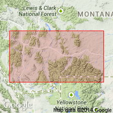
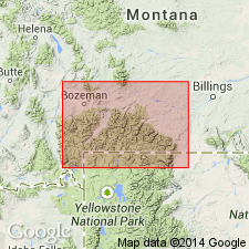
Extends unit to west side of Gallatin Range, Gallatin Co, MT in Montana folded belt province. Crops out about 3/8 mi north of Squaw Creek Ranger Station [now called Shenango Work Center] and forms almost continuous exposure for 1000 ft. At measured section (SWNENW sec 28, T4S, R4E) is 34 ft thick and is where fish scales of BOTHRIOLEPIS are most abundant. McMannis (1962) previously stated that Maywood was 61 ft thick at Squaw Creek Ranger Station. However, correlation with bottom two units of type section of Jefferson at Logan, MT demonstrates that 27 ft was incorrectly assigned to Maywood rather than Jefferson. [No type section designated for Jefferson by Peale (1893)]. Presence of BOTHRIOLEPIS indicates deposition in brackish or fresh water of bay or estuary. Unconformably overlies Upper Cambrian Pilgrim Limestone at measured section and 600 ft to north along outcrop; unconformably overlies Upper Cambrian Red Lion Formation along remainder of outcrop. Conformably underlies lower Upper Devonian Jefferson Formation. Figure 1 shows approximate southern extent of unit occurring east of Bridger Range, western side of Gallatin Range, and northern part of Madison Range. Early Late Devonian age.
Source: GNU records (USGS DDS-6; Denver GNULEX).
- Usage in publication:
-
- Maywood unit
- Modifications:
-
- Revised
- AAPG geologic province:
-
- Montana folded belt
- Yellowstone province
Summary:
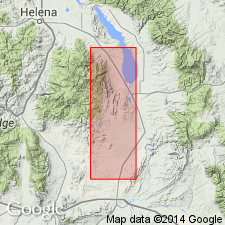
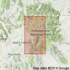
Author accepts evidence of Lochman (1950) and Hanson (1952) that Maywood represents preserved remnant of a soil or zone of chemical weathering that developed prior to deposition of Jefferson Formation. Based on recommendation of Stratigraphic Commission (Cohee and others, 1956, American Association of Petroleum Geologists Bulletin, v. 40 , p. 2003-2014) regarding naming of paleosols, author chooses not to give unit formal status. [Cohee and others (1956) state that "Paleosols may be given geographic names but should not be considered as units of the standard rock-stratigraphic subdivisions unless they can be defined on the basis of consistent stratigraphic relationships."]. Contact with overlying Jefferson is gradational; basal part of unit is transitional with underlying Snowy Range Formation. In Gallatin Co, MT, within Montana folded belt province, thickness of Maywood ranges from 15-110 ft in Horseshoe Hills and Bridger Mountains, averaging 55 ft; at Flying "D" Ranch, southwest of Gallatin Gateway, thickness is 42 ft; and at Squaw Creek [now Storm Castle Creek], it is 32 ft thick. At Crowfoot Ridge in northwest corner of Yellowstone Park, WY, in Yellowstone province, Maywood? is possibly 23 ft thick. Several measured sections; one petrographic description; cross sections. Devonian age.
Source: GNU records (USGS DDS-6; Denver GNULEX).
- Usage in publication:
-
- Maywood Formation*
- Modifications:
-
- Overview
- Areal extent
- AAPG geologic province:
-
- Montana folded belt
Summary:
Western equivalent of Souris River Formation. Name used in MT portion of Beartooth Mountains, Montana folded belt province, and to west of MT, whereas Souris River used in subsurface in eastern MT and northern WY. Maywood represents basal deposit of eastward transgressing sea from Cordilleran miogeosyncline; Souris River is basal deposit of westward transgressing sea from Williston intracratonic basin. Seas coalesced in central and north-central MT early in Late Devonian, then spread south into northern WY. Figure 2 shows southern limit of Maywood in northern Gallatin Range and northern Beartooth Mountains, MT. Overlies Beartooth Butte? Formation; underlies lower member of Jefferson Formation. Late Devonian age.
Source: GNU records (USGS DDS-6; Denver GNULEX).
- Usage in publication:
-
- Maywood Formation*
- Modifications:
-
- Mapped
- AAPG geologic province:
-
- Sweetgrass arch
Summary:
Maywood Formation. Siltstone. Upper and middle strata are light yellow or light brown, thin-bedded, locally platy; basal strata are red. As mapped may include at base strata previously assigned to the Dry Creek Shale of mainly Cambrian age. About 80 feet thick. Unconformably lies above Late Cambrian Pilgrim Limestone; lies below Jefferson Dolomite. [Age is Middle to Late Devonian.]
Source: Publication.

- Usage in publication:
-
- Maywood Formation*
- Modifications:
-
- Age modified
- Biostratigraphic dating
- AAPG geologic province:
-
- Sweetgrass arch
- Montana folded belt
Summary:
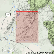
Pg. A28 (fig. 20), A29-A30, pls. 1, 3. Maywood Formation. In Sun River Canyon area, northwestern Montana, subdivided into: upper member, thin-bedded finely crystalline limestone and dolomitic limestone, 70 to 159 feet thick, (= lower part of unit B of Sloss and Laird); and lower member, greenish-gray dolomitic mudstone, 26 to 207 feet thick, (= unit C of Sloss and Laird). Underlies Jefferson Formation; unconformably overlies Cambrian Devils Glen Dolomite. Age is Middle and Late Devonian. Charophytes identified (A.R. Palmer, R.E. Peck) from the lower member indicate Middle Devonian; brachiopods identified (J.T. Dutro, Jr.) from the upper member indicate early Late Devonian (Frasnian), ALLANARIA zone.
Source: Publication.
- Usage in publication:
-
- Maywood Formation*
- Modifications:
-
- Areal extent
- AAPG geologic province:
-
- Montana folded belt
- Sweetgrass arch
Summary:
Mapped with overlying Jefferson and Three Forks Formations in study area which includes portions of Flathead, Lake, Missoula, Powell, Lewis and Clark, and Teton Cos, in northwestern MT in Montana folded belt province and Sweetgrass arch. Maywood thickens from about 21 m in western part of area to 48 m in eastern part. Middle and Late Devonian age.
Source: GNU records (USGS DDS-6; Denver GNULEX).
For more information, please contact Nancy Stamm, Geologic Names Committee Secretary.
Asterisk (*) indicates published by U.S. Geological Survey authors.
"No current usage" (†) implies that a name has been abandoned or has fallen into disuse. Former usage and, if known, replacement name given in parentheses ( ).
Slash (/) indicates name conflicts with nomenclatural guidelines (CSN, 1933; ACSN, 1961, 1970; NACSN, 1983, 2005, 2021). May be explained within brackets ([ ]).