The National Geologic Map Database is migrating to a new infrastructure. We apologize for any service disruptions during this process.
|
|---|


- Usage in publication:
-
- Mauls Point Member
- Modifications:
-
- Named
- Dominant lithology:
-
- Sand
- Mud
- Clay
- AAPG geologic province:
-
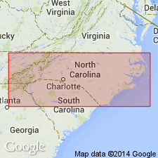
- Atlantic Coast basin
Summary:
The upper member of the Flanner Beach Formation in the Pamlico River Valley in the Blounts Bay area of Beaufort Co., NC, is here named the Mauls Point Member. It consists of a blanket-shaped unit of interbedded sand and mud with clay interlaminations and may represent open lagoonal deposits. Intertongues with and overlies the Hills Point Member of the Flanner Beach. Thickness at type section is 4 m. Age is middle Pleistocene.
Source: GNU records (USGS DDS-6; Reston GNULEX).
For more information, please contact Nancy Stamm, Geologic Names Committee Secretary.
Asterisk (*) indicates published by U.S. Geological Survey authors.
"No current usage" (†) implies that a name has been abandoned or has fallen into disuse. Former usage and, if known, replacement name given in parentheses ( ).
Slash (/) indicates name conflicts with nomenclatural guidelines (CSN, 1933; ACSN, 1961, 1970; NACSN, 1983, 2005, 2021). May be explained within brackets ([ ]).