

- Usage in publication:
-
- Maudlow Formation*
- Modifications:
-
- Named
- Geochronologic dating
- Dominant lithology:
-
- Sandstone
- AAPG geologic province:
-
- Montana folded belt
Summary:
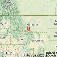
Named formation of Livingston Group for town of Maudlow, Gallatin Co, MT. Was called Maudlow conglomerate lentil of Livingston Formation in two unpublished theses. Type section designated in secs 10, 15, 16, 22, and 28, T4N, R5E, Gallatin Co, Montana folded belt province, where a section 1,624.5 m (5,330+ ft) thick was measured. Restricted to 65 km sq in Maudlow area. Composed of volcaniclastics, flows, breccias, welded tuff interbedded with volcanic sandstone, mudstone, and minor lignitic coal. Divided into 8 informal members (A-H). Sandstones may be gray, fine to coarse grained, calcareous, tuffaceous volcanic, conglomeratic, cross to irregularly bedded. Siltstone is olive gray and poorly bedded. Claystone is olive gray to gray green, volcanic, poorly bedded, siliceous; some beds have cannonball concretions. Several crystal-vitric and crystal-lithic-tuff beds present. Several conglomeratic and volcanic breccia units that range in size from microscopic fragments to 4 ft cobbles and boulders. Overlies Telegraph Creek Formation at type. May also overlie Virgelle Sandstone. Palynomorph and leaf fossils indicate a Late Cretaceous, latest Santonian, or early Campanian age. Radiometric age on hornblende from breccias in members B and F are 78.9 +/-1 and 74.9 +/-1 m.y. respectively. Correlates with Elkhorn Mountains Volcanics, Sedan Formation (new) of Livingston Group, and with Cokedale and Miner Creek Formations.
Source: GNU records (USGS DDS-6; Denver GNULEX).
- Usage in publication:
-
- Maudlow Formation*
- Modifications:
-
- Geochronologic dating
- AAPG geologic province:
-
- Montana folded belt
Summary:
Pg. 16-17, geologic time scale (inside front cover). Samples from the B and F members of Maudlow Formation. Previously published ages (Skipp and McGrew, 1977, USGS Bull. 1422-B, p. B1-B68) are recalculated with revised potassium-40 decay constants, following recommendations of the IUGS Subcommission on Geochronology (Steiger and Jager, 1977, Earth and Planetary Science Letters, v. 36, p. 359-362). Ages determined by USGS personnel in Denver, CO (R.F. Marvin, H.H. Mehnert, E.A. Brandt). Samples collected by B. Skipp.
(1) Sample (K-Ar dacite) from a porphyritic hornblende dacite flow in B member of Maudlow Formation. Dacite is stratigraphically correlated with the ammonite zone SCAPHITES HIPPOCREPIS II. Recalculated [K-Ar] age on hornblende is 80.9 +/-1.0 Ma [Late Cretaceous]; published age 78.9 Ma. Sample no. USGS(D)201S-59. Sample locality: east of Horseshoe Hills, Lat. 46 deg. 02 min. 55 sec. N., Long. 111 deg. 10 min. 50 sec. W., in NW/4 NW/4 sec. 1, T. 3 N., R. 4 E., Maudlow 15-min quadrangle, Gallatin Co., MT.
(2) Sample (K-Ar dacite) from a porphyritic dacite breccia in F member of Maudlow Formation. Breccia is stratigraphically correlated with the ammonite zone BACULITES PERPLEXES. Recalculated [K-Ar] age on hornblende is 76.6 +/-1.0 Ma [Late Cretaceous]; published age 74.9 Ma. Sample no. USGS(D)60S-60. Sample locality: east of Horseshoe Hills, Lat. 46 deg. 01 min. 50 sec. N., Long. 111 deg. 09 min. 50 sec. W., in NE/4 sec. 12, T. 3 N., R. 4 E., Maudlow 15-min quadrangle, Gallatin Co., MT.
Source: Publication.
For more information, please contact Nancy Stamm, Geologic Names Committee Secretary.
Asterisk (*) indicates published by U.S. Geological Survey authors.
"No current usage" (†) implies that a name has been abandoned or has fallen into disuse. Former usage and, if known, replacement name given in parentheses ( ).
Slash (/) indicates name conflicts with nomenclatural guidelines (CSN, 1933; ACSN, 1961, 1970; NACSN, 1983, 2005, 2021). May be explained within brackets ([ ]).