The National Geologic Map Database is migrating to a new infrastructure. We apologize for any service disruptions during this process.
|
|---|


- Usage in publication:
-
- Mattaponi formation*
- Modifications:
-
- Named
- Dominant lithology:
-
- Clay
- AAPG geologic province:
-
- Atlantic Coast basin
Summary:
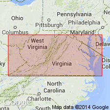
Name Mattaponi formation, new in this report, applied to 429 ft of sediments underlying Aquia formation in type well at Colonial Beach, VA. Top 100 ft is glauconitic to some extent and remainder consists of brightly colored mottled clays, and gray, blue, red and purple-brown clays. Overlies Potomac group. Age is Late Cretaceous and Paleocene.
Source: GNU records (USGS DDS-6; Reston GNULEX).
- Usage in publication:
-
- Mattaponi†
- Modifications:
-
- Abandoned
- AAPG geologic province:
-
- Atlantic Coast basin
Summary:
Abandonment of Mattaponi Formation is here recommended. Unit name was introduced by Cederstrom (1957) to include beds that he considered Paleocene in age. Because the 28 ft below the Marlboro Clay in a corehole at Colonial Beach contained Eocene foraminifers, he assigned that interval to the Aquia Formation. The underlying 149 ft of sediments contained Paleocene foraminifers, and since the Aquia was thought to be Eocene, Cederstrom suggested the term Mattaponi Formation for these Paleocene beds and the underlying 280 ft of sands and clays (probably part of the Potomac Group). The concept of the Mattaponi was based on an age determination derived from forams, and all the beds included in that formation had previously been assigned to lithic units. Therefore, the name should be discarded.
Source: GNU records (USGS DDS-6; Reston GNULEX).
For more information, please contact Nancy Stamm, Geologic Names Committee Secretary.
Asterisk (*) indicates published by U.S. Geological Survey authors.
"No current usage" (†) implies that a name has been abandoned or has fallen into disuse. Former usage and, if known, replacement name given in parentheses ( ).
Slash (/) indicates name conflicts with nomenclatural guidelines (CSN, 1933; ACSN, 1961, 1970; NACSN, 1983, 2005, 2021). May be explained within brackets ([ ]).