The National Geologic Map Database is migrating to a new infrastructure. We apologize for any service disruptions during this process.
|
|---|


- Usage in publication:
-
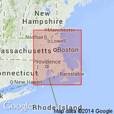
- Mattapan Volcanic Complex*
- Modifications:
-
- Age modified
- Geochronologic dating
- AAPG geologic province:
-
- New England province
Summary:
Unconformably underlies Roxbury Conglomerate of Boston Bay Group. Correlation with volcanic rocks of Pennsylvanian rocks adjacent to Norfolk basin and in Narragansett basin would permit a Pennsylvanian age. However, correlation with adjacent Lynn Volcanic Complex would permit an age as young as Early Devonian. Field relations indicate Mattapan to be younger than Dedham Granite. U-Th-Pb radiometric ages on zircons (Kaye and Zartman, 1980), give an age of 602 +/-3 m.y. for Mattapan. If zircon age is accepted, Mattapan would be Proterozoic Z or younger (earliest Cambrian?). Mattapan is therefore assigned a Proterozoic Z or younger age.
Source: GNU records (USGS DDS-6; Reston GNULEX).

- Usage in publication:
-
- Mattapan Volcanic Complex*
- Modifications:
-
- Overview
- AAPG geologic province:
-
- New England province
Summary:
Used as Mattapan Volcanic Complex of Proterozoic Z or younger age. Consists of rhyolite, melaphyre, agglomerate, and tuff.
Source: GNU records (USGS DDS-6; Reston GNULEX).

- Usage in publication:
-
- Mattapan Volcanic Complex
- Modifications:
-
- Revised
- Geochronologic dating
- Dominant lithology:
-
- Tuff
- Rhyolite
- AAPG geologic province:
-
- New England province
Summary:
Late Proterozoic Mattapan Volcanic Complex, south and west of Boston is here subdivided into the older Twin Pine Tuff and the younger High Rock Tuff (new names). High Rock Tuff includes the ash-flow tuffs of Needham, Newton, and the west side of the Stony Brook Reservation, while Twin Pine Tuff includes the ash-flow tuffs of Westwood, Sherborn, and the east side of Stony Brook Reservation. High Rock averages 25 to 35 percent crystals; Twin Brook averages 5 to 20 percent. In both units, plagioclase is more abundant than quartz and perthite. Pumice in the younger tuff is almost totally obscured by recrystallization; pumice lapilli are more abundant in the Twin Pine and are flattened so that outcrops appear foliated. The High Rock is massive except for local columnar jointing. These high-silica rhyolites differ in color. Fresh surfaces of the Twin Pine are consistently dark gray; fresh surfaces of the High Rock are pinkish or greenish gray. The two units probably did not form continuous "layer-cake" deposits over greater Boston. Partial stratigraphic sections from five study areas are juxtaposed. Thickness of the High Rock at Needham estimated at 865 m; thickness of the Twin Brook at Westwood is a minimum of 1,000 m. Mattapan ash-flow tuffs intruded by Westwood Granite, which has been dated at 579+/-23 Ma (Zartman and Naylor, 1984).
Source: GNU records (USGS DDS-6; Reston GNULEX).
- Usage in publication:
-
- Mattapan Volcanics*
- Modifications:
-
- Age modified
- Geochronologic dating
- AAPG geologic province:
-
- New England province
Summary:
Mattapan Volcanic Complex is found in west and southwest part of Boston basin and beyond, and to the south in Blue Hills. Similar in lithology to Lynn Volcanic Complex. Both units consist largely of partly porphyritic rhyolite and rhyodacite flows, welded ash-flow tuffs, vitric tuff, lapilli tuff, lithic tuff, flow breccias, breccia pipes, and extrusion domes. Mattapan's rhyolite and rhyodacites are thinner and less varied in composition and texture than Lynn's, and volcanic breccias are absent in Lynn. Both units are reported to lie nonconformably on Dedham Granite and unnamed plutonic-volcanic complex of eastern MA; however, Mattapan has been observed as dikes and stocks cutting Dedham Granite (Billings, 1976; Kaye and Zartman, 1980; Chute, 1966), and other workers have pointed out evidence that some of Mattapan may be penecontemporaneous with younger phases of Dedham batholith. Westwood Granite may be intrusive equivalent of Mattapan. Mattapan is conformably and fairly continuously overlain by Roxbury Conglomerate of Boston Bay Group. LaForge (19832) cautioned against identifying rocks interbedded within Mattapan that look like Roxbury, but are still part of Mattapan. Metavolcanic rocks in Blue Hills resembling Mattapan are assigned to Mattapan on State bedrock map (Zen and others, 1983); for years they were considered to be either Silurian and Devonian, or Carboniferous; however, they are chemically and mineralogically distinct from Ordovician and Silurian Blue Hills [sic] Granite Porphyry. Author follows usage of Chute (1966) who could find no difference between volcanic rocks in Blue Hills area and Mattapan rocks, and thus these rocks are assigned to Mattapan. Proterozoic Z age is based on U-Th-Pb zircon date of 602 +/-3 Ma (Zartman, in Kaye and Zartman, 1980). Although Billings (1979) questions reliability of zircon ages from volcanic rocks, discovery of Proterozoic Z acritarchs in overlying Cambridge Argillite indicates zircon age is appropriate. [Chapters A-J in U.S. Geological Survey Professional Paper 1366 are intended as explanations and (or) revisions to 1:250,000-scale MA State bedrock geologic map of Zen and others (1983).]
Source: GNU records (USGS DDS-6; Reston GNULEX).
For more information, please contact Nancy Stamm, Geologic Names Committee Secretary.
Asterisk (*) indicates published by U.S. Geological Survey authors.
"No current usage" (†) implies that a name has been abandoned or has fallen into disuse. Former usage and, if known, replacement name given in parentheses ( ).
Slash (/) indicates name conflicts with nomenclatural guidelines (CSN, 1933; ACSN, 1961, 1970; NACSN, 1983, 2005, 2021). May be explained within brackets ([ ]).