

- Usage in publication:
-
- Matawan formation
- Modifications:
-
- Named
- Dominant lithology:
-
- Clay
- Sand
- AAPG geologic province:
-
- Atlantic Coast basin
Summary:
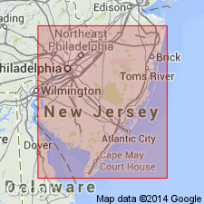
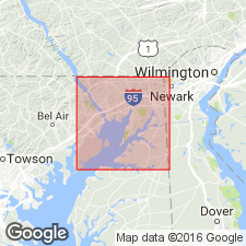
Matawan formation, previously called Clay Marls, is typically developed on shore of Raritan Bay in vicinity of Matawan Creek and along banks of the creek in Monmouth Co., NJ. Consists chiefly of dark-colored clays with interbedded layers of sand, which are very pronounced in upper part. Greensand beds appear at some points but are less pronounced than in overlying formations. Thickness approximately 275 ft. Unit extends to DE and northeastern MD. Conformably underlies Navesink formation and overlies Raritan formation. Age is Late Cretaceous.
Source: GNU records (USGS DDS-6; Reston GNULEX).
- Usage in publication:
-
- Matawan group
- Modifications:
-
- Revised
- Overview
- AAPG geologic province:
-
- Atlantic Coast basin
Summary:
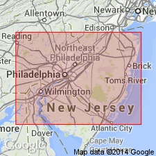
In NJ, group comprises (ascending) Merchantville clay, Woodbury clay, Englishtown sand, Marshalltown formation, and Wenonah sand. In Chesapeake and Delaware Canal area in DE and adjacent parts of MD, the Matawan has been mapped as an individual formation; previous investigators have not considered it practicable to subdivide it. Fresh exposures along canal have made it possible to subdivide the Matawan there, although it has not been deemed feasible to separate the Merchantville and Woodbury clay units, which are therefore treated as a combined unit under the old name Crosswicks clay; Wenonah sand is wanting.
Source: GNU records (USGS DDS-6; Reston GNULEX).
- Usage in publication:
-
- Matawan Formation*, Group*
- Modifications:
-
- Areal extent
- AAPG geologic province:
-
- Atlantic Coast basin
Summary:
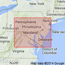
In northeastern MD and northern DE of northernmost Delmarva Peninsula, the Upper Cretaceous terms Matawan and Monmouth Formation or Groups are not useful, and they should be restricted from the area in favor of other formations geographically extended from NJ. The Matawan Formation of northeastern MD (Kent and Cecil Cos.) is replaced by (ascending) Merchantville, Englishtown, and Marshalltown Formations, and the Monmouth Formation by the Mount Laurel Sand. The ascending Woodbury Clay, Wenonah, and Navesink Formations pinch out in NJ and are not present in DE and MD. [Although not stated in this report, Matawan Formation is recognized on the western shore and eastern shore of southern MD where the Merchantville, Englishtown, and Marshalltown cannot be recognized and extended into southern MD (N.F. Sohl, 1984, oral communication).]
Source: GNU records (USGS DDS-6; Reston GNULEX).
- Usage in publication:
-
- Matawan Formation*, Group*
- Modifications:
-
- Areal extent
- AAPG geologic province:
-
- Atlantic Coast basin
Summary:
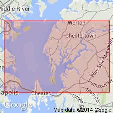
Upper Cretaceous Matawan Formation is used in the Round Bay quad. on Severn River, Anne Arundel Co., MD. Overlies Magothy Formation; underlies Severn Formation [previously Monmouth Group]. It is correlative to (ascending) Merchantville Formation, Woodbury Clay, Englishtown Formation, and Marshalltown Formation in northeastern MD and northern DE of northernmost Delmarva Peninsula. In NJ these units form the Matawan Group. [Per oral communication with N.F. Sohl, 1984, the Matawan extends across Chesapeake Bay to the western shore. Maryland Geological Survey uses Matawan Formation in southern MD in St. Marys and Calvert Cos., on western shore and in Dorchester, Talbot, and Queen Anne Cos., on eastern shore.]
Source: GNU records (USGS DDS-6; Reston GNULEX).
- Usage in publication:
-
- Matawan Group*
- Modifications:
-
- Overview
- AAPG geologic province:
-
- Atlantic Coast basin
Summary:
Within Cecil Co., a few good exposures of the Matawan formations have been seen along the Sassafras River, in the cliffs on Grove Neck, and along the Bohemia River. An unusually high section was measured on a cliff on the west side of Mauldin Mountain on Elk Neck. Here the Merchantville Formation is 22.0 ft, the Englishtown is 10.1 ft, and the Marshalltown is 3.0 ft. Between the Merchantville and the Potomac Group (undifferentiated) are 6 ft of unidentified strata shown as Merchantville(?) or Magothy(?) or Potomac Group(?). The Matawan Group here underlies 35 ft of Mount Laurel Sand of the Monmouth Group. [This manuscript was reviewed by the GNU in 1973, but was not published until 1990. Field work for this study was done in the late 1960's. The nomenclature in this report may not reflect current usage. Matawan should be used only at Formation rank in MD by the USGS according to N.F. Sohl (1984, oral commun).]
Source: GNU records (USGS DDS-6; Reston GNULEX).
- Usage in publication:
-
- Matawan Group
- Modifications:
-
- Overview
- AAPG geologic province:
-
- Atlantic Coast basin
Summary:
Report offers excellent overviews of the formations that compose the Campanian Matawan Group (Merchantville, Woodbury, Englishtown, Marshalltown, and Wenonah Formations) including age, lithology, thickness, fauna, and areal extent.
Source: GNU records (USGS DDS-6; Reston GNULEX).
- Usage in publication:
-
- Matawan Group
- Modifications:
-
- Overview
- AAPG geologic province:
-
- Atlantic Coast basin
Summary:
Matawan Group (undivided) in the Ken-Bf 180 core-hole occupies the interval between 404 ft and 295 ft. Described as a sequence of glauconitic, dark-gray to olive-gray silty clays and very fine to fine sands. Below 320 ft, unit is generally noncalcareous with only rare Foraminifera. Available biostratigraphic information suggests a Campanian age. Overlies Magothy Formation and gradationally underlies Mount Laurel Formation of Monmouth Group.
Source: GNU records (USGS DDS-6; Reston GNULEX).
- Usage in publication:
-
- Matawan Group*
- Modifications:
-
- Overview
- AAPG geologic province:
-
- Atlantic Coast basin
Summary:
Late Cretaceous Matawan Group occurs in MD.
Source: GNU records (USGS DDS-6; Reston GNULEX).
For more information, please contact Nancy Stamm, Geologic Names Committee Secretary.
Asterisk (*) indicates published by U.S. Geological Survey authors.
"No current usage" (†) implies that a name has been abandoned or has fallen into disuse. Former usage and, if known, replacement name given in parentheses ( ).
Slash (/) indicates name conflicts with nomenclatural guidelines (CSN, 1933; ACSN, 1961, 1970; NACSN, 1983, 2005, 2021). May be explained within brackets ([ ]).