- Usage in publication:
-
- Mason Group*
- Modifications:
-
- Original reference
- Dominant lithology:
-
- Sand
- Gravel
- Silt
- Clay
- AAPG geologic province:
-
- Illinois basin
- Michigan basin
- Wisconsin arch
Summary:
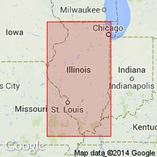
Pg. 5, 6, 14-18, 20 (fig. 10), 50+. Mason Group. Is an extensive unit that blankets most of Illinois. Includes: (1) basal Roxana Silt, reddish brown, up to 50+/- feet; (2) Peoria Silt, yellow brown to gray, up to 80+/- feet; (3) Henry Formation, mostly bedded sand and gravel, up to 210+/- feet; and (4) Equality Formation, mostly silt and clay, up to 65+/- feet; all revised from Willman and Frye (1970). Total thickness <3.3 to about 98 feet (1 to 30 m). Intertongues with diamicton units of Wedron Group. Correlates with part of Atherton and Martinsville Formations of Indiana. Interpreted to be proglacial sorted-sediment deposits, mainly loess, eolian sand, lake sediment, and outwash. Age is considered Pleistocene (Wisconsinan Age; Woodfordian Subage), based on radiocarbon dating; uppermost part considered Holocene.
Type locality: Mason Co., central IL. Named from Mason Co.
Principal reference sections:
(1) Farm Creek section, on south side of Farm Creek, in NE/4 SW/4 SE/4 sec. 30, T. 26 N., R. 3 W., Washington 7.5-min quadrangle, Tazewell Co., IL
(2) Wedron section, in highwalls of pits in Wedron Silica Company quarries, in secs. 8, 9, 10, and 16, T. 34 N., R. 4 E., Wedron 7.5-min quadrangle, La Salle Co., IL.
Source: Publication.
For more information, please contact Nancy Stamm, Geologic Names Committee Secretary.
Asterisk (*) indicates published by U.S. Geological Survey authors.
"No current usage" (†) implies that a name has been abandoned or has fallen into disuse. Former usage and, if known, replacement name given in parentheses ( ).
Slash (/) indicates name conflicts with nomenclatural guidelines (CSN, 1933; ACSN, 1961, 1970; NACSN, 1983, 2005, 2021). May be explained within brackets ([ ]).

