- Usage in publication:
-
- Masket [formation]
- Modifications:
-
- Named
- AAPG geologic province:
-
- Great Basin province
Summary:
Named on cross section and structure section in report on Toquima sequences, Paleozoic continental margin in central NV. Overlies Diana [formation] (new) or Gatecliff [formation] (new). Underlies McMonnigal [formation] (new). Structure section gives Silurian age.
Source: GNU records (USGS DDS-6; Menlo GNULEX).
- Usage in publication:
-
- Masket Shale
- Modifications:
-
- Redescribed
- Dominant lithology:
-
- Argillite
- AAPG geologic province:
-
- Great Basin province
Summary:
Masket Shale described in section in bluff north of March Spring near Ikes Canyon, northern Toquima Range, NV, as yellow-weathering, dark, laminated argillite, breaking into thin, resonant slabs. Graptolites are rare. Overlies Diana Limestone at Ikes Canyon.
Source: GNU records (USGS DDS-6; Menlo GNULEX).
- Usage in publication:
-
- Masket Shale
- Modifications:
-
- Revised
- Areal extent
- AAPG geologic province:
-
- Great Basin province
Summary:
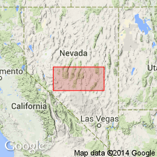
Masket Shale (Kay, 1960) named for Masket Peak, 10,487 ft. Type section designated northwest of peak in Mill Canyon sequence above March Spring [Toquima Range, Nye Co NV]. Consists of 450 ft of buff-weathering, dark argillaceous calcisiltite with 15 ft of fine-laminated calcisiltite about 100 ft from base and interbeds of crinoidal calcarenite and calcisiltite in upper 100 ft. Mapped in Striped Hill, Prospect, June Canyon, Mill Canyon and August Canyon sequences. Includes Bastille Limestone Member in August Canyon sequence. Underlies McMonnigal Limestone; overlies Diana Limestone or Antelope Valley Limestone (where Diana Limestone is absent). Is Silurian age.
Source: GNU records (USGS DDS-6; Menlo GNULEX).
- Usage in publication:
-
- Masket Shale
- Modifications:
-
- Revised
- Age modified
- AAPG geologic province:
-
- Great Basin province
Summary:
Bastille Limestone Member of Masket Shale (Kay and Crawford, 1964) proposed to be raised to formational rank and named Bastille Limestone. Upper limit of Masket Shale placed near Silurian-Devonian boundary on basis of ostracode fauna. Age therefore is Silurian (Wenlockian and Ludlovian) and Early Devonian (Helderbergian).
Source: GNU records (USGS DDS-6; Menlo GNULEX).
- Usage in publication:
-
- Masket Shale*
- Modifications:
-
- Revised
- AAPG geologic province:
-
- Great Basin province
Summary:
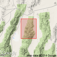
Masket Shale name restricted to August Canyon sequence which includes Bastille Limestone Member. Term "Roberts Mountain Formation" is used for partly correlative strata in other sequences. Shown on map near mouth of Mill Canyon for about 2 mi northward along east front of Toquima Range. Is Silurian and Early Devonian on basis of diagnostic fossils in Bastille Limestone Member and conodonts from upper unnamed member.
Source: GNU records (USGS DDS-6; Menlo GNULEX).
- Usage in publication:
-
- Masket Shale
- Modifications:
-
- Revised
- Not used
- AAPG geologic province:
-
- Great Basin province
Summary:
Authors reassign Masket Shale (Kay and Crawford, 1964) in August Canyon and Mill Canyon sequences to Roberts Mountain Formation following McKee (1976) except for his retention of term Masket in August Canyon sequence. In other areas where Masket was recognized by Kay and Crawford (1964) Masket has been combined with Caesar Canyon Limestone, Diana Limestone, and Gatecliff Formation, undifferentiated, on geologic map of northern Nye Co, NV.
Source: GNU records (USGS DDS-6; Menlo GNULEX).
For more information, please contact Nancy Stamm, Geologic Names Committee Secretary.
Asterisk (*) indicates published by U.S. Geological Survey authors.
"No current usage" (†) implies that a name has been abandoned or has fallen into disuse. Former usage and, if known, replacement name given in parentheses ( ).
Slash (/) indicates name conflicts with nomenclatural guidelines (CSN, 1933; ACSN, 1961, 1970; NACSN, 1983, 2005, 2021). May be explained within brackets ([ ]).

