- Usage in publication:
-
- Maryland Point Formation
- Modifications:
-
- First used
- Dominant lithology:
-
- Sand
- Clay
- AAPG geologic province:
-
- Atlantic Coast basin
Summary:
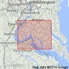
Maryland Point Formation in Charles and St. Marys Cos., MD, consists of well-sorted to poorly sorted, grayish orange fine- to coarse grained sand in the upper third. Most of the lower part is poorly sorted silty gray to olive clay with olive gray pebbly sand at the base. Clay contains plant fragments in places. Oyster beds present 2 to 10 ft above sea level at Maryland Point. Wavy-bedded white and orange sand exposed between Nanjemoy Creek and the Prince Georges Co. line are also part of the unit. Correlates with Ironshire, Nassawadox, Sedgefield, and Norfolk (in part) Formations. Typically 25 to 40 ft thick. Unconformably underlies Kent Island Formation and unconformably overlies Omar Formation or Miocene or older deposits. Age is late Pleistocene. [Nomenclature in this report reflects the usage of the Maryland Geological Survey.]
Source: GNU records (USGS DDS-6; Reston GNULEX).
For more information, please contact Nancy Stamm, Geologic Names Committee Secretary.
Asterisk (*) indicates published by U.S. Geological Survey authors.
"No current usage" (†) implies that a name has been abandoned or has fallen into disuse. Former usage and, if known, replacement name given in parentheses ( ).
Slash (/) indicates name conflicts with nomenclatural guidelines (CSN, 1933; ACSN, 1961, 1970; NACSN, 1983, 2005, 2021). May be explained within brackets ([ ]).

