

- Usage in publication:
-
- Marye Sand Member
- Modifications:
-
- Named
- Dominant lithology:
-
- Sand
- AAPG geologic province:
-
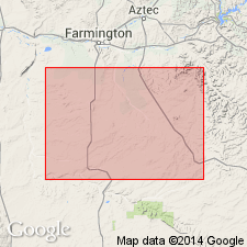
- San Juan basin
Summary:
Name applied in the subsurface of northwest NM to one of three sandstones in the Gallup Sandstone that was formed as a sand bar. Type well designated as the British American No. B-4 Marye in NE1/4 SW1/4 sec 35, T26N, R13W, San Juan Co, NM in the San Juan basin. The interval 4,900 to 4,930 is assigned to the member. Grades down into the "Low SP interval" of the Gallup. Is overlain by the "Upper Mancos Shale." Occurs in an area about 1-2 mi wide and 30 mi long. Has a maximum thickness of 40 ft. Cross sections, areal extent map. The sand is medium to fine grained, subangular to subround, moderately sorted, with little dolomite and characterized by abundant glauconite. Of Late Cretaceous age.
Source: GNU records (USGS DDS-6; Denver GNULEX).
For more information, please contact Nancy Stamm, Geologic Names Committee Secretary.
Asterisk (*) indicates published by U.S. Geological Survey authors.
"No current usage" (†) implies that a name has been abandoned or has fallen into disuse. Former usage and, if known, replacement name given in parentheses ( ).
Slash (/) indicates name conflicts with nomenclatural guidelines (CSN, 1933; ACSN, 1961, 1970; NACSN, 1983, 2005, 2021). May be explained within brackets ([ ]).