The National Geologic Map Database is migrating to a new infrastructure. We apologize for any service disruptions during this process.
|
|---|


- Usage in publication:
-
- Martin Bridge Formation
- Modifications:
-
- Original reference
Summary:
Pg. 4. Martin Bridge Formation. Calcareous shale, limestone, agglomerate, basalt, andesite, and tuff. Age is Late Triassic.
[Named for locally well-known bridge on Eagle Creek, Wallowa Mountains region, northeastern OR, according to C.P. Ross, personal commun.]
Source: US geologic names lexicon (USGS Bull. 896, p. 1311).
- Usage in publication:
-
- Martin Bridge formation*
Summary:
Pg. 12. Martin Bridge formation. The Triassic rocks of Wallowa Mountains have been named Martin Bridge formation. The consist of 1,000 to 3,000 feet of limestone, limy shale, and interbedded volcanic rocks of Late Triassic age. A comparable thickness of chiefly andesitic volcanic rock exposed in valley of Cliff River is believed by C.P. Ross to be contemporaneous with Martin Bridge formation. [C.P. Ross states (personal commun.) that latter rocks were probably included in Martin Bridge formation of Chaney.]
Source: US geologic names lexicon (USGS Bull. 896, p. 1311).
- Usage in publication:
-
- Martin Bridge formation*
- Modifications:
-
- Named
- Dominant lithology:
-
- Limestone
- Dolomite
- Shale
- AAPG geologic province:
-
- Snake River basin
- Eastern Columbia basin
Summary:
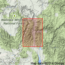
Named for a bridge that crosses the Eagle River near where the best preserved fossils are found. Mapped (geologic map) in linear belt extending from south of Martin bridge in Baker Co, OR in the Snake River basin, north to the Imnaha River in Wallowa Co, OR in the Eastern Columbia basin. No type locality designated. Much of the formation is gray to black limestone. Is locally converted to dolomite. Lower part may be limy shale, tuffaceous sandstone, and conglomerate. Fossiliferous (corals, sponges, etc.). Section 630 ft thick measured at Martin Bridge; this section includes calcareous shale near base, "barren" shales in middle, and argillaceous shale near top. Some beds contain iron-stained concretions. May be more than 2,500 ft thick; could be as much as 3,000 ft thick. Intruded by Cretaceous granite near head of Imnaha River. Is in contact with Jurassic sedimentary rocks, and with Carboniferous? sedimentary rocks. Assigned to the Late Triassic.
Source: GNU records (USGS DDS-6; Denver GNULEX).
- Usage in publication:
-
- [Martin Bridge formation]
Summary:
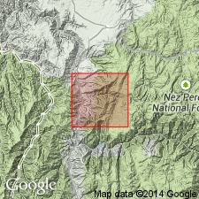
Pg. 6 (fig. 2), 8, 10-11, 13. [Martin Bridge formation.] Described in Wallowa Lake quadrangle, northeastern Oregon. Unconformably overlies a unit termed the Lower Sedimentary Series, or where series is lacking, unconformably overlies Clover Creek greenstone. Grades upward into and is intercalated with Hurwal formation (new).
Source: US geologic names lexicon (USGS Bull. 1200, p. 2400).
- Usage in publication:
-
- Martin Bridge Limestone*
- Modifications:
-
- Areal extent
- Redescribed
- Dominant lithology:
-
- Limestone
- Dolomite
- Slate
- Schist
- AAPG geologic province:
-
- Snake River basin
- Idaho Mountains province
Summary:
A limestone 1,000+ ft thick with Late Triassic fossils is correlated with the Martin Bridge Formation of eastern OR. The name Martin Bridge is extended into area, and rank term is modified--Martin Bridge Limestone--to reflect its predominant lithology. This limestone is mapped (geologic map) in a linear north-south belt the length of map in Idaho Co, Idaho Mountains province, and Adams Co, Snake River basin, ID, where it overlies a Seven Devils Volcanics and underlies Lucile Slate (restricted usage). Extension of name Martin Bridge into report area necessitates restriction of Lucile to only the dark gray slate. The original Lucile included rocks reassigned to Martin Bridge Limestone in report area. Composed largely of gray limestone, schistose limestone, and foliated limestone in geologic map area. Also contains intercalations of gray slate or phyllite, and greenstone or fine green schist. Proportion of marble increases northward. With increasing metamorphism, grain size in the limestone increases and shear lamination shows as sugary white to gray lenses and layers. Some limestone pebble conglomerate. In measured section in Cuprum quad: the limestone is buff, gray to black, granular to aphanitic, massive, fossiliferous (pelecypods, cephalopods, brachiopods); some dolomite. Late Triassic age.
Source: GNU records (USGS DDS-6; Denver GNULEX).
- Usage in publication:
-
- Martin Bridge Limestone*
- Modifications:
-
- Contact revised
- AAPG geologic province:
-
- Eastern Columbia basin
Summary:
Lower contact revised in that Martin Bridge Limestone overlies the newly named Doyle Creek Formation of Seven Devils Group; this contact is depositional. Upper beds of Doyle Creek are dusky red conglomerate or breccia with clasts of volcanic flow rocks. Basal Martin Bridge is green calcareous siltstone, graywacke, argillaceous limestone 0-5 m thick. These basal Martin Bridge beds thicken and thin; the basal contact can be an unconformity at some localities. Grades upward into black shale, sandstone, and mudstone of Upper Triassic Hurwal Formation. Includes following rock types--limestone (sparite, biosparite, micrite), dolomite, limestone breccia, and thin calcareous shale beds in lower part. Beds range from 30 cm to 20 m thick. Probably deposited far from terrigenous source. Ammonites of earliest Norian, Late Triassic age. Cross section. Recognized widely in outcrops in northeast OR, western ID, and southeast WA in the Eastern Columbia basin.
Source: GNU records (USGS DDS-6; Denver GNULEX).
- Usage in publication:
-
- Martin Bridge Formation*
- Modifications:
-
- Revised
- Redescribed
- Dominant lithology:
-
- Phyllite
- Schist
- Marble
- AAPG geologic province:
-
- Idaho Mountains province
Summary:
Is lithologically heterogeneous unit at Martins Bridge, OR. Extended into Idaho Co, ID, Idaho Mountains province, but name applied only to limestone part of Lucile "series." So Lucile restricted to upper slate of original Lucile and rank term for Lucile changed to "Slate." Information obtained in this study indicates rocks assigned to Martin Bridge and Lucile not superposed. Rather, calcareous phyllite, schist, marble interfinger throughout area, and are mapped as single unit. Limestone recrystallized everywhere to marble and the slate to phyllite to schist. Name Martin Bridge predates Lucile; Lucile abandoned. Martin Bridge applied to single map unit above Doyle Creek Formation of Seven Devils Group; its rank term changed from "Limestone" to "Formation." The mapped unit dominantly calcareous phyllite and schist (textural gradation depends on metamorphic grade) with lesser amounts of marble, conglomeratic calcareous schist (some has stretched cobbles), and metavolcanic chlorite schist, limestone (at 2 localities). Lenses and thick layers (up to 500 m thick) of medium- to coarse-grained marble with pyrite and biotite present near structural top. Top of formation not exposed because of faulting. Thickness unknown; thickness at sections measured varies from about 250-1,700 m. Has a lower amphibolite facies metamorphic grade in east and lower greenschist facies metamorphic grade in west exposures. Late Triassic fossils in limestone south of study area.
Source: GNU records (USGS DDS-6; Denver GNULEX).
For more information, please contact Nancy Stamm, Geologic Names Committee Secretary.
Asterisk (*) indicates published by U.S. Geological Survey authors.
"No current usage" (†) implies that a name has been abandoned or has fallen into disuse. Former usage and, if known, replacement name given in parentheses ( ).
Slash (/) indicates name conflicts with nomenclatural guidelines (CSN, 1933; ACSN, 1961, 1970; NACSN, 1983, 2005, 2021). May be explained within brackets ([ ]).