The National Geologic Map Database is migrating to a new infrastructure. We apologize for any service disruptions during this process.
|
|---|


- Usage in publication:
-
- Marshalltown bed
- Modifications:
-
- Named
- Dominant lithology:
-
- Sand
- Clay
- Marl
- AAPG geologic province:
-
- Atlantic Coast basin
Summary:
Marshalltown bed described as marly clay sand underlying Wenonah bed and overlying Columbus bed [now Englishtown sand]. Included in Clay Marl series [Matawan Group].
Source: GNU records (USGS DDS-6; Reston GNULEX).
- Usage in publication:
-
- Marshalltown bed*
- Modifications:
-
- Overview
- AAPG geologic province:
-
- Atlantic Coast basin
Summary:
Unit ranges from sandy clay to clayey marl. Thickness ranges 30 to 40 ft. Underlies Wenonah sand and overlies Columbus sand. Age is Late Cretaceous.
Source: GNU records (USGS DDS-6; Reston GNULEX).
- Usage in publication:
-
- Marshalltown formation
- Modifications:
-
- Areal extent
- AAPG geologic province:
-
- Atlantic Coast basin
Summary:
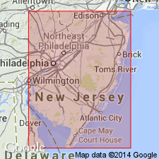
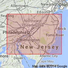
Marshalltown Formation extends from Sandy Hook Bay southwestward to Delaware River. Can be traced in banks of Chesapeake and Delaware Canal a distance of approximately 5 mi, from 2,100 ft west of Summit Bridge to 0.25 mi east of St. Georges Bridge where it disappears beneath water level.
Source: GNU records (USGS DDS-6; Reston GNULEX).
- Usage in publication:
-
- Marshalltown member
- Modifications:
-
- Revised
- AAPG geologic province:
-
- Atlantic Coast basin
Summary:
Marshalltown reduced to member of Matawan, which is here reduced to formational rank. Underlies Wenonah member and overlies Englishtown member; both contacts conformable. Thickness is 30 to 40 ft. Dips about 25 ft to the mile southeastward. Probably present in Chesapeake and Delaware Canal where it cannot be differentiated from Crosswicks Clay. Beds in Canal called Marshalltown by Carter are believed to be Navesink and Mount Laurel.
Source: GNU records (USGS DDS-6; Reston GNULEX).
- Usage in publication:
-
- Marshalltown formation
- Modifications:
-
- Revised
- AAPG geologic province:
-
- Atlantic Coast basin
Summary:
Unit is here considered to be of formation rank. Excellent exposure occurs in cut along NJ Turnpike at Fellowship, 2 mi south of Moorestown, Burlington Co. Thickness about 14 ft. Here formation contains so little clay that it is water bearing.
Source: GNU records (USGS DDS-6; Reston GNULEX).
- Usage in publication:
-
- Marshalltown Formation*
- Modifications:
-
- Areal extent
- AAPG geologic province:
-
- Atlantic Coast basin
Summary:
In northeastern MD and northern DE of northernmost Delmarva Peninsula, the Upper Cretaceous terms Matawan and Monmouth Formation or Groups are not useful, and they should be restricted from the area in favor of other formations geographically extended from NJ. The Matawan Formation of northeastern MD (Kent and Cecil Cos.) is replaced by (ascending) Merchantville, Englishtown, and Marshalltown Formations, and the Monmouth Formation by the Mount Laurel Sand. The ascending Woodbury Clay, Wenonah, and Navesink Formations pinch out in NJ and are not present in DE and MD. [Although not stated in this report, Matawan Formation is recognized on the western shore and eastern shore of southern MD where the Merchantville, Englishtown, and Marshalltown cannot be recognized and extended into southern MD (N.F. Sohl, 1984, oral communication).]
Source: GNU records (USGS DDS-6; Reston GNULEX).
- Usage in publication:
-
- Marshalltown Formation*
- Modifications:
-
- Overview
- AAPG geologic province:
-
- Atlantic Coast basin
Summary:
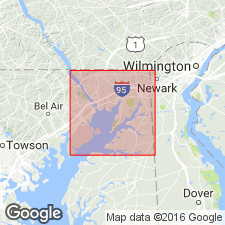
Marshalltown Formation in and near the study area is a glauconitic, greenish-gray clayey silty fine sand, containing less mica than the two underlying Englishtown and Merchantville Formations. Unit is well-exposed, though incomplete, along the Chesapeake and Delaware Canal in DE and also near Betterton in Kent Co., MD, a few mi to the southwest. Unit is unstratified and poorly sorted. Color ranges from greenish-black where fresh, to moderate yellow. Very fossiliferous along canal. Unit was measured on Mauldin Mountain at 3.0 ft. Other exposures in Cecil Co. yield thicknesses of 4 and 5 ft. In this report, the Marshalltown, Englishtown, and Merchantville Formations are assigned to the Matawan Group. [This manuscript was reviewed by the GNU in 1973, but was not published until 1990. Field work for this study was done in the late 1960's. The nomenclature in this report may not reflect current usage. Matawan Group is no longer used in this area by the USGS.]
Source: GNU records (USGS DDS-6; Reston GNULEX).
- Usage in publication:
-
- Marshalltown Formation
- Modifications:
-
- Overview
- AAPG geologic province:
-
- Atlantic Coast basin
Summary:
Definition of Knapp IN Weller (1907) that described the Marshalltown as changing from a sandy marl in Salem Co. to a clay and sand with beds of marl in Monmouth Co. has been followed by most workers. According to the author, the U.S. Geological Survey in Owens and Sohl (1969) and Owens and others (1970) disregarded the original definition and arbitrarily placed the clay and sand beds in the Englishtown, reserving the term Marshalltown to describe the silty micaceous glauconite sand that predominates in the southwestern part of the outcrop belt. Thickness depends on the definition used. Unit is 4.6 to 6 m according to Owens and Sohl (1969) and 14 m according to Richards (1956) and Petters (1976). Abundant and diverse marine invertebrates are found in the southwest, while at Ellisdale, Monmouth Co., numerous vertebrate fossils have been found. The unit is traceable from Raritan Bay on the northeast to the Sassafras River area on the eastern shore of the Chesapeake Bay in MD. Overlies the Englishtown and downdip, the Woodbury Formation. Underlies the Wenonah Formation. Age is late Campanian.
Source: GNU records (USGS DDS-6; Reston GNULEX).
- Usage in publication:
-
- Marshalltown Formation*
- Modifications:
-
- Biostratigraphic dating
- AAPG geologic province:
-
- Atlantic Coast basin
Summary:
Marshalltown Formation shown as Late Cretaceous (late Campanian) on fig. 1. Late Campanian age based on CRASSATELLA HODGEI collected from Chesapeake and Delaware Canal.
Source: GNU records (USGS DDS-6; Reston GNULEX).
- Usage in publication:
-
- Marshalltown Formation, sequence
- Modifications:
-
- Overview
- AAPG geologic province:
-
- Atlantic Coast basin
Summary:
Uppermost Campanian unconformity-bounded sequence in the NJ coastal plain, informally termed the Marshalltown sequence in this report, includes the Marshalltown, Wenonah, and Mount Laurel Formations and ranges in age from 74.1 to 69.9 Ma based on Sr-isotope age estimates. Sequence boundaries of the Marshalltown match boundaries elsewhere in the Atlantic Coastal Plain and the inferred global sea-level record of Haq and others (1987). Eustatic changes determined to be the mechanism controlling deposition of this sequence. The Marshalltown Formation is a fine-grained, silty, quartzose, glauconite sand deposited in middle- to outer-shelf environments (30-200 m). The Wenonah and Mount Laurel Formations vary greatly in lithology and thickness. Finer grained Wenonah dominates the sequence in northern NJ, while the coarse, massive quartz sand of the Mount Laurel dominates in the south.
Source: GNU records (USGS DDS-6; Reston GNULEX).
For more information, please contact Nancy Stamm, Geologic Names Committee Secretary.
Asterisk (*) indicates published by U.S. Geological Survey authors.
"No current usage" (†) implies that a name has been abandoned or has fallen into disuse. Former usage and, if known, replacement name given in parentheses ( ).
Slash (/) indicates name conflicts with nomenclatural guidelines (CSN, 1933; ACSN, 1961, 1970; NACSN, 1983, 2005, 2021). May be explained within brackets ([ ]).