

- Usage in publication:
-
- Marshall diorite
- Modifications:
-
- Original reference
- Dominant lithology:
-
- Diorite
- AAPG geologic province:
-
- Northern Cascade Range-Okanagan province
Summary:
Pg. 7 (table), 21-23, pl. 1. Marshall diorite. Medium-gray to almost black diorite that occurs mainly in sills which vary in thickness from 3 to 1,200 feet. Intrudes Bead Lake and Skookum formations of Newport group (all new). Age is pre-Cambrian(?).
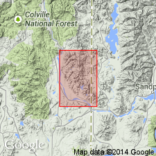
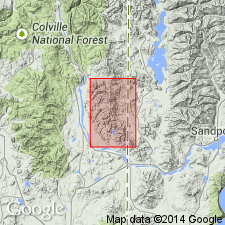
Named from Marshall Creek, along which a sill of igneous rock is well exposed, [Newport 7.5-min quadrangle], Pend Oreille Co., northeastern WA.
Source: Publication; US geologic names lexicon (USGS Bull. 1200, p. 2394).
- Usage in publication:
-
- Marshall Diorite[†]
- Modifications:
-
- [Abandoned]
- AAPG geologic province:
-
- Northern Cascade Range-Okanagan province
Summary:
[Geol. map. †Marshall Diorite of Schroeder (1952) considered abandoned. Rocks included in unnamed metadiorite sills which are restricted to Prichard Formation, except for one occurrence in middle part of Burke Formation. Consist of diorite or diabase, recrystallized to amphibolite in most places. Age is considered Precambrian, older than Addy Quartzite and younger then Burke Formation. See also F.K. Miller, Prelim. geol. map Newport No. 3 quad., Pend Oreille, Sevens, and Spokane Cos., WA, Washington Div. Geol. Earth Sci. Geol. Map, GM-9, 1974.]
Source: Publication.
For more information, please contact Nancy Stamm, Geologic Names Committee Secretary.
Asterisk (*) indicates published by U.S. Geological Survey authors.
"No current usage" (†) implies that a name has been abandoned or has fallen into disuse. Former usage and, if known, replacement name given in parentheses ( ).
Slash (/) indicates name conflicts with nomenclatural guidelines (CSN, 1933; ACSN, 1961, 1970; NACSN, 1983, 2005, 2021). May be explained within brackets ([ ]).