- Usage in publication:
-
- Marshall Butte Member
- Modifications:
-
- Named
- Dominant lithology:
-
- Sandstone
- Breccia
- Gravel
- Pyroclastics
- Diamictite
- AAPG geologic province:
-
- Black Mesa basin
Summary:
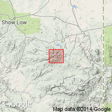
Named as lower of two members of Sheep Crossing Formation for hill on southwest side of Mount Baldy in White Mountains, southern Apache Co, AZ, Black Mesa basin. Type section at Marshall Butte, 33 deg 48'30"N, 109 deg 46'30"W in Corn Creek Plateau quad. Occurs as isolated exposures around perimeter of Mount Baldy Formation (new); most extensive exposures in areas of Thompson Ranch and Marshall Butte. Consists of interbedded laharic breccia, sandstone, gravel, air-fall tephra and abundant diamicton units probably deposited as mudflows. At type shown to be about 67 m thick (fig. 13). Overlies older sediments and volcanics deposited before 12 m.y. ago; underlies Campground Member (new) of Sheep Crossing. Geologic map. Miocene age.
Source: GNU records (USGS DDS-6; Denver GNULEX).
For more information, please contact Nancy Stamm, Geologic Names Committee Secretary.
Asterisk (*) indicates published by U.S. Geological Survey authors.
"No current usage" (†) implies that a name has been abandoned or has fallen into disuse. Former usage and, if known, replacement name given in parentheses ( ).
Slash (/) indicates name conflicts with nomenclatural guidelines (CSN, 1933; ACSN, 1961, 1970; NACSN, 1983, 2005, 2021). May be explained within brackets ([ ]).

