

- Usage in publication:
-
- Marquette Range Supergroup*
- Modifications:
-
- Original reference
- Dominant lithology:
-
- Iron-formation
- Metavolcanics
- Slate
- AAPG geologic province:
-
- Lake Superior region
Summary:
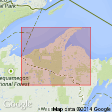
Marquette Range Supergroup. Local name proposed to replace †Animikie series of James (1958) south of Lake Superior, in Northern Peninsula of Michigan and adjacent areas of Wisconsin. Animikie Group remains in good usage in northern Minnesota. Present in Marquette Range, Iron River-Crystal Falls district, Menominee Range, and Gogebic Range. Composed of (ascending) Chocolay, Menominee, Baraga, and Paint River Groups of James (1958). Baraga Group has widest geographic distribution. Radiometric age determinations (citing Goldich and others, 1961, Minnesota Geol. Survey Bull., no. 41, 193 p.; Aldrich and others, 1965, Jour. Petrol., v. 6, pt. 3, p. 445-472) indicate an age of about 2.5 billion years for granitic basement rocks, and an age of about 1.9 billion years for regional metamorphism which has affected all middle Precambrian rocks.
Source: Publication; Changes in stratigraphic nomenclature, 1970 (USGS Bull. 1354-A, p. A16-A17).
- Usage in publication:
-
- Marquette Range Supergroup*
- Modifications:
-
- Revised
- AAPG geologic province:
-
- Lake Superior region
Summary:
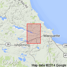
Marquette Range Supergroup is revised in that its basal Chocolay Group is revised to include the Reany Creek Formation (middle Precambrian) at base as mapped in Negaunee quadrangle, Marquette Co, MI (Lake Superior region). "Metasedimentary rocks of middle Precambrian age form a belt across the southern part of the quadrangle and underlie the Dead River basin in the central and western parts of the quadrangle. The rocks belong to the Chocolay, Menominee, and Baraga Groups of the Marquette Range Supergroup (Cannon and Gair, 1970) and are unconformable on lower Precambrian rocks. The Chocolay Group comprises the Reany Creek Formation, the Enchantment Lake Formation, the Mesnard Quartzite, the Kona Dolomite, and the Wewe Slate; the Menominee, the Ajibik Quartzite, the Siamo Slate, and the Negaunee Iron-Formation; the Baraga Group, the Michigamme Slate." Correlation of map units (pl. 1) shows Reany Creek correlative with Enchantment Lake Formation at base of Chocolay at base of Marquette Range Supergroup. Text (p. 23) notes Reany Creek is similar to Enchantment Lake Formation in Marquette syncline, hence might be correlative with lower part of Marquette Range Supergroup; but no meaningful age data on which to base a correlation.
Source: GNU records (USGS DDS-6; Reston GNULEX).
- Usage in publication:
-
- Marquette Range Supergroup*
- Modifications:
-
- Revised
- AAPG geologic province:
-
- Lake Superior region
Summary:
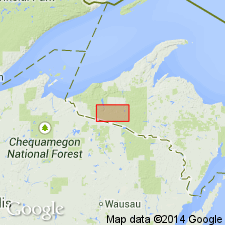
Marquette Range Supergroup. Revised to include Blair Creek Formation (new) as its basal unit in the Marenisco-Watersmeet area, Northern Peninsula, Michigan. Unconformably overlies and truncates Archean gneiss; locally overlies quartzite and dolomite of Chocolay Group. Age is Early Proterozoic (2,500 to 1,600 Ma).
Source: Publication.
For more information, please contact Nancy Stamm, Geologic Names Committee Secretary.
Asterisk (*) indicates published by U.S. Geological Survey authors.
"No current usage" (†) implies that a name has been abandoned or has fallen into disuse. Former usage and, if known, replacement name given in parentheses ( ).
Slash (/) indicates name conflicts with nomenclatural guidelines (CSN, 1933; ACSN, 1961, 1970; NACSN, 1983, 2005, 2021). May be explained within brackets ([ ]).