The National Geologic Map Database is migrating to a new infrastructure. We apologize for any service disruptions during this process.
|
|---|


- Usage in publication:
-
- Markham Mill formation
- Modifications:
-
- Named
- Dominant lithology:
-
- Sandstone
- Shale
- AAPG geologic province:
-
- Ouachita folded belt
Summary:
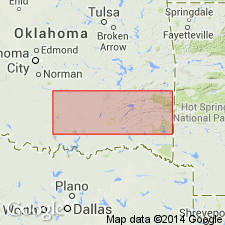
Named as a formation (1 of 4) of Jackfork group (raised in rank) of Pushmataha series (new) of the Bendian period; name taken from a saw mill, Markham Mill. Type locality designated in NE corner SW1/4 sec 21, T2S, R14E, Atoka Co, OK in the Ouachita tectonic belt province; 400 ft thickness measured. Second type locality chosen in sec 2, T2S, R12E, along Campbell Creek. Very widespread in entire Ouachita Mountains. Basal division of Markham Mill consists of hard, platy to blocky, dark-gray, siliceous shale 15-20 ft thick; has black carbonized plant fragments, and its color commonly is gray to dark gray with black mottling; weathers light dull pink, grading into deep maroon to dark gray mottling. Middle and upper parts of formation are thin-bedded, subangular, quartz sandstones. Upper beds are sandstones containing large milky white quartz grains. Some cherty sandstone conglomerate lenses. Thickness varies from 220 to about 500 ft. Weathers as large slabs. Overlies Prairie Mountain formation (new) and underlies Wesley shale (new), both of Jackfork group of Pushmataha series of Bendian period. Contains plant fossils-SIGILLARIA and CALAMITES. Correlation chart. Map showing type locality. Of Carboniferous age.
Source: GNU records (USGS DDS-6; Denver GNULEX).
For more information, please contact Nancy Stamm, Geologic Names Committee Secretary.
Asterisk (*) indicates published by U.S. Geological Survey authors.
"No current usage" (†) implies that a name has been abandoned or has fallen into disuse. Former usage and, if known, replacement name given in parentheses ( ).
Slash (/) indicates name conflicts with nomenclatural guidelines (CSN, 1933; ACSN, 1961, 1970; NACSN, 1983, 2005, 2021). May be explained within brackets ([ ]).