

- Usage in publication:
-
- Marion formation
- Modifications:
-
- Named
- Dominant lithology:
-
- Limestone
- Marl
- Shale
- Conglomerate
- AAPG geologic province:
-
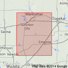
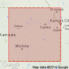
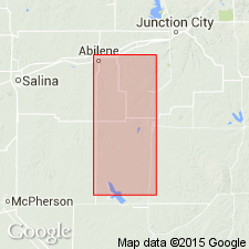
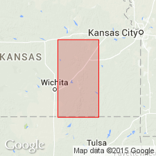
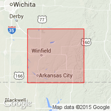
- Sedgwick basin
Summary:
Pg. 786-789. Marion formation. Named uppermost formation of the Permian series of the Carboniferous period in Marion County, central Kansas (Sedgwick basin). "Succeeding the Chase formation are thin, buff limestones and shales; higher, marls and shales with gypsum; and lastly, colored shales and marls which continue to the base of the brown Dakota sandstones of the Cretaceous. These rocks cover the greater part of Marion County and are exposed in many places so it is proposed to call them the Marion formation." Estimated to have a thickness of 400 feet. Brachiopods are present in lower part, becoming rare in upper part; species lists given from several localities. Abilene conglomerate (new) described 150 feet above base. Characteristic fossils listed (table, p. 797) for three units in lower 130 feet. Comparisons presented with Swallow's (1866) section and with Meek and Hayden (1859).
Named from exposures in Marion Co., KS.
[GNC remark (ca. 1938, US geologic names lexicon, USGS Bull. 896, p. 1300): The Tertiary age of typical Abilene conglomerate is now regarded as established.]
Source: US geologic names lexicon (USGS Bull. 896, p. 1300-1301); supplemental information from GNU records (USGS DDS-6; Denver GNULEX).
- Usage in publication:
-
- Marion formation
- Modifications:
-
- Not used
Summary:
Sumner division of Big Blue series divided into Wellington shales (above) and Geuda salt measures (below). "Prosser's term Marion formation is equivalent to Geuda salt measures plus lower part of Wellington." Rests on Chase limestones.
Source: US geologic names lexicon (USGS Bull. 896, p. 1300-1301).
- Usage in publication:
-
- Marion formation
- Modifications:
-
- Revised
Summary:
Marion formation restricted to lower part of Marion formation as originally defined, and upper part is here called Wellington formation. I now agree with Cragin that upper 200 to 445 feet of bluish gray, greenish, and reddish shales originally included in Marion formation should be a distinct formation. The division line is difficult, but absence of limestones and of fossils in the Wellington may serve as means of separation. The Marion as here defined consists of thin buff limestones, shales, and marls, with beds of gypsum and salt, and is Geuda salt measures of Cragin. It overlies Chase formation, top member of which has been called "Marion concretionary limestone, " but is here replaced by Winfield concretionary limestone.
Source: US geologic names lexicon (USGS Bull. 896, p. 1300-1301).
- Usage in publication:
-
- Marion formation
- Modifications:
-
- Revised
Summary:
Wellington beds consist of (descending): (1) varicolored shales and marls; (2) shales and marls alternating with gypsum and thick beds of rock salt; (3) buff limestones and marls. Thickness 400 feet. Overlie Marion beds, top member of which is Abilene conglomerate [Tertiary] which consists of limestone and quartz pebbles. [This was a restriction of Marion formation, which as originally defined included the salt measures.]
Source: US geologic names lexicon (USGS Bull. 896, p. 1300-1301).
- Usage in publication:
-
- Marion stage
- Modifications:
-
- Revised
- AAPG geologic province:
-
- Sedgwick basin
Summary:
Marion stage, limited to following formations (descending): (1) Abilene conglomerate (?), correlation not positive; (2) Pearl shales, 70 feet; (3) Herington limestone; (4) Enterprise shale, 44 feet; (5) Luta limestone, 0 to 30 feet. Overlies Winfield limestone.
Source: US geologic names lexicon (USGS Bull. 896, p. 1300-1301).
- Usage in publication:
-
- Marion formation
- Modifications:
-
- Revised
Summary:
Marion formation, 150+/- feet thick, divided into (descending): Abilene conglomerate member, Pearl shale member, Herington limestone member, Enterprise shale member, and Luta limestone member.
Source: US geologic names lexicon (USGS Bull. 896, p. 1300-1301).

- Usage in publication:
-
- Marion formation
- Modifications:
-
- Revised
Summary:
Pg. 63, footnote. So-called Abilene conglomerate is Tertiary. It appears that so-called Abilene conglomerate, which has previously been referred to uppermost part of Marion formation, is in reality a Tertiary deposit. It contains fragments of rock which apparently belong to Dakota sandstone, and at no point has it been observed in a stratigraphic position beneath the Wellington shale.
[GNC remark (ca. 1938, US geologic names lexicon, USGS Bull. 896, p. 9, 1301): Subsequent reports treated Pearl shale as top member of Marion formation and included the salt beds in overlying Wellington formation (p. 1301). Other geologists continued to classify [Abilene conglomerate] as Permian (p. 9).]
Source: US geologic names lexicon (USGS Bull. 896, p. 8-9, 1300-1301).
- Usage in publication:
-
- Marion formation†
- Modifications:
-
- Abandoned
- AAPG geologic province:
-
- Nemaha anticline
Summary:
†Marion formation of Sumner group. Abandoned. Wellington formation redefined to include all beds below "Red Beds" and above Herington limestone, and "Marion formation" was abandoned.
Source: US geologic names lexicon (USGS Bull. 896, p. 1300-1301).

- Usage in publication:
-
- Marion formation
- Modifications:
-
- Overview
- AAPG geologic province:
-
- Nemaha anticline
- Salina basin
- Anadarko basin
Summary:
Continued to use Marion formation to include Pearl shale at top and Luta limestone at base, the underlying formation being called Winfield. Age is Permian (Big Blue).
Source: US geologic names lexicon (USGS Bull. 896, p. 1122); GNC KS-NE Permian Corr. Chart, Oct. 1936.
For more information, please contact Nancy Stamm, Geologic Names Committee Secretary.
Asterisk (*) indicates published by U.S. Geological Survey authors.
"No current usage" (†) implies that a name has been abandoned or has fallen into disuse. Former usage and, if known, replacement name given in parentheses ( ).
Slash (/) indicates name conflicts with nomenclatural guidelines (CSN, 1933; ACSN, 1961, 1970; NACSN, 1983, 2005, 2021). May be explained within brackets ([ ]).