The National Geologic Map Database is migrating to a new infrastructure. We apologize for any service disruptions during this process.
|
|---|


- Usage in publication:
-
- Marion concretionary limestone
- Modifications:
-
- Named
- Dominant lithology:
-
- Limestone
- AAPG geologic province:
-
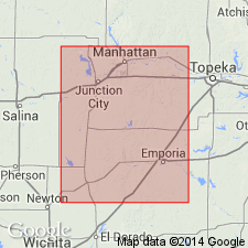
- Sedgwick basin
- Nemaha anticline
Summary:
Named as unranked unit at top of Chase formation (new) in Marion Co, KS (Sedgwick basin) and occurs in Butler, Chase, and Morris Cos (Nemaha anticline). "The highest flint and limestones is well exposed along the bluffs of the river and small streams near Marion, and its base is about 123 ft above base of Florence flint. Near Marion...a zone 10 ft thick, composed of two strata of limestone separated by shales, limestones containing large irregular concretions which weather to a brown color...and occasionally the [flint] particles in the concretionary limestone are small and inconspicuous. As a rule, however, concretions are large and stratum may be readily traced across the country either from its exposure in bluffs or streams, or from the line of loose brown concretions crossing the prairie. This limestone has been traced...from center part of Butler county across Chase and Marion counties into Morris county ...is highest prominent flint ledge in upper Paleozoic of Kansas...and on account of good exposures of this zone near Marion City, the horizon has been called Marion flint and concretionary limestone." Described as: "Massive limestone-containing large flint concretions which weather brown and contain PRODUCTUS and a few other fossils...composed of two layers separated by a thin shale" in composite section (p. 773). Characteristic fossils listed in table (p. 797). Assigned to Permian series of Carboniferous period.
Source: GNU records (USGS DDS-6; Denver GNULEX).
- Usage in publication:
-
- Marion limestone
- Modifications:
-
- Not used
- AAPG geologic province:
-
- Sedgwick basin
- Nemaha anticline
Summary:
Pg. 12. Also, Jour. Geol., v. 44, no. 1. Marion limestone not used; beds extending from top of Herington limestone to top of Luta limestone divided into two formations, Nolans limestone above and Odell shale below.
Source: Kansas lexicon (Kansas Geol. Survey Bull. 231, p. 149); GNC KS-NE Permian Corr. Chart, Oct. 1936.
For more information, please contact Nancy Stamm, Geologic Names Committee Secretary.
Asterisk (*) indicates published by U.S. Geological Survey authors.
"No current usage" (†) implies that a name has been abandoned or has fallen into disuse. Former usage and, if known, replacement name given in parentheses ( ).
Slash (/) indicates name conflicts with nomenclatural guidelines (CSN, 1933; ACSN, 1961, 1970; NACSN, 1983, 2005, 2021). May be explained within brackets ([ ]).