

- Usage in publication:
-
- Maricopa shale*
- Modifications:
-
- First used
- Dominant lithology:
-
- Shale
- Sandstone
- AAPG geologic province:
-
- California Coast Ranges province
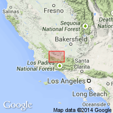
Summary:
Maricopa shale named as formation in upper part of Monterey group in Cuyama Valley. Named credited to R.W. Pack (in preparation) in report on Sunset-Midway region [Pack, 1920, USGS Prof. Paper 116]. Maricopa shale has been separately mapped as far eastward as Salisbury Canyon. It consists of chocolate-colored to pink shale in which reef-like outcrops of white sandstone are locally prominent. Is about 1700 ft thick. Overlies Vaqueros formation of Monterey group. Unconformably underlies Santa Margarita formation. Map legend gives age as Miocene.
Source: GNU records (USGS DDS-6; Menlo GNULEX).
- Usage in publication:
-
- Maricopa shale*
- Modifications:
-
- Named
- Dominant lithology:
-
- Shale
- Sandstone
- AAPG geologic province:
-
- San Joaquin basin
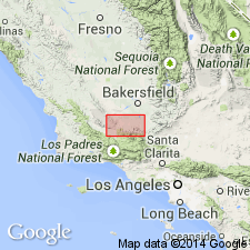
Summary:
Maricopa shale was named as formation of Monterey group for section near Maricopa in Sunset Valley. Is used to describe thick mass of diatomaceous shale that forms central part of south end of Temblor Range and crops out in places along north flank of San Emigdio Mountains. Name first published by English (1916) for strata in Cuyama Valley; however these strata should properly be called Salinas shale. [Hill and others (1958) renamed these strata as Saltos shale member of Monterey shale]. Type section of Maricopa designated south of Pioneer, secs.13 and 24 T11N R24W, Kern Co, CA is 4800 ft thick. Lower part contains relatively small amount of arkosic sandstone; upper part has numerous lenses of arkosic sandstone and boulder beds. Conformably overlies Vaqueros formation; unconformably underlies Etchegoin formation (which may include Jacalitos formation at its base). Age given as middle Miocene. Geologic map included.
Source: GNU records (USGS DDS-6; Menlo GNULEX).
- Usage in publication:
-
- Maricopa shale†
- Modifications:
-
- Abandoned
- AAPG geologic province:
-
- California Coast Ranges province
- San Joaquin basin
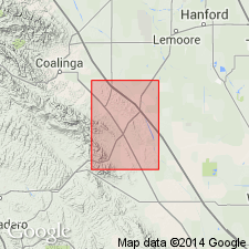
Summary:
Maricopa shale of English (1916) and of Pack (1920) was introduced as replacement of former name Monterey shale which had been raised to group rank. It is proposed to abandon Monterey as group name and to treat Monterey shale as a formation name. This results in abandonment of Salinas shale and Maricopa shale as synonyms of Monterey shale.
Source: GNU records (USGS DDS-6; Menlo GNULEX).
For more information, please contact Nancy Stamm, Geologic Names Committee Secretary.
Asterisk (*) indicates published by U.S. Geological Survey authors.
"No current usage" (†) implies that a name has been abandoned or has fallen into disuse. Former usage and, if known, replacement name given in parentheses ( ).
Slash (/) indicates name conflicts with nomenclatural guidelines (CSN, 1933; ACSN, 1961, 1970; NACSN, 1983, 2005, 2021). May be explained within brackets ([ ]).