

- Usage in publication:
-
- Manning beds
- Modifications:
-
- Original reference
- Dominant lithology:
-
- Sand
- Clay
- AAPG geologic province:
-
- Gulf Coast basin
Summary:
Pg. 462, 463. Manning beds. Light-greenish sands and carbonaceous sandy clays. Top member of Jackson beds. Underlie Corrigan sands. Separated from underlying Caddell beds by lignitic or carbonaceous chocolate-colored clays and sands with light-brown sandstones and coarse-grained gray sandstones.
Named from exposures at station on St. Louis and Santa Fe RR, Angelina Co., eastern TX.
Source: US geologic names lexicon (USGS Bull. 896, p. 1286).
- Usage in publication:
-
- Manning beds
- Modifications:
-
- Revised
- AAPG geologic province:
-
- Gulf Coast basin
Summary:
Pg. 1307. Manning beds. Stratigraphically above Wellborn sandstones occur a series of beds designated Manning beds. Dumble [Univ. Texas Bull., no. 1869, p. 134, 1920] described a Manning section which included more beds than are referred to as Manning beds in this paper, which include all beds stratigraphically above Wellborn sands and below Dilworth sands. They extend from Sabine River to Atascosa River, and consist of lignitic chocolate-brown shales with thin partings of sand; brown carbonaceous sands; tuffaceous sandstones and beds of volcanic ash and cross-bedded glass; chocolate-brown diatomaceous shales, and brown bentonitic shales. Essentially nonfossiliferous and essentially nonmarine. [Age is Eocene.]
Source: US geologic names lexicon (USGS Bull. 896, p. 1286).

- Usage in publication:
-
- Manning beds
- Modifications:
-
- Not used
- AAPG geologic province:
-
- East Texas basin
Summary:
Pg. 685. Miss Ellisor's McElroy member of Fayette formation (east Texas) includes rocks previously called Manning beds by Dumble. Dumble did not define his division clearly nor designate a type section, and consequently geologists have had difficulty in distinguishing the limits of Manning beds. [See entry under McElroy.]
Source: US geologic names lexicon (USGS Bull. 896, McElroy entry p. 1251).
- Usage in publication:
-
- Manning formation
- Modifications:
-
- Revised
- AAPG geologic province:
-
- Gulf Coast basin
Summary:
Table opp. p. 17, and p. 32-43, on area between Walker and Gonzales Counties. Manning formation is here retained for the beds between top of Wellborn formation (of which Carlos sandstone is top member) and base of Whitsett formation. It does not seem to be appropriate to use McElroy formation for these strata, because Miss Ellisor includes Wooley's Bluff clays, Wellborn sands, and Manning beds in the McElroy. Also, in paleontologic reports on wells McElroy has come to be almost synonymous with TEXTULARIA HOCKLEYENSIS zone, but, as Miss Ellisor points out, this foraminifer ranges up into uppermost Jackson strata. The Manning is here divided into (descending): (1) chocolate-colored lignitic clay with interbedded tan sand and sandstone and gray tuffaceous sandstone and thin beds of lignite, but chiefly nonmarine, 0 to 25 feet; (2) Yuma sandstone, 3 to 25 feet; (3) same as No. 1; (4) Dilworth sandstone, 2 to 22 feet; and (5) chocolate-colored lignitic clay with interbedded tan sand and sandstone and gray tuffaceous sandstone, thin beds of lignite; mostly nonmarine [thickness not given]. Thickness of Manning formation 250 to 350 feet. [Age is Eocene.]
Source: US geologic names lexicon (USGS Bull. 896, p. 1286).
- Usage in publication:
-
- Manning beds
- Modifications:
-
- Areal extent
- AAPG geologic province:
-
- Gulf Coast basin
Harris, G.D., 1941, Report on the geology of Lee County, Texas: University of Texas-Austin, Bureau of Economic Geology Mineral Resources Circular, no. 33, 60 p.
Summary:
Pg. 22, 26-28. In Lee County, eastern Texas, Fayette formation is divided into three members (ascending): Caddell clays and sands, Wellborn sandstone, and Manning beds. [Age is late Eocene.]
Source: US geologic names lexicon (USGS Bull. 1200, p. 2358-2359).
- Usage in publication:
-
- Manning formation
- Modifications:
-
- Revised
- AAPG geologic province:
-
- Gulf Coast basin
Summary:
Pg. 45. Manning formation contains Plum bentonite (new).
Source: US geologic names lexicon (USGS Bull. 1200, p. 2358-2359).

- Usage in publication:
-
- Manning formation
- Modifications:
-
- Revised
- AAPG geologic province:
-
- Gulf Coast basin
Summary:
Pg. 165-172. Strata of Manning formation comprise sandstones, shales, and volcanic ash. Basal 100 feet contains greater percentage of lignite than is normal for rest of formation. At the top of this lower lignitic zone in Brazos and Grimes Counties, eastern Texas, is a sandstone herein named Goodbread. At the top of the Manning are two sandstones each from 5 to 50 feet thick. They are separated by a shale zone 30 to 60 feet thick. Upper sandstone was named Yuma by Renick. Lower sandstone named Dilworth by Renick on assumption that it was equivalent to Dilworth sandstone of Gonzales County. However, there is no conclusive proof of this equivalence, and lower sandstone herein named Tuttle. Overlies Wellborn; underlies Whitsett. [Age is late Eocene.]
Source: US geologic names lexicon (USGS Bull. 1200, p. 2358-2359).
- Usage in publication:
-
- Manning clay member*
- Modifications:
-
- Revised
- AAPG geologic province:
-
- Gulf Coast basin
Summary:
Pg. 2626 (table 1), 2629-2630. Manning clay member of McElroy formation. Rank reduced to member status in McElroy formation (redefined). Underlies Dilworth sandstone member; overlies Wellborn sandstone. Renick (Univ. Texas Bull., no. 3619, 1936) considered the Manning a formation and included in it Dilworth and Yuma sandstones as members. He also included as much as 25 feet of clay above the Yuma sandstone member in the Manning. Manning formation of Renick is, with possible exception of his Yuma sandstone member, equivalent to McElroy formation as classified in present report, and Manning clay member of present report is equivalent to Manning beds of Ellisor (1933, AAPG Bull., v. 17, no. 11). Note on type locality.
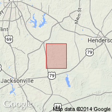
The railroad and town, formerly the site of a lumbermill, are now abandoned; so is Manning Church, shown on Angelina County map of TX State Highway Dept. Only one inhabited house, that of M.M. Flourney, remains at site of village and mill, which is on Farm Road 844, 10.2 mi by road south-southwest of Huntington, [east-central TX].
Source: US geologic names lexicon (USGS Bull. 1200, p. 2358-2359).
- Usage in publication:
-
- Manning Formation
- Modifications:
-
- Mapped 1:250k
- Dominant lithology:
-
- Sand
- Clay
- Lignite
- AAPG geologic province:
-
- Gulf Coast basin
- East Texas basin
Summary:
Pamphlet [p. 3]. Manning Formation. Sand, clay, and lignite. Quartz sand, fine- to medium-grained, lignitic, light-gray; weathers medium-gray. Clay, sandy, lignitic, brownish gray; weathers pale brownish gray. Lignite, brownish black, weathers brownish gray. Fossil wood abundant. Thickness 250 feet. Lies above Wellborn Formation (Eocene) and below Whitsett Formation (Eocene or Oligocene). Age is Eocene.
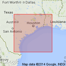
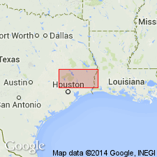
[Mapped in Grimes, Houston, Trinity, and Walker Cos., eastern TX.]
Source: Publication.
- Usage in publication:
-
- Manning Clay*
- Modifications:
-
- Revised
- AAPG geologic province:
-
- Gulf Coast basin
Summary:
Manning Clay Member of McElroy Formation (now abandoned) raised to formational rank in Jackson Group as Manning Clay. Overlies Wellborn Sandstone; underlies Whitsett Formation. Age is late Eocene. Recognized in south-central Texas.
Source: Changes in stratigraphic nomenclature, 1972 (USGS Bull. 1394-A, p. A28-A29).

- Usage in publication:
-
- Manning Formation
- Modifications:
-
- Mapped 1:250k
- Dominant lithology:
-
- Clay
- Sandstone
- Bentonite
- AAPG geologic province:
-
- Gulf Coast basin
Summary:
Manning Formation. Clay, sandstone, and bentonite; clay, lignitic chocolate brown, interbedded fine- to medium-grained sand, fossil wood common; sandstone, fine- to medium-grained, tuffaceous, indurated, brittle, thick-bedded, some excellent cross-bedding, forms resistant ledges, light yellowish gray; Plum Bentonite (not separately mapped), indurated, waxy, conchoidal fracture, light yellowish to white, 1.6 feet thick near Plum, Fayette Co. Thickness 250 to 305 feet. Overlies Wellborn Formation (Eocene); underlies Whitsett Formation (Eocene and Oligocene(?)). Age is Eocene.
Mapped in Karnes, Gonzales, and Fayette Cos., southeastern TX.
Source: Modified from GNU records (USGS DDS-6; Denver GNULEX).

- Usage in publication:
-
- Manning Formation
- Modifications:
-
- Mapped 1:250k
- Dominant lithology:
-
- Clay
- Tuff
- Sandstone
- AAPG geologic province:
-
- Gulf Coast basin
Summary:
Manning Formation of Jackson Group. Clay, tuff, and sandstone; chiefly bentonitic clay and carbonaceous to lignitic tuff, with interbedded sandstone, light yellowish gray, fossil wood common; sandstone, fine-grained, tuffaceous, indurated, brittle, thick-bedded, occurs in upper and lower parts. Thickness 250 to 350 feet. Lies above Wellborn Sandstone and below Whitsett Formation (both of Jackson). Age is Eocene.
[Mapped in McMullen, Atascosa, Karnes, and Wilson Cos., southern TX.]
Source: Publication.

- Usage in publication:
-
- Manning Formation
- Modifications:
-
- Mapped 1:250k
- Dominant lithology:
-
- Clay
- Sandstone
- AAPG geologic province:
-
- Gulf Coast basin
Summary:
Pamphlet [p. 2]. Manning Formation. Clay and sandstone; chiefly clay, massive to laminated, slightly carbonaceous, tuffaceous, bentonitic, thin interbeds of tuffaceous siltstone; sandstone in upper part, very fine- to fine-grained, tuffaceous, contains silicified wood fragments. Thickness 350 feet, uppermost part crops out on adjacent sheets to south [Crystal City-Eagle Pass] and east [Seguin]. Overlies Wellborn Formation (Eocene); underlies Leona Formation (Pleistocene) and younger sediments. [Age is late Eocene.]
[Mapped in Fall City oil field, in southeastern corner of sheet along Wilson-Karnes Co. line, southern TX.]
Source: Publication.
For more information, please contact Nancy Stamm, Geologic Names Committee Secretary.
Asterisk (*) indicates published by U.S. Geological Survey authors.
"No current usage" (†) implies that a name has been abandoned or has fallen into disuse. Former usage and, if known, replacement name given in parentheses ( ).
Slash (/) indicates name conflicts with nomenclatural guidelines (CSN, 1933; ACSN, 1961, 1970; NACSN, 1983, 2005, 2021). May be explained within brackets ([ ]).