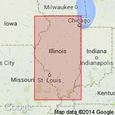
- Usage in publication:
-
- Manitowoc Till Member
- Modifications:
-
- Original reference
- Dominant lithology:
-
- Till
- AAPG geologic province:
-
- Michigan basin
Lineback, J.A., Gross, D.L., and Meyer, R.P., 1974, Glacial tills under Lake Michigan: Illinois Geological Survey Environmental Geology Notes, v. 69, 44 p., Also issued as Univ. Wisconsin Geophys. Polar Research Center Contrib., no. 311
Summary:
Pg. 6 (fig. 3), 16, 40 (App.). Manitowoc Till Member of Wedron Formation. Brown to reddish brown silty clayey till. Thickness ranges from inches to 100+ feet (31 m) due at least in part to bedrock topography. Is top member of Wedron Formation. Lies above Shorewood Till Member of Wedron. The Manitowoc contains more expandable clay minerals, less illite, more vermiculite, and more total carbonates (chiefly dolomite) than does the Shorewood. Lies below [Two Rivers Till]. Considered equivalent to till underlying Two Creeks forest bed. Age is Pleistocene (Wisconsinan; latest Woodfordian), based on stratigraphic relations.
Type section (subsurface): depth-interval 259 cm to 328 cm, core 904, in Lake Michigan, 28 mi (45 km) southeast of Manitowoc, Lat. 43 deg. 45 min. N., Long. 87 deg. 22.2 min. W., Manitowoc Co., WI. Named from Manitowoc, Manitowoc Co., WI.
Recognized beneath central part of Lake Michigan, in area north of mid-lake bedrock high. [On p. 24 authors state the Manitowoc is also found onshore in places and has previously been called Valders or Port Huron.]
Source: Publication; US geologic names lexicon (USGS Bull. 1520, p. 193).

- Usage in publication:
-
- Manitowoc Member
- Modifications:
-
- Revised
For more information, please contact Nancy Stamm, Geologic Names Committee Secretary.
Asterisk (*) indicates published by U.S. Geological Survey authors.
"No current usage" (†) implies that a name has been abandoned or has fallen into disuse. Former usage and, if known, replacement name given in parentheses ( ).
Slash (/) indicates name conflicts with nomenclatural guidelines (CSN, 1933; ACSN, 1961, 1970; NACSN, 1983, 2005, 2021). May be explained within brackets ([ ]).

