- Usage in publication:
-
- Manitou limestone*
- Modifications:
-
- Original reference
- Dominant lithology:
-
- Limestone
- Dolomite
- AAPG geologic province:
-
- Denver basin
Summary:
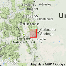
Manitou limestone. Best seen in upper part of Garden Park, where it consists of fine-grained pink or reddish dolomite less than 100 feet thick and contains same fossils that characterize the formation at Manitou Springs and in Manitou Park, for which it is named. To east is wanting at many places. In Garden Park is conformably overlain by Harding sandstone. Rests on Algonkian granite and gneiss, but probably a small thickness of quartzite and cherty limestone below Manitou limestone are of Cambrian age.
Source: US geologic names lexicon (USGS Bull. 896, p. 1281).
- Usage in publication:
-
- Manitou limestone*
- Modifications:
-
- Areal extent
- AAPG geologic province:
-
- Eagle basin
- South Park basin
Summary:
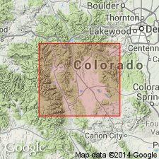
Manitou limestone. Replaces use of "White" limestone (a miners term) in Lake and Park Counties, Colorado. Overlies Peerless shale member (new) of Sawatch quartzite. Age is Ordovician.
Source: Modified from GNU records (USGS DDS-6; Denver GNULEX).
- Usage in publication:
-
- Manitou limestone
- Modifications:
-
- Revised
- Dominant lithology:
-
- Limestone
- AAPG geologic province:
-
- Denver basin
Summary:
Pg. 379-382. Manitou limestone. Representative type section designated in which name Manitou is restricted to Ordovician limestone lying between Cambrian Sawatch sandstone and Devonian limestone herein named Williams Canyon. Consists of light gray to buff dolomitic limestone; thickness 218 feet. Lower part weathers thin bedded and nodular and contains much chert. Fossils found about 5 feet above base. Upper part is massive.
Type section: measured on east side of canyon above the Narrows of Williams Canyon, north of Manitou, in SW/4 sec. 32, T. 13 S., R. 67 W., El Paso Co., eastern CO.
Source: US geologic names lexicon (USGS Bull. 1200, p. 2351-2352); supplemental information from GNU records (USGS DDS-6; Denver GNULEX).

- Usage in publication:
-
- Manitou limestone*
- Modifications:
-
- Areal extent
Summary:
Manitou limestone (of Beekmantown age; Early Ordovician) is now [ca. 1938] recognized over a large area on both the east and west sides of Front Range, eastern Colorado. It is in places overlain by Harding sandstone and Fremont limestone, both of Ordovician age, and in other places by Parting quartzite member of Chaffee formation (Devonian). It rests on Sawatch quartzite, the transition shaly beds at the top of which are now known as Peerless shale member.
Source: US geologic names lexicon (USGS Bull. 896, p. 1281).
- Usage in publication:
-
- Manitou limestone*
- Modifications:
-
- Areal extent
- AAPG geologic province:
-
- South Park basin
Summary:
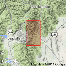
Pg. 8 (table 1). Manitou limestone. In London fault area, Mosquito Range, [Park County, Colorado], the Manitou is as much as 130 feet thick; overlies Peerless shale member of Sawatch quartzite; underlies Parting quartzite member of Chaffee formation. Age is Early Ordovician.
Source: US geologic names lexicon (USGS Bull. 1200, p. 2351-2352).
- Usage in publication:
-
- Manitou dolomite*
- Modifications:
-
- Areal extent
- Dominant lithology:
-
- Dolomite
- Limestone
- AAPG geologic province:
-
- Piceance basin
- Eagle basin
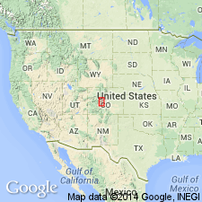
Summary:
Pg. 308 (table 1), 314-320. Manitou dolomite. Ordovician sequence along Sawatch Range includes remnants of three formations: Manitou dolomite, Harding sandstone, and Fremont limestone. The Manitou consists of thinly bedded dolomites and dolomitic limestone; very siliceous in places. Thickness 100 to 370 feet. Separated by unconformities from Sawatch quartzite below and Harding sandstone above. Age is Early Ordovician.
Source: US geologic names lexicon (USGS Bull. 1200, p. 2351-2352).
- Usage in publication:
-
- Manitou limestone*
- Modifications:
-
- Areal extent
- AAPG geologic province:
-
- Las Animas arch
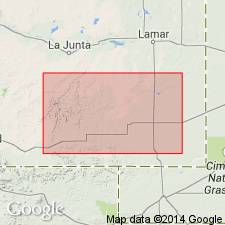
Summary:
Extended into the subsurface of Otero County, Colorado, on the Las Animas arch. Overlies pre-Cambrian rocks and underlies Glen Eyrie shale. Age is Cambrian and Ordovician. Report includes correlation chart.
Source: Modified from GNU records (USGS DDS-6; Denver GNULEX).
- Usage in publication:
-
- Manitou limestone*
- Modifications:
-
- Revised
- AAPG geologic province:
-
- Denver basin
Summary:
Manitou limestone. Restricted at base to exclude 8 to 14 feet of dolomite herein named Ute Pass dolomite. Thickness of restricted Manitou about 187 feet. Underlies Williams Canyon limestone. Age is Early Ordovician.
South of Ute Pass fault consists of finely granular to medium-crystalline dolomite that may be pink to red, buff to brown, with abundant chert. North of Ute Pass fault consists of buff to dark-buff, finely crystalline limestone and an upper pink, finely granular to medium-crystalline dolomite.
Source: US geologic names lexicon (USGS Bull. 1200, p. 2351-2352); supplemental information from GNU records (USGS DDS-6; Denver GNULEX).
- Usage in publication:
-
- Manitou
- Modifications:
-
- Areal extent
- AAPG geologic province:
-
- Eagle basin
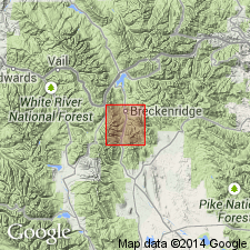
Summary:
Pg. 9 (table 1). Manitou limestone. In Blue River area, Summit County, Colorado, consists of thin-bedded white to medium-blue mostly crystalline dolomite. Thickness about 70 feet. Overlies Peerless formation; disconformably underlies Parting quartzite member of Chaffee formation. Age is Early Ordovician.
Source: US geologic names lexicon (USGS Bull. 1200, p. 2351-2352).
- Usage in publication:
-
- Manitou formation*
- Modifications:
-
- Revised
- Redescribed
- Dominant lithology:
-
- Limestone
- Conglomerate
- Shale
- Dolomite
- AAPG geologic province:
-
- Piceance basin
Summary:
Pg. 892 (fig. 2), 893, 905-911. Manitou formation of this report [White River Plateau] includes a little more than upper half of Dotsero dolomite (Bassett, 1939). Term formation preferred to limestone because unit includes variety of rock types. Subdivided into (ascending) Dead Horse conglomerate and Tie Gulch dolomite members (both new). Thickness 80 to 155 feet. Overlies Clinetop algal limestone member (new) of Dotsero formation; underlies Parting member of Chaffee formation. Fossils. Age is Early Ordovician. Report includes cross section, measured section.
Source: US geologic names lexicon (USGS Bull. 1200, p. 2351-2352); supplemental information from GNU records (USGS DDS-6; Denver GNULEX).
- Usage in publication:
-
- Manitou dolomite*
- Modifications:
-
- Areal extent
- AAPG geologic province:
-
- Eagle basin
- Piceance basin
Summary:
Pg. 11-12, pl. 1. Manitou dolomite. Described in Garfield quadrangle, Gunnison and Chaffee Counties, Colorado. At most places, rests unconformably on irregular surface of Sawatch quartzite, but in southern part of Tomichi district, and in Monarch district, rests on Precambrian granite. Manitou dolomite is equivalent to the limestone below the quartzite in Tomichi limestone of Crawford's (1913) nomenclature. Thickness 175 to 250 feet. Manitou is characteristically bluish-gray crystalline well-bedded dolomite. Individual beds range in thickness from a few inches to several feet in thickness. Metamorphic processes, particularly those related to intrusion of Mount Princeton quartz monzonite, have locally changed the dolomite to marble. Unconformably underlies Harding quartzite. Age is Early Ordovician.
Source: US geologic names lexicon (USGS Bull. 1200, p. 2351-2352).
- Usage in publication:
-
- Manitou formation*
- Modifications:
-
- Areal extent
- AAPG geologic province:
-
- Denver basin
Summary:
Pg. 106-119. Manitou formation. On basis of faunal correlations, unit termed Ute Pass at Williams Canyon [in T. 13 S., R. 67 W., El Paso County, Colorado] is reassigned to lower part of Manitou. On bases of lithology and stratigraphic position, the Ute Pass of Missouri Gulch [in T. 38 N., R. 07 W., La Plata County, Colorado] is correlated with Peerless formation and term Ute Pass dolomite abandoned. The Manitou consists of finely to coarsely crystalline limestone and minor amounts of dolomite that total 195 feet at type locality. Here section is sparingly fossiliferous and contains trilobite and brachiopod fauna in lower part and gastropod fauna above. To northwest in Manitou Park, formation consists chiefly of dense red dolomite as in vicinity of Missouri Gulch, and trilobites occur mainly in thin beds of limestone. South of Williams Canyon, the Manitou is massive dense unfossiliferous dolomite. Faunal evidence indicates that the Manitou slowly lapped southward over eroded pre-Ordovician surface. From north to south, formation rests successively on Peerless formation, Sawatch quartzite, and Precambrian rocks. Overlapped by Middle Ordovician Harding sandstone. Age is Early Ordovician. Report includes fossil lists, cross section.
Source: US geologic names lexicon (USGS Bull. 1200, p. 2351-2352); supplemental information from GNU records (USGS DDS-6; Denver GNULEX).
- Usage in publication:
-
- Manitou Limestone
- Modifications:
-
- Revised
- AAPG geologic province:
-
- Denver basin
Summary:
Divided in the Canon City embayment, El Paso Co, CO, Denver basin into the Helena Canyon Member (new), the cherty and the massive members. Section of Manitou 95.7 ft thick measured in Helena Canyon along the Shelf Road to Cripple Creek, sec 22, T16S, R70W where the Manitou unconformably overlies Precambrian gneiss and schist and unconformably underlies Harding Sandstone of Champlainian age. In the measured section, the Helena Canyon is a 12.5-ft-thick pink, massive to blocky dolomite; the cherty member is an 18-ft-thick pink, blocky to platy dolomite with as much as 50 percent 3-inch-thick chert beds; the massive member is primarily pink dolomite that varies from blocky to platy to massive and wavy bedded, and two interbedded pink to white limestones with algal ball structure 65.2 ft thick. The Helena Canyon is about 10 ft thick at most places. The cherty member has a maximum thickness of 45 ft. The massive member has a maximum thickness of 75 ft. The Manitou reaches its maximum thickness at the north end of the embayment and it pinches out southward in Priest Canyon area, sec 31, T18S, R70W. Of Early Ordovician age. Columnar section, geologic map, cross section.
Source: GNU records (USGS DDS-6; Denver GNULEX).
- Usage in publication:
-
- Manitou Limestone
- Modifications:
-
- Revised
- AAPG geologic province:
-
- Denver basin
- South Park basin
- Piceance basin
Summary:
Name Horseshoe Mountain Group applied to rocks of the Sauk sequence in central CO of Late Cambrian and Early Ordovician age. In its northwest province near Glenwood Springs, Garfield Co in Piceance basin, the group is divided into the Sawatch Sandstone, Dotsero Formation (and its Glenwood Canyon and Clinetop Members) and Manitou Limestone (and its Deadhorse and Tie Gulch Members). In its southeast province--near Salida, Gunnison Co in Piceance basin, Colorado Springs, El Paso Co in Denver basin, and Fairplay, Park Co in South Park basin--the group is divided into the Sawatch Sandstone, Peerless Formation, and Manitou Limestone (and its Helena Canyon, Ptarmigan (provisional), and Fairplay (provisional) Members. The group is named for exposures on Horseshoe Mountain (the type section) near Fairplay in Park Co. Rocks of the group include conglomerate, sandstone, shale, limestone, and dolomite. Correlation chart. Thickness of group at its type section (in the southeast facies--sec. 12, T. 10 S., R. 79 W.) is 352 ft: Manitou, 167 ft; Peerless, 35 ft; and Sawatch, 150 ft. Thickness of group in northwest facies (sec. 15, T. 5 S., R. 87 W.) is 772 ft: Manitou, 156 ft; Dotsero, 96 ft; and Sawatch, 520 ft.
Source: GNU records (USGS DDS-6; Denver GNULEX).
- Usage in publication:
-
- Manitou Formation
- Modifications:
-
- Revised
- AAPG geologic province:
-
- Piceance basin
- Eagle basin
- South Park basin
Summary:
Revised in that Manitou Formation conformably overlies the newly named Deadmans Gulch Formation in western Gunnison Co, CO in the Piceance basin, in eastern Eagle Co, eastern Pitkin Co, southern Summit Co, Lake Co, and northern Chaffee Co, CO in the Eagle basin, and in western Park Co, CO in the South Park basin. The new formation was included in the upper part of the Sawatch Quartzite in earlier reports. The Deadmans Gulch is missing elsewhere in CO. Isopach map of Deadmans Gulch. Cross sections. Ordovician age.
Source: GNU records (USGS DDS-6; Denver GNULEX).
- Usage in publication:
-
- Manitou Formation
- Modifications:
-
- Revised
- AAPG geologic province:
-
- Denver basin
- South Park basin
- Piceance basin
Summary:
Manitou includes several lithologies; name changed from Manitou Limestone to Manitou Formation. In its northwestern facies (Glenwood Springs area, Garfield Co CO, Piceance basin) Manitou is divided into Deadhorse Conglomerate Member (base) and Tie Gulch Dolomite Member (top). In its southeastern facies (Salida, Colorado Springs, and Fairplay CO in Gunnison Co, Piceance basin, El Paso Co, Denver basin, and Park Co, South Park basin, respectively) Manitou is assigned to Horseshoe Mountain Group (new) as its upper formation and is divided into Helena Canyon (base), Ptarmigan Chert (new), and Leavick Tarn Dolomite (new) Members. Two sections measured. At type section (SW1/4 sec 32, T13S, R67W) Manitou is 213.4 ft thick: Helena Canyon is 20.7 ft thick; Ptarmigan is 160.8 ft thick; and Leavick Tarn is 31.9 ft thick. Unconformably overlies Sawatch Sandstone and unconformably underlies Williams Canyon Limestone at type. In second measured section (secs 7 and 18, T10S, R78W, Park Co) Manitou is 154.4 ft thick: Helena Canyon is 23.6 ft thick; Ptarmigan is 95.4 ft thick; and Leavick Tarn is 35.4 ft thick. Manitou transitionally overlies Peerless Formation, middle formation of Horseshoe Mountain Group, and unconformably underlies Parting Sandstone. Is Early Ordovician age. Could also be of Cambrian age.
Source: GNU records (USGS DDS-6; Denver GNULEX).
For more information, please contact Nancy Stamm, Geologic Names Committee Secretary.
Asterisk (*) indicates published by U.S. Geological Survey authors.
"No current usage" (†) implies that a name has been abandoned or has fallen into disuse. Former usage and, if known, replacement name given in parentheses ( ).
Slash (/) indicates name conflicts with nomenclatural guidelines (CSN, 1933; ACSN, 1961, 1970; NACSN, 1983, 2005, 2021). May be explained within brackets ([ ]).

