The National Geologic Map Database is migrating to a new infrastructure. We apologize for any service disruptions during this process.
|
|---|


- Usage in publication:
-
- Mammoth Cave series
- Modifications:
-
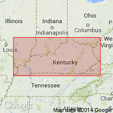
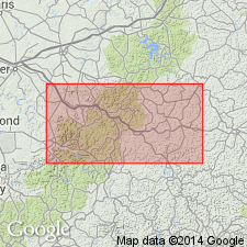
- Areal extent
- Dominant lithology:
-
- Limestone
- AAPG geologic province:
-
- Cincinnati arch
Miller, A.M., 1917, Table of geological formations for Kentucky: University of Kentucky, 7 p.
Summary:
Pg. 3. Mammoth Cave series. Best developed in western Kentucky. Includes Newman [limestone] in part in eastern Kentucky. Includes St. Louis limestone, St. Genevieve limestone, Bethel sandstone, and Gasper [oolite]. Age is Mississippian.
[Apparently named from Mammoth Cave, Edmonson Co., western central Kentucky.]
[Typographical error (US geologic names lexicon, USGS Bull. 896, p. 1274): Table of geological formations of Kentucky published in 1917, not 1919.]
Source: US geologic names lexicon (USGS Bull. 896, p. 1274).

- Usage in publication:
-
- Mammoth Cave limestone series
- Modifications:
-
- Principal reference
- Dominant lithology:
-
- Limestone
- AAPG geologic province:
-
- Cincinnati arch
Summary:
Pg. 103. Mammoth Cave limestone series. This name is proposed for the almost uninterrupted deposit of relatively pure limestone, which has as a highly conspicuous feature the presence in it of caverns of considerable extent. Greatest development in State is in region surrounding the Western coal fields, where it may reach maximum thickness of 600 feet. Is generally less than 100 feet. Includes Ste. Genevieve and St. Louis stages. Underlies Bethel sandstone and overlies [disconformably, p. 250] Warsaw stage. Is closely = Maxville, Greenbrier, and Newman limestones. Age is Mississippian.
[Apparently named from Mammoth Cave, Edmonson Co., western central Kentucky.]
Source: US geologic names lexicon (USGS Bull. 896, p. 1274).
- Usage in publication:
-
- Mammoth Cave limestone
- Modifications:
-
- Overview
- AAPG geologic province:
-
- Appalachian basin
Summary:
General term covering a number of Mississippian limestones including the St. Louis, Ste. Genevieve, and lower Chester. These are the limestones in which Mammoth Cave and other large KY caves occur. Occurs below Beattyville shale and above Waverly formation.
Source: GNU records (USGS DDS-6; Reston GNULEX).
For more information, please contact Nancy Stamm, Geologic Names Committee Secretary.
Asterisk (*) indicates published by U.S. Geological Survey authors.
"No current usage" (†) implies that a name has been abandoned or has fallen into disuse. Former usage and, if known, replacement name given in parentheses ( ).
Slash (/) indicates name conflicts with nomenclatural guidelines (CSN, 1933; ACSN, 1961, 1970; NACSN, 1983, 2005, 2021). May be explained within brackets ([ ]).