The National Geologic Map Database is migrating to a new infrastructure. We apologize for any service disruptions during this process.
|
|---|


- Usage in publication:
-
- Mameyes Formation*
- Modifications:
-
- Named
- Dominant lithology:
-
- Lava
- Andesite
- Sandstone
- Siltstone
- AAPG geologic province:
-
- Caribbean region
Summary:
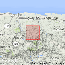
The Mameyes Formation, here named, consists of a thick unit of andesitic lava flows and subordinate interbedded volcanic sandstone and siltstone. Conformably and sharply overlies the Vista Alegre Formation; conformably and sharply underlies the Tetuan Formation, but not at the same stratigraphic position at all localities because the lava beds intertongue with the under and overlying units. Thickness ranges from 750 to 1,100 m. Age is Late Cretaceous (Santonian to Campanian ammonite found in Tetuan Formation).
Source: GNU records (USGS DDS-6; Reston GNULEX).

- Usage in publication:
-
- Mameyes Formation*
- Modifications:
-
- Overview
- AAPG geologic province:
-
- Caribbean region
Summary:
The Mameyes Formation occurs in central Puerto Rico and consists of Pillowed andesitic lava flows and intercalated volcanic sandstone and siltstone. Maximum estimated thickness is 1100 meters. The Mameyes is of Late(?) Cretaceous age.
Source: GNU records (USGS DDS-6; Reston GNULEX).
For more information, please contact Nancy Stamm, Geologic Names Committee Secretary.
Asterisk (*) indicates published by U.S. Geological Survey authors.
"No current usage" (†) implies that a name has been abandoned or has fallen into disuse. Former usage and, if known, replacement name given in parentheses ( ).
Slash (/) indicates name conflicts with nomenclatural guidelines (CSN, 1933; ACSN, 1961, 1970; NACSN, 1983, 2005, 2021). May be explained within brackets ([ ]).