

- Usage in publication:
-
- Malta gravel*
- Modifications:
-
- Named
- Dominant lithology:
-
- Gravel
- AAPG geologic province:
-
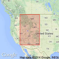
- Eagle basin
Summary:
Named for railroad station of Malta, 3 mi southwest of Leadville, Lake Co, CO in the Eagle basin. No type section designated. Can be seen in a cut 60 ft high behind the station, and along the upper Arkansas Valley. Is the high terrace gravel of earlier reports. Is a buff, massive, coarse, and dirty gravel. Has little stratification except for shingled arrangement of cobbles and a few small lenses of sand or silt. The gravel includes silt-size to boulder-size material, though rounded cobbles 4 to 10 in. in diameter predominate. Fills old valleys; thickness varies; 300 ft thick in subsurface. Postdates glacial episode 1. Assigned to the Pleistocene.
Source: GNU records (USGS DDS-6; Denver GNULEX).
- Usage in publication:
-
- Malta Gravel*
- Modifications:
-
- Age modified
- AAPG geologic province:
-
- Eagle basin
Summary:
A unit known in the Leadville area, Lake Co, CO, in Eagle basin, that is considered to be of middle middle Pleistocene or pre-Illinoian age, younger than the Pearlette "O" volcanic ash bed and older than Bull Lake moraine.
Source: GNU records (USGS DDS-6; Denver GNULEX).
For more information, please contact Nancy Stamm, Geologic Names Committee Secretary.
Asterisk (*) indicates published by U.S. Geological Survey authors.
"No current usage" (†) implies that a name has been abandoned or has fallen into disuse. Former usage and, if known, replacement name given in parentheses ( ).
Slash (/) indicates name conflicts with nomenclatural guidelines (CSN, 1933; ACSN, 1961, 1970; NACSN, 1983, 2005, 2021). May be explained within brackets ([ ]).