The National Geologic Map Database is migrating to a new infrastructure. We apologize for any service disruptions during this process.
|
|---|


- Usage in publication:
-
- Makaweli formation
- Modifications:
-
- First used
- AAPG geologic province:
-
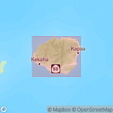
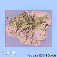
- Kauai
Summary:
Volcanic rocks accumulated in graben on SW side of shield, Island of Kauai, are called Makaweli formation [will be formally named in Bulletin 13 of Hawaii Department of Hydrography]. Sedimentary rocks interbedded with Makaweli Formation are known as Mokuone formation. Assigned Pliocene(?) age on figure map.
Source: GNU records (USGS DDS-6; Menlo GNULEX).
- Usage in publication:
-
- Makaweli formation
- Modifications:
-
- Age modified
- AAPG geologic province:
-
- Kauai
Summary:
Occupies 25 sq mi in SW part of Island of Kauai. Age of Makaweli formation is Pliocene(?).
Source: GNU records (USGS DDS-6; Menlo GNULEX).
- Usage in publication:
-
- Makaweli formation*
- Modifications:
-
- Named
- Dominant lithology:
-
- Basalt
- AAPG geologic province:
-
- Kauai
Summary:
Named for volcanic rocks of Makaweli depression on southwest side of Kauai Volcano shield, Island of Kauai. Type localities are west wall of canyon of Makaweli River [21 deg 58'08"N 159 deg 39'28"W, Hanapepe 7.5'quad] and east wall of Waimea Canyon (between mouth of Omao Stream and confluence of Waimea and Makaweli Rivers). Is youngest formation of Waimea Canyon volcanic series. Greatest exposed thickness is 1500 ft on east side of Waimea Canyon. Consists of thick flows of olivine basalt, basalt, picrite-basalt, and rare andesite accumulated in graben on southwest side of shield. Breccia and conglomerate beds intercalated with lavas of Makaweli are herein named Mokuone Member (formerly Mokuone Formation of Macdonald, Davis and Cox, 1954). Makaweli Formation is in fault contact with Olokele and Napali Formations of Waimea Canyon volcanic series. Base not exposed. Unconformably underlies Koloa volcanic series. Underlies with erosional unconformity Quaternary unconsolidated alluvium along stream valleys. Is considered to be coeval with upper part of Olokele Formation and probably of middle to late Pliocene age. Stratigraphic chart assigns Pliocene age.
Source: GNU records (USGS DDS-6; Menlo GNULEX).
- Usage in publication:
-
- Makaweli formation*
- Modifications:
-
- Geochronologic dating
- AAPG geologic province:
-
- Kauai
Summary:
K-Ar ages on lava samples from Makaweli Formation collected in Waimea Canyon and flow on Olokole ditch track ranged from 4.05 to 3.48 Ma.
Source: GNU records (USGS DDS-6; Menlo GNULEX).
- Usage in publication:
-
- Makaweli Formation*
- Modifications:
-
- Paleomagnetics
- AAPG geologic province:
-
- Kauai
Summary:
"In general, the magnetic polarity results and radiometric age data obtained by McDougall (1964) are in agreement with recent summaries of the polarity epoch time scale (Cox, 1968)." Samples of Makaweli Formation are all reversely magnetized and "placed in late portion of Gilbert Reversed Polarity Epoch".
Source: GNU records (USGS DDS-6; Menlo GNULEX).

- Usage in publication:
-
- Makaweli Member*
- Modifications:
-
- Age modified
- Revised
- AAPG geologic province:
-
- Kauai
Summary:
Makaweli Formation of Macdonald, Davis and Cox (1960) reduced in rank and renamed Makaweli Member of Waimea Canyon Basalt. Includes Mokuone Breccia Beds (formerly Mokuone Member of Macdonald, Davis and Cox, 1960) at base and intercalated with Makaweli flows. Type locality: west wall of Makaweli River canyon. Reference locality: east wall of lower Waimea Canyon. Assigned Pliocene age based on K-Ar aged samples.
Source: GNU records (USGS DDS-6; Menlo GNULEX).
- Usage in publication:
-
- Makaweli Member*
- Modifications:
-
- Geochronologic dating
- AAPG geologic province:
-
- Kauai
Summary:
Best ages for Makaweli Member of Waimea Canyon Basalt is 4.16 to 4.00 Ma for tholeiitic flows and coeval age of 3.92 Ma for alkalic flows (McDougall, 1964 and this study).
Source: GNU records (USGS DDS-6; Menlo GNULEX).
For more information, please contact Nancy Stamm, Geologic Names Committee Secretary.
Asterisk (*) indicates published by U.S. Geological Survey authors.
"No current usage" (†) implies that a name has been abandoned or has fallen into disuse. Former usage and, if known, replacement name given in parentheses ( ).
Slash (/) indicates name conflicts with nomenclatural guidelines (CSN, 1933; ACSN, 1961, 1970; NACSN, 1983, 2005, 2021). May be explained within brackets ([ ]).