


- Usage in publication:
-
- Madera limestone
- Modifications:
-
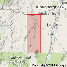
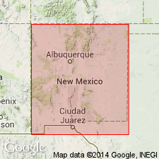
- Areal extent
- Dominant lithology:
-
- Limestone
- AAPG geologic province:
-
- Estancia basin
- San Juan basin
Summary:
Pg. 339; C.R. Keyes, 1903, Ore and Metals, v. 12, p. 48. Madera limestone. The upper Carboniferous blue to gray beds, the superior part of the great limestone formation, are called Madera limestone in Sandia Mountains. They overlie middle Carboniferous limestones. Contains an abundant fauna that clearly points to an age of late Carboniferous [Pennsylvanian].
[Sandia Mountains in Sandoval and Bernalillo Cos., central NM.]
Source: Modified from US geologic names lexicon (USGS Bull. 896, p. 1262).
- Usage in publication:
-
- Madera Formation
- Modifications:
-
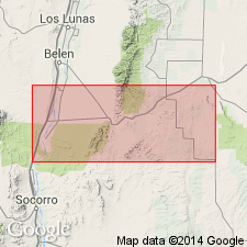
- Areal extent
- Dominant lithology:
-
- Limestone
- AAPG geologic province:
-
- Estancia basin
- San Juan basin
Keyes, C.R., 1904, Unconformity of the Cretaceous on older rocks in central New Mexico: American Journal of Science, v. 18, no. 107, art. 38, p. 360-362.
Summary:
Pg. 360-362. Madera formation. Consists of 300 feet of limestones underlying Bernalillo shales, 1,000 feet thick, and overlying Sandia limestones, 300 feet thick, which rest on Lake Valley limestone. [Age is Pennsylvanian.]
[Recognized in Sandia Mountains, Sandoval and Bernalillo Cos., central NM.]
Source: Publication; US geologic names lexicon (USGS Bull. 896, p. 1262).
- Usage in publication:
-
- Madera limestone*
- Modifications:
-
- Revised
- Areal extent
- AAPG geologic province:
-
- Orogrande basin
- San Juan basin
Summary:
Madera limestone of Magdalena group revised in report area, Lucero uplift, Valencia and Socorro Cos, NM in San Juan and Orogrande basins--divided into (ascending): 1) Gray Mesa member, cherty limestone with minor shale and sandstone, 850-900 ft thick; 2) Atrasado member, limestone, shale, and conglomeratic sandstone, 550-800 ft thick; and 3) Red Tanks member, limestone, conglomeratic sandstone, and shale and siltstone, 200-300 ft thick (all new names). Madera areally extended into Socorro Co, Orogrande basin. Overlying Madera's upper (Red Tanks) member is Permian? Abo formation; underlying Madera's lower member (Gray Mesa) is upper clastic member of Sandia formation (revised) of Magdalena group. Is of Pennsylvanian age. Measured sections, cross sections, and geologic map.
Source: GNU records (USGS DDS-6; Denver GNULEX).
- Usage in publication:
-
- Madera limestone*
- Modifications:
-
- Contact revised
- AAPG geologic province:
-
- Orogrande basin
- San Juan basin
Summary:
Upper contact revised in that Madera underlies the newly named Bursum formation, upper formation of Magdalena group, on the east flank of the Manzano and Los Pinos Mountains, Valencia Co, San Juan basin, and Socorro Co, Orogrande basin, NM. Geologic map. Cross sections. Conformably overlies Sandia formation of Magdalena group. Divided into two mapped members, the lower gray limestone (80-830 ft thick) and the upper arkosic limestone (520 ft thick). The upper member is not present in the Joyita Hills. Assigned to the Pennsylvanian.
Source: GNU records (USGS DDS-6; Denver GNULEX).
- Usage in publication:
-
- Madera limestone*
- Modifications:
-
- Overview
- AAPG geologic province:
-
- San Juan basin
Summary:
As the upper formation of the Magdalena group, Madera is divided into two informal mapped members, the lower gray limestone and an upper arkosic limestone member. The lower member: 1) consists of dark-gray limestone interbedded with gray shale and a few sandstone beds; 2) overlies Pennsylvanian Sandia formation of Magdalena at most places, but in vicinity of Joaquin Mesa, lies on pre-Cambrian; 3) north of the mesa, it is missing; 4) is of Lampasas and early Des Moines age. The upper member: 1) consists of limestone, arkosic limestone, gray and red shale and arkose; 2) rests on lower member in south and on pre-Cambrian in north; 3) is of early Des Moines to Virgil in age. Both members are fossiliferous (fusulinids, brachiopods, bryozoans). Extensive listing of fossils. Mapped in southeast part of area, Sandoval Co, NM, San Juan basin. Underlies Permian? Abo formation.
Source: GNU records (USGS DDS-6; Denver GNULEX).
- Usage in publication:
-
- Madera formation
- Modifications:
-
- Revised
- AAPG geologic province:
-
- Las Vegas-Raton basin
Summary:
Divided into gray limestone member (base), arkosic limestone member (middle), and Whiskey Creek Pass limestone member (top) in Huerfano Park and at La Veta Pass, Huerfano Co, CO in the Las Vegas-Raton basin. Underlies the newly named Pass Creek sandstone at La Veta Pass. Underlies Sangre de Cristo formation in Huerfano Park. Assigned a Desmoinesian [Middle] Pennsylvanian age. Is correlative with Minturn formation, Paradox formation. Faunal lists (fusulinids, brachiopods). Correlation chart.
Source: GNU records (USGS DDS-6; Denver GNULEX).
- Usage in publication:
-
- Madera Limestone
- Modifications:
-
- Not used
Summary:
Sandia Formation could not be consistently delineated in the southern part of the report area--upper Pecos Valley area, including the Dalton Bluff exposure 6 mi north of Pecos, southern edge of Sangre de Cristo Mountains, San Miguel Co, NM in Palo Duro basin--consequently, name "Sandia" not used in this report. Pennsylvanian rocks in southernmost Sangre de Cristos here divided into (both new): 1) La Pasada Formation, 973 ft thick at Dalton Bluff, San Miguel Co, NM, Palo Duro basin, and equal there to Sandia Formation plus the lower gray limestone member of Madera Limestone (as used in this area by Brill, 1952); and 2) Alamitos Formation (about 1,275 ft thick in Alamitos and Pecos Valley areas, San Miguel Co, and equal to the upper arkosic limestone member of Madera Limestone (of Brill). Stratigraphic relations of these two new formations to the "Madera Limestone" of Sandia Mountains further to southwest is unknown--therefore, term "Madera" not used in report area. "Magdalena Group" not used either, because it is essentially synonymous with systemic term "Pennsylvanian". La Pasada Formation's northern equivalent is Flechado Formation (new); Flechado extends north of Jicarilla area, Rio Arriba Co, to Taos area, San Luis basin. Measured sections, geologic map, correlation chart.
Source: GNU records (USGS DDS-6; Denver GNULEX).
- Usage in publication:
-
- Madera Group*
- Modifications:
-
- Revised
- AAPG geologic province:
-
- Estancia basin
- San Juan basin
Summary:
F3-F4. Madera Group. In Manzano Mountains area of central New Mexico, the Madera Limestone (or Madera Formation) is raised to group rank, and divided into (ascending): Los Moyos Limestone (new), Wild Cow Formation (new), and Bursum Formation. Bursum remains uppermost formation of Magdalena Group elsewhere. Overlies Sandia Formation and underlies Abo Formation. Age is Middle Pennsylvanian (late Atokan) to Early Permian (Wolfcampian).
Source: Publication; Changes in stratigraphic nomenclature, 1973 (USGS Bull. 1395-A, p. A24-A25).
- Usage in publication:
-
- Madera Formation
- Modifications:
-
- Revised
- AAPG geologic province:
-
- San Juan basin
Summary:
Madera Formation revised in that it is now underlain by Osha Canyon Formation (newly named, this report) in Pinos and Penasco Canyons--Osha Canyon overlies Log Springs Formation unconformably and underlies Sandia Formation unconformably at type section (at Guadalupe Box); in Pinos and Penasco Canyons overlies Log Springs with angular unconformity and underlies Madera Formation with sharp angular unconformity (Sandia Formation is absent here). Osha Canyon occurs in several locations in southern Nacimiento and Jemez Mountains, including Pinos and Penasco Canyons and several places in and near Guadalupe Box (all in Sandoval Co, NM, San Juan basin); not observed outside this area. Osha Canyon not reported in San Pedro or Sandia Mountains. The fossiliferous Osha Canyon is of Morrowan--probably late Morrowan (Early Pennsylvanian)--age, based on brachiopod fauna. Stratigraphic chart.
Source: GNU records (USGS DDS-6; Denver GNULEX).
- Usage in publication:
-
- Madera Group*
- Modifications:
-
- Revised
- Overview
- AAPG geologic province:
-
- Las Vegas-Raton basin
- Palo Duro basin
Summary:
Raised to group status in southeastern Sangre de Cristo Mountains, north-central NM in Las Vegas-Raton and Palo Duro basins. Divided into Porvenir Formation (named) at base, of Desmoinesian, Middle Pennsylvanian age, and Alamitos Formation (adopted) at top, of Desmoinesian to Virgilian, or Middle and Late Pennsylvanian age, and locally Wolfcampian, and Early Permian age. Unconformably overlies Sandia Formation; unconformably underlies Sangre de Cristo Formation. Was deposited in a marine (Porvenir) and marine to nonmarine fluviatile (Alamitos) environment.
Source: GNU records (USGS DDS-6; Denver GNULEX).
- Usage in publication:
-
- Madera Limestone*
- Modifications:
-
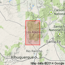
- Areal extent
- AAPG geologic province:
-
- San Juan basin
Summary:
Shown on an isopach map in the southeastern part of the San Juan basin. Name Madera used southeast of a line drawn through southern Rio Arriba Co. across northwest Sandoval Co. into central McKinley Co., NM in the San Juan basin. Is a correlative of the Paradox, Honaker Trail and lower part of Rico Formations. Correlation chart. Term is used where cyclic beds of the Paradox can no longer be used. Has a maximum thickness of 1290 ft in the subsurface of northwest Sandoval Co. Lower gray limestone and arkose members recognized. Overlies Sandia Formation. Underlies Abo Formation. Pennsylvanian age.
Source: GNU records (USGS DDS-6; Denver GNULEX).
- Usage in publication:
-
- Madera Formation*
- Modifications:
-
- Biostratigraphic dating
- AAPG geologic province:
-
- San Luis basin
- Las Vegas-Raton basin
Summary:
Fusulinids BEEDEINA sp. and WEDEKINDELLINA sp. from middle and upper gray limestone members are mid-Desmoinesian age (D. A. Myers, 1994, written commun.). Author notes that Tischler (1961, 1963) assigned an Atokan age to lowermost 116 m of Madera at La Veta Pass and a Desmoinesian age to all of overlying Madera. Study area is within San Luis and Las Vegas-Raton basins.
Source: GNU records (USGS DDS-6; Denver GNULEX).
For more information, please contact Nancy Stamm, Geologic Names Committee Secretary.
Asterisk (*) indicates published by U.S. Geological Survey authors.
"No current usage" (†) implies that a name has been abandoned or has fallen into disuse. Former usage and, if known, replacement name given in parentheses ( ).
Slash (/) indicates name conflicts with nomenclatural guidelines (CSN, 1933; ACSN, 1961, 1970; NACSN, 1983, 2005, 2021). May be explained within brackets ([ ]).