

- Usage in publication:
-
- Macklyn Member
- Modifications:
-
- Named
- Dominant lithology:
-
- Graywacke
- Mudstone
- Chert
- Conglomerate
- AAPG geologic province:
-
- Klamath Mountains province
Summary:
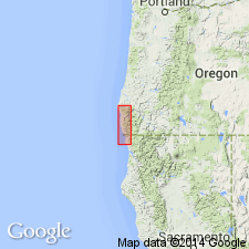
Report discusses west-central Klamath Mountains province in southwestern OR and northwestern CA. Macklyn Cove is in Curry Co, OR. Named as member of Chetco Formation (new). Is gradational with Winchuck Member (new) (Chetco Formation). Contains numerous volcanic rocks, bedded radiolarian cherts, and coarse conglomerates, some with pre-Nevadan granitic boulders. Considered older than middle Portlandian.
Source: GNU records (USGS DDS-6; Menlo GNULEX).
- Usage in publication:
-
- Macklyn Member
- Modifications:
-
- Revised
- AAPG geologic province:
-
- Klamath Mountains province
Summary:
Macklyn Member [of Chetco Formation] of Widmier [1963] is described and mapped as member of Dothan Formation. Type section designated by Widmier [1963] is on south side of Macklyn Cove at Chetco Point [T40S R13W] Curry Co, OR. Consists of 50% gray sandstone, nearly 40% mudstone and siltstone, nearly 10% volcanic rocks and less than 1% chert and conglomerate. Is 200 ft thick at type section. Discussion of age relationship with Franciscan and Otter Point complexes.
Source: GNU records (USGS DDS-6; Menlo GNULEX).
For more information, please contact Nancy Stamm, Geologic Names Committee Secretary.
Asterisk (*) indicates published by U.S. Geological Survey authors.
"No current usage" (†) implies that a name has been abandoned or has fallen into disuse. Former usage and, if known, replacement name given in parentheses ( ).
Slash (/) indicates name conflicts with nomenclatural guidelines (CSN, 1933; ACSN, 1961, 1970; NACSN, 1983, 2005, 2021). May be explained within brackets ([ ]).