- Usage in publication:
-
- Macho member*
- Modifications:
-
- Named
- Dominant lithology:
-
- Breccia
- AAPG geologic province:
-
- Palo Duro basin
- Las Vegas-Raton basin
- San Luis basin
- Estancia basin
Summary:
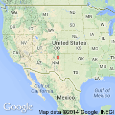
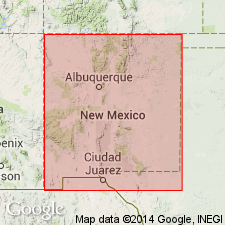
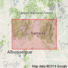
Named for exposures (designated type section) northwest of confluence of Macho Creek and Pecos River, 5.3 mi south of Tererro, San Miguel Co, NM in Palo Duro basin. Is lowest of three members of Tererro formation (all new). At type section Macho is 8-12 ft thick and composed of light- to medium-gray limestone breccia consisting of angular blocks of limestone as large as 2 ft across, randomly oriented in a sandy calcite matrix which includes angular fragments of brown, gray, and white chert. In most of southern part of Sangre de Cristo Mountains weathers to a prominent thick, rounded ledge. Derived in large part from solution and collapse of cavernous parts of upper part of underlying Espiritu Santo formation, and in minor part from collapsed parts of overlying Manuelitas member of Tererro (all new)--both contacts are erosional unconformities. Locally absent in parts of eastern foothills of Sangre de Cristos due to erosion. Thickest in Pecos River Canyon, where averages 30 ft and on El Cielo Mountain where as much as 60 ft thick (both in San Miguel Co); in eastern foothills of Sangre de Cristos, ranges from a trace to 15 ft. Present throughout most of Sangre de Cristos (except along western margin, where rocks have been cut out or concealed by Precambrian overthrust rocks), Taos, Mora, San Miguel, and Santa Fe Cos, NM, in San Luis, Las Vegas-Raton, Palo Duro, and Estancia basins. Early Mississippian age. Measured sections.
Source: GNU records (USGS DDS-6; Denver GNULEX).

- Usage in publication:
-
- Macho Member
- Modifications:
-
- Age modified
- AAPG geologic province:
-
- San Luis basin
- Palo Duro basin
- Estancia basin
- Las Vegas-Raton basin
Summary:
Age of Tererro Formation and its (ascending) Macho, Manuelitas, and Cowles Members modified. Age of Manuelitas Member of Tererro given by Baltz and Read (1960) as Early Mississippian, based on faunule found in Manuelitas Member; in this report, species of ENDOTHYRA have been collected from all three members of Tererro, studied by Zimmerman of Sun Oil Co. Research Laboratory, and found to be definitely Meramecian age. Since none of the fossils (primarily brachiopods) listed by Baltz and Read (1960) were identified with certainty and were poorly preserved as well, the well-preserved endothyrid faunas of this report are believed to provide a more reliable indication of probable age. The entire Tererro Formation is therefore best considered to be of Meramecian (Late Mississippian) age, as previously proposed by Armstrong (1958), who studied endothyrid faunas from various Mississippian localities in northern NM. Tererro present throughout most of Sangre de Cristo Mountains (except along western margin, where rocks have been cut out or concealed by overthrust rocks of Precambrian age) in Taos, Mora, San Miguel, and Santa Fe Cos, NM, in San Luis, Las Vegas-Raton, Palo Duro, and Estancia basins. Present in Rincon, Santa Fe, Taos, and western part of Truchas Ranges. Geologic map, measured sections.
Source: GNU records (USGS DDS-6; Denver GNULEX).

- Usage in publication:
-
- Macho Member*
- Modifications:
-
- Age modified
- Biostratigraphic dating
- Revised
- AAPG geologic province:
-
- Las Vegas-Raton basin
- Palo Duro basin
Summary:
Upper contact of Macho Member of Tererro Formation (revised, age modified) of Arroyo Penasco Group (raised in rank to group in this report) revised--now overlain by newly named Turquillo Member of Tererro. Age modified; age was given by Johnson (1972) in Geologic Atlas of the Rocky Mountain Region [figs. 1, 2, 4-6] as Kinderhookian (Early Mississippian), but in this report, age of Macho is given as Meramecian (Late Mississippian) based on microfossils in the matrix that are middle to late Visean (Meramecian) in age. Some blocks of the underlying late Tournaisian (Osagean) Espiritu Santo Formation of Arroyo Penasco Group found in base of Macho; blocks of overlying Turquillo Member in upper part of Macho contain middle Visean microfauna. Macho is not present in Nacimiento Mountains, Sandoval Co, or at San Pedro Mountain (Rio Arriba Co, both in San Juan basin, NM); nor is it present in Sandia Mountains (Bernalillo Co in Estancia basin) or Jemez Mountains (Sandoval Co, San Juan basin). Is present in sections in eastern part of report area, at Mora Gap (Mora Co, Las Vegas-Raton basin); Coco City (Sangre de Cristo Mountains, Mora Co, Las Vegas-Raton basin); Jack's Creek (Sangre de Cristo Mountains, San Miguel Co, Palo Duro basin); and Tererro (San Miguel Co, Palo Duro basin) [may be present in other places as well--areal limits not clearly stated]. Correlation chart, measured sections, discussion of depositional cycles.
Source: GNU records (USGS DDS-6; Denver GNULEX).
For more information, please contact Nancy Stamm, Geologic Names Committee Secretary.
Asterisk (*) indicates published by U.S. Geological Survey authors.
"No current usage" (†) implies that a name has been abandoned or has fallen into disuse. Former usage and, if known, replacement name given in parentheses ( ).
Slash (/) indicates name conflicts with nomenclatural guidelines (CSN, 1933; ACSN, 1961, 1970; NACSN, 1983, 2005, 2021). May be explained within brackets ([ ]).

