- Usage in publication:
-
- Macho pyroxene andesites
- Modifications:
-
- Named
- Dominant lithology:
-
- Andesite
- AAPG geologic province:
-
- Basin-and-Range province
- Orogrande basin
Summary:
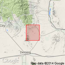
Named from Macho mining district at W1/2 sec 20, T19S, R7W, Sierra Co, NM in Orogrande basin, where forms a fairly thick series of flows, flow breccias, and tuffs. No type locality designated. Crops out in Old Hadley, Macho, and Lake Valley districts. The tuffs are not exposed in Macho district, but only in Old Hadley district southeast of Cooks Peak, in Luna Co, Basin-and-Range province. The pyroxene andesite flows are mostly dark purple to purplish-gray porphyritic rocks with phenocrysts of labradorite, augite, hypersthene, and other dark minerals. Breccias are purple to brownish red and contain fragments of pyroxene andesite flow rock in a groundmass similar to the flow rock except for color. Tuffs form earliest part of the series, ranging from bright purple through brown to bright red and bluish gray. Tuffs are often interbedded with sandstones and lenses of red conglomerate. Graded bedding suggests tuffs were water-laid. Mineralized in many areas. Crops out only in topographically low areas; probably eroded to form surface for later volcanic deposition. Chart shows as about 1,000 ft thick. Unconformities above and below. Older than Rubio Peak formation; younger than Late Cretaceous and early Tertiary orogeny. Shown on chart as early? Tertiary. Geologic map. Generalized stratigraphic chart.
Source: GNU records (USGS DDS-6; Denver GNULEX).
For more information, please contact Nancy Stamm, Geologic Names Committee Secretary.
Asterisk (*) indicates published by U.S. Geological Survey authors.
"No current usage" (†) implies that a name has been abandoned or has fallen into disuse. Former usage and, if known, replacement name given in parentheses ( ).
Slash (/) indicates name conflicts with nomenclatural guidelines (CSN, 1933; ACSN, 1961, 1970; NACSN, 1983, 2005, 2021). May be explained within brackets ([ ]).

