

- Usage in publication:
-
- MacGowan concretionary bed*
- Modifications:
-
- Named
- Dominant lithology:
-
- Dolomite
- Limestone
- AAPG geologic province:
-
- Sweetgrass arch
Summary:
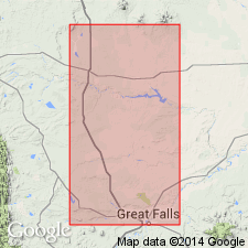
Named as a resistant bed in the middle part of Kevin shale member (new) of Marias River shale (new) of Colorado group (rank raised) for exposures on the MacGowan lease in SE1/4 SW1/4 NE1/4 sec 4, T35N, R3W, Kevin-Sunburst oil field, Toole Co, MT on the Sweetgrass arch. Consists of concretionary dolostone and limestone, weathering to light brown, or orange brown, or very dusky red, which serve as a matrix for abundant small pellets of light olive-gray phosphatic siltstone of local concretionary origin, and of varying amounts of polished rounded granules, and small pebbles of gray and black chert. Is 18 in thick at type. Overlies lower part of middle unit of Kevin. Unconformably underlies upper part of middle unit of Kevin. Is about 314 ft above base of member--the midpoint of the member. Correlates with lower part of Smoky Hill Member of Niobrara formation. Is of Coniacian, Late Cretaceous age. Correlation chart.
Source: GNU records (USGS DDS-6; Denver GNULEX).
- Usage in publication:
-
- MacGowan Concretionary Bed*
- Modifications:
-
- Overview
- AAPG geologic province:
-
- Sweetgrass arch
Summary:
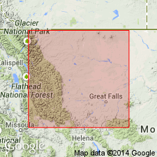
Is a bed in Kevin Member of Marias River Shale of Colorado Group. Description of type section measured in NW1/4 SW1/4 sec 3 to SE1/4 SE1/4 NE1/4 sec 4, T35N, R3W, Toole Co, MT on the Sweetgrass arch given. Is a bed in the middle of the Kevin Member of Marias River Shale of Colorado Group, about 96 m below top and 0.4 m thick. Composed of dark gray shale at base that is overlain by brownish-olive gray limestone that is in turn overlain by a brownish gray dolostone. Concretionary beds present in lower shale and middle limestone. Phosphatic pebbles are more numerous than chert pebbles. Is of widespread extent and easily recognized. Of Late Cretaceous age.
Source: GNU records (USGS DDS-6; Denver GNULEX).
For more information, please contact Nancy Stamm, Geologic Names Committee Secretary.
Asterisk (*) indicates published by U.S. Geological Survey authors.
"No current usage" (†) implies that a name has been abandoned or has fallen into disuse. Former usage and, if known, replacement name given in parentheses ( ).
Slash (/) indicates name conflicts with nomenclatural guidelines (CSN, 1933; ACSN, 1961, 1970; NACSN, 1983, 2005, 2021). May be explained within brackets ([ ]).