

- Usage in publication:
-
- MacColl Ridge Formation*
- Modifications:
-
- Named
- Dominant lithology:
-
- Sandstone
- Conglomerate
- Siltstone
- AAPG geologic province:
-
- Alaska Southern region
Summary:
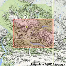
Named for exposures on MacColl Ridge, southern Wrangell Mountains. Type section designated about 3 mi east of west boundary of McCarthy A-4 quad, southern AK, and trends southward. Largely confined to high mountainous terrane. Also exposed in southern part of McCarthy B-4 and B-5 quads. Consists of coarse-grained sandstone grading into conglomerate or siltstone. Is about 2500 ft thick at type section. Overlies with apparent conformity Chititu Formation (new). Near Pyramid Peak and elsewhere intruded by Tertiary granodiorite plutons. Locally unconformably underlies unconsolidated Quaternary surficial deposits. Age is considered Late Cretaceous (late Campanian or Maestrichtian) on basis of stratigraphic relations.
Source: GNU records (USGS DDS-6; Menlo GNULEX).
For more information, please contact Nancy Stamm, Geologic Names Committee Secretary.
Asterisk (*) indicates published by U.S. Geological Survey authors.
"No current usage" (†) implies that a name has been abandoned or has fallen into disuse. Former usage and, if known, replacement name given in parentheses ( ).
Slash (/) indicates name conflicts with nomenclatural guidelines (CSN, 1933; ACSN, 1961, 1970; NACSN, 1983, 2005, 2021). May be explained within brackets ([ ]).