The National Geologic Map Database is migrating to a new infrastructure. We apologize for any service disruptions during this process.
|
|---|


- Usage in publication:
-
- Mabton sedimentary interbed
- Modifications:
-
- Areal extent
- AAPG geologic province:
-
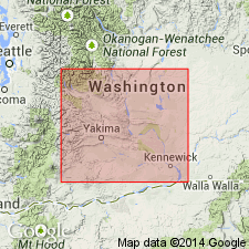
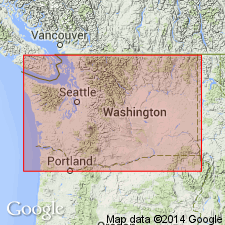
- Eastern Columbia basin
Summary:
Pg. 25. Mabton sedimentary interbed in Priest Rapids Basalt Member of Yakima Basalt. A sedimentary interbed 75 feet thick in the Priest Rapids Basalt Member (new) in section near Mabton, [Yakima County, south-central Washington]. Name credited to Laval (1956, unpub. thesis). [Age is Miocene.]
Source: Publication; US geologic names lexicon (USGS Bull. 1350, p. 447).
- Usage in publication:
-
- Mabton interbed
- Modifications:
-
- Areal extent
- Dominant lithology:
-
- Tuff
- Silt
- Sand
- AAPG geologic province:
-
- Eastern Columbia basin
Summary:
Pg. 95. Mabton interbed in Priest Rapids Member of Yakima Basalt. In eastern part of Toppenish Ridge and Horse Heaven Hills, [west and south of Mabton, Zillah quadrangle (scale 1:125,000), Yakima County, south-central Washington], the Priest Rapids Member is as much as 700 feet thick and includes the Basal flows, the Mabton interbed, and the Upper (Umatilla and Sillusi) flows. South of Mabton, the sedimentary Mabton interbed is about 75 feet thick and consists of tuff and tuffaceous silts and sands. Farther east the Mabton is as much as 100 feet thick and contains quartzose micaceous sand. The Mabton may be the stratigraphic equivalent of Mackin's Quincy diatomite. [Age is Miocene.]
[Additional locality information from USGS historical topographic map collection TopoView, accessed August 26, 2013.]
Source: US geologic names lexicon (USGS Bull. 1350, p. 447).
- Usage in publication:
-
- Mabton member
- Modifications:
-
- [Revised]
- AAPG geologic province:
-
- Eastern Columbia basin
Summary:
Pg. 1481 (fig. 2), 1484-1485. Mabton member of Ellensburg Formation. A sedimentary interbed chiefly of quartz-bearing conglomerate and siliclastic sandstone. Thickness up to 110 m. On south flank of Yakima Ridge, Benton County, central southern Washington, lies between Umatilla Member of Saddle Mountain Basalt above and Priest Rapids Member of Wanapum Basalt below. Age is [middle Miocene], between 14.1 and 14.5 Ma.
Source: Publication; GNC index card files (USGS-Menlo; USGS-Reston).
For more information, please contact Nancy Stamm, Geologic Names Committee Secretary.
Asterisk (*) indicates published by U.S. Geological Survey authors.
"No current usage" (†) implies that a name has been abandoned or has fallen into disuse. Former usage and, if known, replacement name given in parentheses ( ).
Slash (/) indicates name conflicts with nomenclatural guidelines (CSN, 1933; ACSN, 1961, 1970; NACSN, 1983, 2005, 2021). May be explained within brackets ([ ]).