

- Usage in publication:
-
- Lysite formation
- Modifications:
-
- Named
- Dominant lithology:
-
- Sandstone
- Shale
- Gypsum
- AAPG geologic province:
-
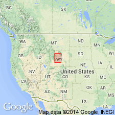
- Wind River basin
Summary:
Named as a lower stage of the Wind River series and as the Lysite formation for Lysite Creek north of Lost Cabin, Fremont Co, WY in the Wind River basin, as the lower formation of the Wind River group. Type area is on Lysite and Cottonwood Creeks where more than 350 ft of the Lysite measured consists of (ascending): 1) dull-colored disintegrated clay, some feldspathic sandstone, and gypsum, thickness undetermined; 2) gray and red sandy shale and gray sandstone 100 ft thick; 3) buff sandstone and red and gray shale 200 ft thick; 4) yellow and gray sandy shale 50 ft thick. Overlies pre-Tertiary rocks at type. Lies below and is faunally distinct from the LAMBDOTHERIUM zone which is named Lost Cabin stage or formation (new) of Wind River group. Of Eocene age. [Term Wind River group not used.]
Source: GNU records (USGS DDS-6; Denver GNULEX).
- Usage in publication:
-
- Lysite member*
- Modifications:
-
- Revised
- Overview
- AAPG geologic province:
-
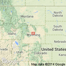
- Wind River basin
Summary:
Reduced in stratigraphic rank and assigned to the Wind River formation as its lower member. Consists of hard ledgy yellow-brown sandstone interbedded with brick-red, orange-red, tan and gray sandy siltstone and claystone. Many of the sandstones are conglomeratic. Sandstone beds are more numerous to north near the mountains. Criteria for identifying the Lysite are: 1) the conglomerates were derived from post-Cambrian Paleozoic rocks and locally from Mesozoic rocks; 2) brick-red and orange-red are the predominant colors, violet shades are rare; 3) variegated beds of Lysite grade laterally into drab and gray fine-grained beds; 4) sandstones contain very little white mica and almost no black mica. Overlaps Cretaceous rocks. Relation to older Tertiary rocks is unknown. Maximum thickness observed is 600 ft on Cedar Ridge (SE1/4 sec 8 and SW1/4 sec 9, T39N, R89W). Underlies Lost Cabin member (revised) of Wind River formation. Fossil mammals listed. Stratigraphic chart. Geologic map of area form T38N to 40N, R88W to 94W, northwest Natrona and adjoining northeast Fremont Co, WY, Wind River basin. Of early Eocene age. Name should be used only along southern margin of Big Horn Mountains.
Source: GNU records (USGS DDS-6; Denver GNULEX).
For more information, please contact Nancy Stamm, Geologic Names Committee Secretary.
Asterisk (*) indicates published by U.S. Geological Survey authors.
"No current usage" (†) implies that a name has been abandoned or has fallen into disuse. Former usage and, if known, replacement name given in parentheses ( ).
Slash (/) indicates name conflicts with nomenclatural guidelines (CSN, 1933; ACSN, 1961, 1970; NACSN, 1983, 2005, 2021). May be explained within brackets ([ ]).